 EMODnet Product Catalogue
BY_CelticVoyager_MalinSea_14m_WGS84
owner : {{md.getOwnername()}}
{{'mdStatusRecord' | translate}}: {{('mdStatus-' + md.mdStatus) | translate}}
- Identification
- Content
- ReferenceSystem
- Quality
- DomainConsistancy
- Constraints
- Distribution
- Meta-metadata
- ObjectCatalogue
| Alternate title | KN172L08 SeaBeam 3012-P1 Bathymetry Grid |
|---|---|
| Date | 2021-12-13T00:00:00 |
| Date type | Creation: Date identifies when the resource was brought into existence |
| Date | 2021-12-13T00:00:00 |
| Date type | Revision: Date identifies when the resource was examined or re-examined and improved or amended |
| Unique resource identifier | BY_CelticVoyager_MalinSea_14m_WGS84 |
Point of contact
| Organisation name | Geological Survey Ireland |
|---|---|
| Voice | +353-1-6782000 |
| Delivery point | Beggars Bush Barracks |
| City | Haddington Road |
| Postal code | D04 K7X4 |
| Country | Ireland |
| Electronic mail address | GSI-Seabed@gsi.ie |
| Linkage | https://www.gsi.ie/ |
| Role | Originator: Party who created the resource |
Point of contact
| Organisation name | Geological Survey Ireland |
|---|---|
| Voice | +353-1-6782000 |
| Delivery point | Beggars Bush Barracks |
| City | Haddington Road |
| Postal code | D04 K7X4 |
| Country | Ireland |
| Electronic mail address | GSI-Seabed@gsi.ie |
| Linkage | https://www.gsi.ie/ |
| Role | Custodian: Party that accepts accountability and responsability for the data and ensures appropriate care and maintenance of the resource |
Descriptive keywords
| Project name | EMODNet Bathymetry |
|---|---|
| SeaDataNet device categories |
multi-beam echosounders
|
multi-beam echosounders
|
| SeaDataNet device categories |
multi-beam echosounders
|
Differential Global Positioning System receivers
|
| Parameter Discovery Vocabulary (P02) | Bathymetry and Elevation |
| GEMET - INSPIRE themes, version 1.0 | |
| GDI-Vlaanderen Trefwoorden | Metadata GDI-Vl-conform |
Spatial resolution
| Denominator | 100000 |
|---|
Spatial resolution
| Distance | 0.000130208334 degree |
|---|
| Language | English |
|---|---|
| Character set | UTF8: 8-bit variable size UCS Transfer Format, based on ISO/IEC 10646 |
| Topic category code |
|
Reference System Information
| Anchor | EPSG:84 |
|---|
Reference System Information
| Unique resource identifier | WGS 84 (EPSG:4326) |
|---|---|
| Codespace | EPSG |
| Hierarchy level | Dataset: Information applies to the dataset |
|---|---|
| Hierarchy level | Feature: Information applies to a feature |
| Hierarchy level | Software: Information applies to a computer program or routine |
| Hierarchy level | Property type: Information applies to a property type |
| Hierarchy level | Dataset: Information applies to the dataset |
| Other | software |
Absolute external positional accuracy
Quantitative result
|
|||
Absolute external positional accuracy
Quantitative result
|
|||
Lineage
| Statement | no information |
|---|
Lineage
| Statement | EMODnet processing methodology using Globe software |
|---|
mdLegalAndSecurityConstraintsSection
Resource constraints
|
|||||||||||
| Distribution format | NetCDF (Version: 4) | ||||||||||||||||||||||||
|---|---|---|---|---|---|---|---|---|---|---|---|---|---|---|---|---|---|---|---|---|---|---|---|---|---|
Transfer options
|
|||||||||||||||||||||||||
| File identifier | SDN_CPRD_366_BY_CelticVoyager_MalinSea_14m_WGS84 | ||||||||||||||||||
|---|---|---|---|---|---|---|---|---|---|---|---|---|---|---|---|---|---|---|---|
| Metadata language | English | ||||||||||||||||||
| Character set | UTF8: 8-bit variable size UCS Transfer Format, based on ISO/IEC 10646 | ||||||||||||||||||
| Hierarchy level name | Composite Product Record | ||||||||||||||||||
| Date stamp | 2023-01-26T14:58:41.682Z | ||||||||||||||||||
| Metadata standard name | ISO 19115:2003/19139 - EMODNET - BATHYMETRY | ||||||||||||||||||
| Metadata standard version | 1.0 | ||||||||||||||||||
Contact
|
|||||||||||||||||||
Overviews
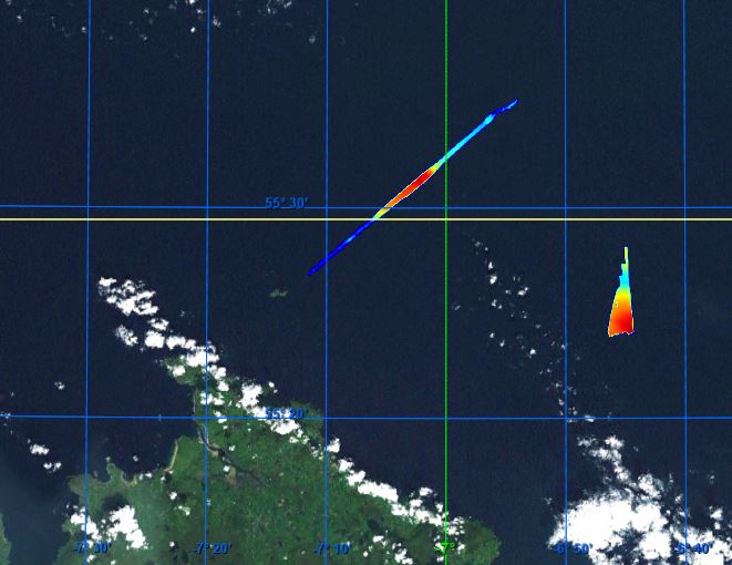
BY_CelticVoyager_MalinSea_14m_WGS84.JPG
extent
- geoDesc
- {{d}}
- geoBox
-
}})
- geoDescCode
- {{mdView.current.record.geoDescCode}}
tempExtent
- creationDate
- publicationDate
- revisionDate
- tempExtentBegin
Associated resources
Not available