 EMODnet product catalogue
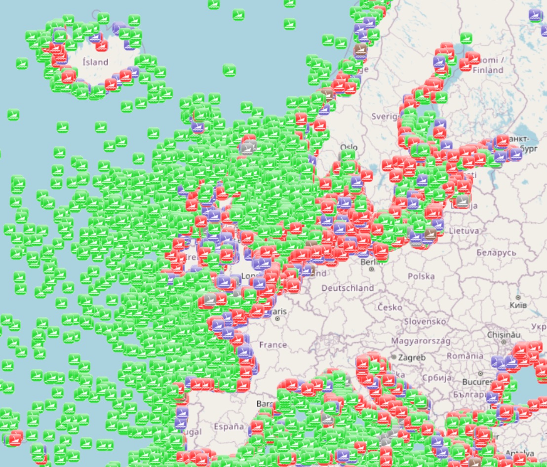
EMODnet Human Activities, Worldwide wrecks locations (UK Hydrographic Office)
The dataset is a subset of the UK Hydrographic Office wrecks and obstructions data set. It contains over 67,000 charted, uncharted, live and dead wrecks from around the world. Where available each point has the following attributes: Wreck Id, Wreck category, Status, Position, Latitude, Longitude, Horizontal datum, Position method, Depth, Depth method, Depth quality, Depth accuracy, Water depth, Water level, Vertical datum, Name, Type, Flag, Length, Width, Draught, Sonar length, Sonar width, Shadow height, Orientation, Tonnage, Tonnage type, Cargo, Conspic visual, Conspic radar, Date sunk, Bottom texture, Scour dimensions, Debris field, Original sensor, Last sensor, Original detection, Last detection, Origin, Markers, Circumstances of loss, Surveying details, General comments, Last amended. The original dataset is updated on a quarterly basis and is made available free of charge under an Open Government Licence, which can be accessed here: https://www.nationalarchives.gov.uk/doc/open-government-licence/version/3/.
Simple
- Date (Publication)
- 2024-12-28
- Date (Revision)
- 2024-12-26
- Date (Creation)
- 2024-12-26
- Citation identifier
- Emodnet_HA_Heritage_WW_Wrecks_20241226
- Point of contact
-
Organisation name Individual name Electronic mail address Role AND-International
Author UK Hydrographic Office
Resource provider
-
GEMET - INSPIRE themes, version 1.0
-
-
Protected sites
-
-
INSPIRE - Feature Concept Dictionary, version 3
-
-
Protected Site
-
-
GEMET - Concepts, version 4.2.1
-
-
culture (society)
-
-
GEMET - Concepts, version 4.2.1
-
-
wreck
-
-
GEMET - Themes, version 4.2.1
-
-
waste
-
-
GEMET - Groups, version 4.2.1
-
-
WASTES, POLLUTANTS, POLLUTION
-
- Spatial representation type
- Vector
- Denominator
- 100000
- Language
- English
- Topic category
-
- Oceans
))
- Access constraints
- Other restrictions
- Other constraints
- No limitations on public access
- gmd:useconstraints
- otherRestrictions
- Other constraints
-
Creative Commons CC-BY 4.0 https://creativecommons.org/licenses/by/4.0/
- gmd:useconstraints
- otherRestrictions
- Other constraints
-
This data was downloaded from the EMODnet Portal ( https://emodnet.ec.europa.eu/en/). The data originator is AND-International.
- Transfer size
- 0
- OnLine resource
-
Protocol Linkage Name WWW:LINK
http://emodnet.ec.europa.eu/human-activities EMODnet Human Activities
WWW:DOWNLOAD
https://ows.emodnet-humanactivities.eu/geonetwork/srv/api/records/108ef240-fa6e-4b83-8569-09b509e2959d/attachments/EMODnet_HA_Heritage_WW_Wrecks_20241226.zip EMODnet_HA_Heritage_WW_Wrecks_20241226.zip
OGC:WMS
https://ows.emodnet-humanactivities.eu/wms wwshipwrecks
OGC:WFS
https://ows.emodnet-humanactivities.eu/wfs emodnet:wwshipwrecks
- Distribution format
-
Name Version Esri geodatabase gco:nilReason="unknown"> Esri shapefile gco:nilReason="unknown">
- Hierarchy level
- Dataset
Conformance result
- Date
- 2020-12-23
- Explanation
-
See the referenced specification
- Statement
-
Depending on the source of information, the amount of information available on a specific wreck varies. More specific information on the metadata and quality of data can be found on the sources website.
Metadata
- File identifier
- 108ef240-fa6e-4b83-8569-09b509e2959d XML
- Metadata language
- English
- Character set
- MD_CharacterSetCode_utf8
- Hierarchy level
- Dataset
- Date stamp
- 2025-09-02T08:28:41.259321Z
- Metadata standard name
-
ISO19115
- Metadata standard version
-
2003/Cor.1:2006
- Metadata author
-
Organisation name Individual name Electronic mail address Role AND-International
Point of contact
)))
