 EMODnet product catalogue
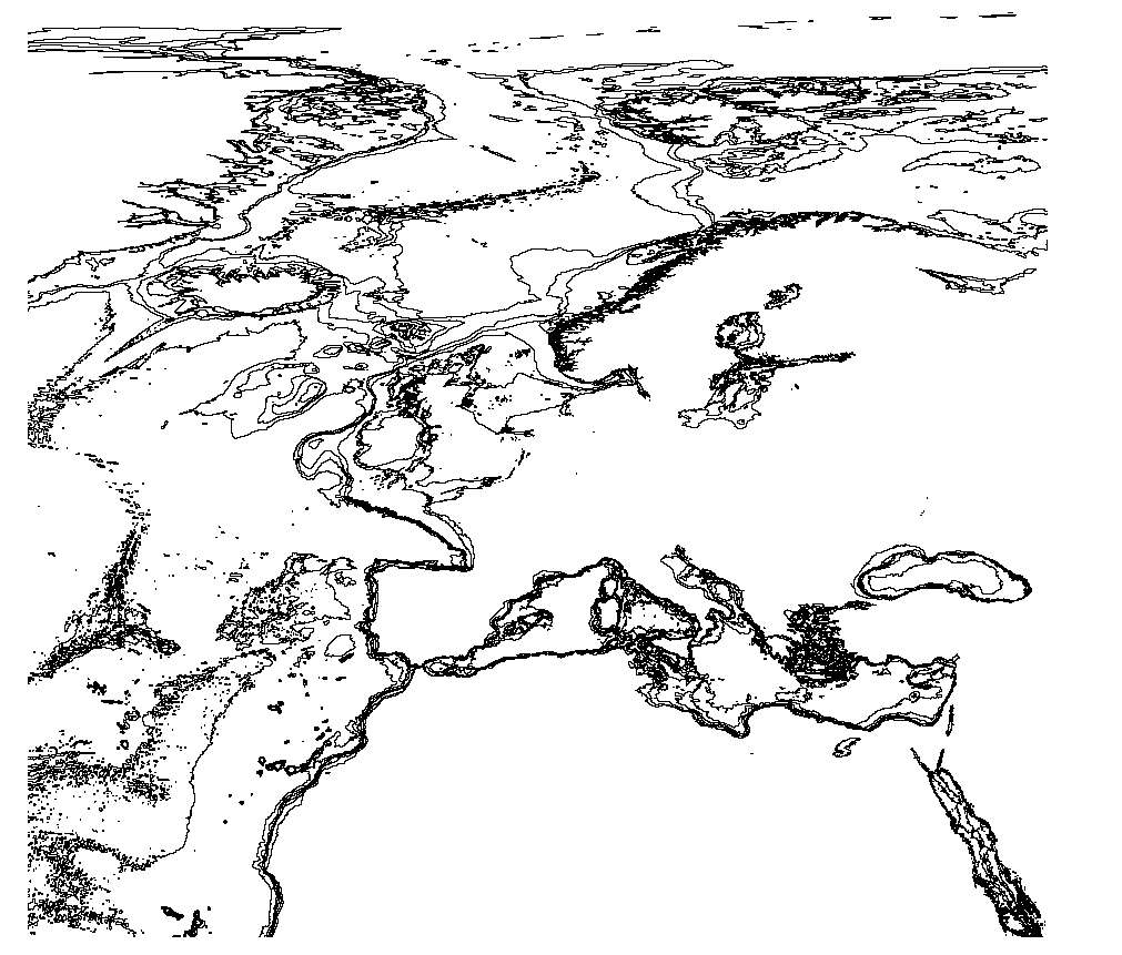
EMODnet Bathymetry - Bathymetric Contours version 2022
The EMODnet Bathymetric Contours are available as a WFS service from EMODnet Bathymetry. Service URL is: https://ows.emodnet-bathymetry.eu/wfs
The bathymetric contours of this layer are generated automatically based on the EMODnet DTM. New contour sets will be available for each consecutive update of the EMODnet DTM. The contours are generated by GGSgc BV using the proprietary GGSgc software.
Simple
- Date (Publication)
- 2023-03-15
- Citation identifier
- EMODnet_Bathymetry_contours
- Point of contact
-
Organisation name Individual name Electronic mail address Role EMODnet Bathymetry consortium
Point of contact
-
Thèmes Sextant
-
-
/Physical Environment/Bathymetry/Bathymetric Contours
-
-
GEMET - INSPIRE themes, version 1.0
-
-
Oceanographic geographical features
-
-
Ocean Hackathon - City and challenge
-
-
/Boulogne-sur-Mer
-
/Bournemouth
-
/Brest
-
/Cherbourg
-
/Concepción/CON01
-
/La Rochelle
-
/Peniche
-
/Plymouth
-
/Toulon
-
- Access constraints
- Creative Commons Attribution 4.0 International
- Use constraints
- Other restrictions
- Other constraints
-
DO NOT USE FOR NAVIGATION
- Spatial representation type
- Vector
- Language
- English
- Character set
- UTF8
- Topic category
-
- Oceans
))
- Distribution format
-
Name Version
- OnLine resource
-
Protocol Linkage Name WWW:LINK
https://tiles.emodnet-bathymetry.eu/ EMODnet Bathymetry WMTS service
WWW:LINK
https://emodnet.ec.europa.eu/geoviewer EMODnet viewer
WWW:DOWNLOAD
https://downloads.emodnet-bathymetry.eu/v11/EMODnet_Bathymetry_2022_contours.zip EMODnet_Bathymetry_2022_contours
- Hierarchy level
- Dataset
Conformance result
- Title
-
RÈGLEMENT (UE) N o 1089/2010 DE LA COMMISSION du 23 novembre 2010 portant modalités d'application de la directive 2007/2/CE du Parlement européen et du Conseil en ce qui concerne l'interopérabilité des séries et des services de données géographiques
- Date (Publication)
- 2010-12-08
- Explanation
-
See the referenced specification
- Statement
-
Contours are generalized to appear cartographically correct at a product scale of 1:500000. Small closed contours (both deeps and shallows) are removed. The contour set is therefore not hydrographically correct and CAN NOT BE USED FOR NAVIGATION.
The following contour values are included in the set: 50|100|200|500|1000|2000|5000|7000 . Depth units are defined positive downwards in meters.
Metadata
- File identifier
- 4f7ab468-f4b9-4c2c-8d3b-49a375cf9964 XML
- Metadata language
- English
- Character set
- UTF8
- Hierarchy level
- Dataset
- Date stamp
- 2023-11-09T16:31:58.706Z
- Metadata standard name
-
ISO 19115:2003/19139 - SEXTANT
- Metadata standard version
-
1.0
- Metadata author
-
Organisation name Individual name Electronic mail address Role EMODnet Bathymetry consortium
Point of contact
Overviews
Spatial extent
)))
Provided by
