 EMODnet product catalogue
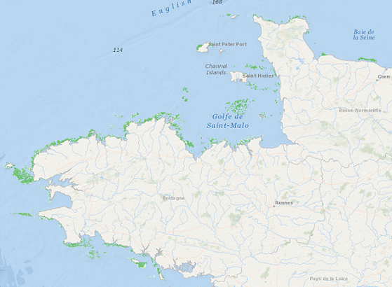
Kelp distribution model across Brittany, France
A habitat distribution modelling approach was used to model the spatial distribution of kelp forests along BritannyÔÇÖs coast (France). Lineage: Data represents percentage cover of kelp forest. The Habitat model was generated from kelp forest presence/absence determined from acoustic surveys of laminarial algae. KdPar, sea surface temperature, depth and current speed were used as predictive variables. Habitat model represents only the areas where kelp forests may occur, not the areas confirmed in field observations. Type of occurrence data used: Acoustic surveys of kelp forest were carried out in spring 2005-2006-2007 in 10 study areas along the coast of Brittany. A specific algorithm was developed for automatic detection of presence/absence of kelp forest from the acoustic data. Environmental covariates/explanatory variables: Covariates used were: - KPAR (proxy of light availability): spatial resolution 1km, averaged values (temporal coverage 7 years -1998-2004-, temporal resolution 1 week) - Sea surface temperature: spatial resolution 1km, averaged values (temporal coverage 20 years, temporal resolution 1 week) - Tidal current velocity: spatial resolution 300m, maximum values (temporal coverage one mean spring tide) Algorithm/modelling approach: A stepwise multiple regression with a backward selection of variables was used to predict values of kelp frequency (%)For EMODNet Seabed habitats portal, the dataset was scaled between 0-1. Original data is 0-100.
Simple
- Alternate title
-
FR300004
- Date (Publication)
- 2010-04-11
- Citation identifier
- DOI:10.12770/9617fdd6-e960-4e17-8d23-8f75911d774c
- Citation identifier
- IFR_MORLAIX_KELP_PRESENCE_ABSENCE
- Citation identifier
- 9617fdd6-e960-4e17-8d23-8f75911d774c
- Presentation form
- Digital map
- Credit
-
Meleder Tard Vona, Populus Jacques, Guillaumont Brigitte, Perrot Thierry, Mouquet Pascal (2010). Predictive modelling of seabed habitats: case study of subtidal kelp forests on the coast of Brittany, France. Marine Biology, 157(7), 1525-1541. Publisher's official version : https://doi.org/10.1007/s00227-010-1426-4 , Open Access version : https://archimer.ifremer.fr/doc/00006/11758/
- Point of contact
-
Organisation name Individual name Electronic mail address Role University of Nantes
Vona Meleder
Point of contact IFREMER
DYNECO
Point of contact
-
GEMET - INSPIRE themes, version 1.0
-
-
Habitats and biotopes
-
- Theme
-
-
GEMET - INSPIRE themes, version 1.0
-
Uncategorized
-
/Biological Environment/Habitats
-
Marine habitat mapping
-
- Keywords
-
-
Downloadable Data
-
- Use limitation
-
Creative Commons license to apply : Attribution + Non Commercial + No Derivs (BY-NC-ND) : http://creativecommons.org/licenses/?lang=en
- Use limitation
-
Viewable, not downloadable
- Access constraints
- License
- Use constraints
- License
- Other constraints
-
Limited usability. The product thematic accuracy is low.
- Spatial representation type
- Grid
- Distance
- 150 meter
- Language
- English
- Character set
- UTF8
- Topic category
-
- Environment
- Environment description
-
Microsoft Windows 7 Version 6.1 (Build 7601) Service Pack 1; Esri ArcGIS 10.5.1.7333
))
- Reference system identifier
- EPSG / WGS 84 / UTM zone 30N (EPSG:32630) / 6.14(3.0.1)
- Number of dimensions
- 2
- Dimension name
- Column
- Dimension size
- 5462
- Dimension name
- Row
- Dimension size
- 5674
- Cell geometry
- Area
- Transformation parameter availability
- Yes
- Number of dimensions
- 2
- Dimension name
- Column
- Dimension size
- 3206
- Resolution
- 0.001691 deg
- Dimension name
- Row
- Dimension size
- 1728
- Resolution
- 0.001691 deg
- Cell geometry
- Area
- Transformation parameter availability
- Yes
- Checkpoint Availability
- No
Center point
- Point in Pixel
-
- Center
- Distribution format
-
Name Version Raster Dataset
- OnLine resource
-
Protocol Linkage Name WWW:LINK-1.0-http--metadata-URL
http://dx.doi.org/10.12770/9617fdd6-e960-4e17-8d23-8f75911d774c DOI du jeu de donn├®e
- OnLine resource
-
Protocol Linkage Name OGC:WMS
http://www.ifremer.fr/services/wms/biologie KELP_DISTRIBUTION_MODEL_BRITTANY
- Hierarchy level
- Dataset
Conformance result
- Title
-
R├êGLEMENT (UE) N o 1089/2010 DE LA COMMISSION du 23 novembre 2010 portant modalit├®s d'application de la directive 2007/2/CE du Parlement europ├®en et du Conseil en ce qui concerne l'interop├®rabilit├® des s├®ries et des services de donn├®es g├®ographiques
- Date (Publication)
- 2010-12-08
- Explanation
-
See the referenced specification
- Pass
- No
- Statement
-
Data represents percentage cover of kelp forest. The Habitat model was generated from kelp forest presence/absence determined from acoustic surveys of laminarial algae. KdPar, sea surface temperature, depth and current speed were used as predictive variables. Habitat model represents only the areas where kelp forests may occur, not the areas confirmed in field observations. For EMODNet Seabed habitats portal, the dataset was scaled between 0-1. Original data is 0-100.
- Content type
- Image
- Descriptor
-
Band_1
- Maximum value
- 1
- Minimum value
- 0
- Bits per value
- 32
Metadata
- File identifier
- 9617fdd6-e960-4e17-8d23-8f75911d774c XML
- Metadata language
- English
- Character set
- UTF8
- Hierarchy level
- Dataset
- Hierarchy level name
-
dataset
- Date stamp
- 2022-07-19T11:17:28.408Z
- Metadata standard name
-
INSPIRE Metadata Implementing Rules: Technical Guidelines based on EN ISO 19115 and EN ISO 19119
- Metadata standard version
-
V. 1.2
- Metadata author
-
Organisation name Individual name Electronic mail address Role University of Nantes
Vona Meleder
Point of contact
)))
