 EMODnet product catalogue
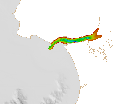
590_HR_RioTejo
Bathymetric data resulting from hydrographic surveys for cartographic purposes and/or port management. Surveys carried out in accordance with the IHO S-44 standard.
Simple
- Date (Creation)
- 2013
- Date (Revision)
- 2020
- Citation identifier
- HR_RioTejo
- Point of contact
-
Organisation name Individual name Electronic mail address Role IHPT, Hydrographic Institute
Custodian IHPT, Hydrographic Institute
Originator
-
Parameter Discovery Vocabulary (P02)
-
-
Bathymetry and Elevation
-
-
SeaDataNet device categories
-
-
multi-beam echosounders
-
-
Positioning devices
-
-
Differential Global Positioning System receivers
-
-
SeaDataNet depth measurement reference planes
-
-
Lowest Astronomical Tide
-
-
Project name
-
-
EMODnet HRSM
-
-
Thèmes Sextant
-
-
/Physical Environment/Bathymetry/Digital Terrain Model
-
- Access constraints
- Creative Commons Attribution 4.0 International
- Use constraints
- Other restrictions
- Other constraints
-
DO NOT USE FOR NAVIGATION
- Spatial representation type
- Grid
- Denominator
- 5000
- Distance
- 0.0078125 Arc minute
- Language
- English
- Character set
- UTF8
- Topic category
-
- Oceans
- Begin date
- 2013
- End date
- 2013 Before
Vertical extent
- Minimum value
- 1.11
- Maximum value
- 45.69
- Description
-
Tagus River - Lisbon - Portugal
))
- Reference system identifier
- EPSG / WGS 84 (EPSG:4326) / 7.4
- Number of dimensions
- 3
- Dimension name
- Column
- Dimension size
- 2176
- Dimension name
- Row
- Dimension size
- 768
- Dimension name
- Time
- Dimension size
- 1
- Cell geometry
- Point
- Transformation parameter availability
- No
- Checkpoint Availability
- No
- Point in Pixel
-
- Lower left
- Distribution format
-
Name Version XYZ Ascii
- Distributor contact
-
Organisation name Individual name Electronic mail address Role IHPT, Hydrographic Institute
Distributor
- Distributor contact
-
Organisation name Individual name Electronic mail address Role Distributor
- Distributor contact
-
Organisation name Individual name Electronic mail address Role IHPT, Hydrographic Institute
Distributor
- Transfer size
- 58
- OnLine resource
-
Protocol Linkage Name WWW:LINK
https://emodnet.ec.europa.eu/geoviewer/ EMODnet viewer
WWW:DOWNLOAD
https://downloads.emodnet-bathymetry.eu/high_resolution/590_HR_RioTejo.emo.zip WWW:LINK
https://tiles.emodnet-bathymetry.eu/ EMODnet Bathymetry WMTS service
- Hierarchy level
- Dataset
Conformance result
- Title
-
Shoal bias
- Date
- Pass
- No
Quantitative attribute accuracy
- Name of measure
-
depth
- Measure identification
- depth accuracy
- Measure description
-
According to the S44 (OHI) order of the source
Quantitative result
- Value
- not defined
Gridded data positional accuracy
- Name of measure
-
horizontal accuracy
- Measure identification
- horizontal accuracy of coordinate
- Measure description
-
According to the S44 (OHI) order of the source
Quantitative result
- Value type
- horizontal accuracy
Absolute external positional accuracy
- Name of measure
-
emodnet-bathymetry.QI.Horizontal
- Value
- 3 < 20 m
Absolute external positional accuracy
- Name of measure
-
emodnet-bathymetry.QI.Vertical
- Value
- 3 - Lidar, SBES high frequency
Domain consistency
- Name of measure
-
emodnet-bathymetry.QI.Purpose
- Value
- 3 - Hydrographic survey or compatible with hydrographic standards
- Hierarchy level
- Software
- Other
-
software
- Hierarchy level
- Property type
- Description
-
parameters of data processing
- Statement
-
EMODnet processing methodology using Globe software
- Description
-
Data sources: Multibeam Survey (2013)
CDIs: 590_RioTejo
Metadata
- File identifier
- SDN_CPRD_590_HR_RioTejo XML
- Metadata language
- English
- Character set
- UTF8
- Hierarchy level name
-
Composite Product Record
- Date stamp
- 2022-07-19T08:06:32.734Z
- Metadata standard name
-
ISO 19115:2003/19139 - EMODNET - BATHYMETRY
- Metadata standard version
-
1.0
- Metadata author
-
Organisation name Individual name Electronic mail address Role IHPT, Hydrographic Institute
Author
)))
