 EMODnet product catalogue
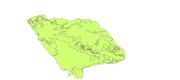
Condor Seamount Seabed features
Map derived from the work presented by F.Tempera and coleagues on the Condor seamount, near Faial Island in the Azores. High-resolution datasets collected by multibeam and acoustic backscatter surveys were
used to produce fine-scale seafloor nature and morpho-tectonic interpretations of the seamount, collected from various acoustic surveys from 2008 to 2010. submitted in Fernando Tempera, Ana Hip├│lito, Jos├® Madeira, Sara Vieira,
Aldino S. Campos, Neil C. Mitchell, Condor seamount (Azores, NE Atlantic): A
morpho-tectonic interpretation, Deep-Sea Research II, http://dx.doi.org/10.1016/j.
dsr2.2013.09.016
Simple
- Alternate title
-
PT100009
- Date (Publication)
- 2013-09-24T15:28:00
- Edition
-
version 1.0
- Presentation form
- Digital map
- Purpose
-
Research supported by MeshAtlantic project
- Status
- On going
- Point of contact
-
Organisation name Individual name Electronic mail address Role DOP/IMAR University of the Azores
Ricardo Serrão Santos
Point of contact
- Maintenance and update frequency
- Not planned
- Place
-
-
Azores
-
- Theme
-
-
Seafloor mapping
-
-
GEMET - INSPIRE themes, version 1.0
-
-
Habitats and biotopes
-
- Use limitation
-
These files are intended for personal use. Any commercial use of these data is strictly prohibited. For any use other than personal, please contact the digital data custodian.
- Access constraints
- Intellectual property rights
- Use constraints
- Intellectual property rights
- Spatial representation type
- Vector
- Denominator
- 200000
- Language
-
eng
- Character set
- UTF8
- Topic category
-
- Environment
- Begin date
- 1999-01-01T16:49:00
- End date
- 2011-12-31T16:49:00
))
Vertical extent
- Minimum value
- -185
- Maximum value
- -2003
- Reference system identifier
- WGS 1984
- Distribution format
-
Name Version shapefile
ESRI ArcGIS 10.1
- OnLine resource
-
Protocol Linkage Name WWW:LINK-1.0-http--link
webgis OGC:WMS
https://ows.emodnet-seabedhabitats.eu/geoserver/emodnet_view_maplibrary/wms? pt100009
OGC:WFS
https://ows.emodnet-seabedhabitats.eu/geoserver/emodnet_open_maplibrary/wfs? pt100009
WWW:LINK-1.0-http--link
https://files.emodnet-seabedhabitats.eu/data/EMODnetSBHsurvey_PT100009.zip EMODnet Seabed Habitats download
- Hierarchy level
- Dataset
Conformance result
- Title
-
EUNIS habitats of the Condor seamount
- Date (Publication)
- 2013-10-01
- Explanation
-
EUNIS habitats of the Condor seamount interpreted from multibeam backscatter and topography
- Pass
- No
- Statement
-
Backscatter mosaics were integrated in the ArcGIS project and used as a basis for a human-assisted interpretation of seabed nature (consolidated vs. unconsolidated) at a scale of 1:20,000. Interpretation of tonal and textural backscatter properties followed Blondel and Murton (1997). In situations where backscatter exhibited insufficient quality, the demarcation of the rocky areas was assisted by (i) an examination of the geomorphological context, (ii) seafloor type information derived from groundtruthing surveys and (iii) bathymetric texture in the form of high-resolution slope and sun-illuminated relief maps. Using this complementary information was particularly relevant to improve the substrate delineation in areas where acoustic backscatter was only provided by the TOBI backscatter mosaic. Because of towfish-ship location uncertainties, this dataset was poorly registered with respect to the multibeam bathymetry at the fine scale used.
Metadata
- File identifier
- b291e8df-8d6a-4fae-958a-68fef88c61c1 XML
- Metadata language
-
eng
- Character set
- UTF8
- Date stamp
- 2020-01-16T13:19:48
- Metadata standard name
-
ISO 19115:2003/19139
- Metadata standard version
-
1.0
- Metadata author
-
Organisation name Individual name Electronic mail address Role DOP/IMAR University of the Azores
Ricardo Serrão Santos
Point of contact
)))
