 EMODnet product catalogue
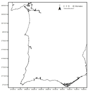
Zostera marina meadows in Portugal
Zostera marina meadows distribution in the Portuguese mainland from historical data.
Data provided by the Life Project BIOMARES and published in:
ÔÇ£Seagrasses in Portugal: A most endangered marine habitatÔÇØ. Aquatic Botany. doi:10.1016/j.aquabot.2011.08.007.
ÔÇ£Estimation of available seagrass meadows area in Portugal for transplanting purposes ÔÇØ. Journal of Coastal Research (2009) :SI 56 (1100-1104)
Simple
- Alternate title
-
PT000009
- Date (Revision)
- Presentation form
- Digital map
- Purpose
-
Provide information on the distribution of historical Zostera marina meadows in the Portuguese continental coast
- Status
- Historical archive
- Point of contact
-
Organisation name Individual name Electronic mail address Role University of Algarve (UAlg-FCT)- Centre of Marine Science (CCMAR)
Luis Bentes & Jorge Gonçalves
Author Biomares Project
Point of contact
- Maintenance and update frequency
- Not planned
- Theme
-
-
Habitat
-
- Place
-
-
Portugal
-
-
GEMET - INSPIRE themes, version 1.0
-
-
Habitats map
-
- Use limitation
-
The access and use is possible with request to the Biomares Life Project and Centre of Marine Sciences (CCMAR) of the University of Algarve (UAlg/FTC)
- Access constraints
- License
- Use constraints
- License
- Spatial representation type
- Vector
- Denominator
- 10000
- Language
-
eng
- Character set
- UTF8
- Topic category
-
- Biota
))
Vertical extent
- Reference system identifier
- WGS 1984
- Distribution format
-
Name Version Shapefile
ESRI ArcGis
- OnLine resource
-
Protocol Linkage Name WWW:LINK-1.0-http--link
www.projectobiomares.com WWW:LINK-1.0-http--link
https://www.emodnet-seabedhabitats.eu/access-data/launch-map-viewer/?zoom=9¢er=-8.35103,37.75284&layerIds=502&baseLayerId=1&activeFilters=NobwRANghgngpgJwJIBMwC4CsAGATAGjADMBLCAF0VQwBYAOQ0ixAGQHs2BrAVwAdUAzhmABdRmUoIAKnAAe5DGAAKU7GrUBOMAF8RQA EMODnet Seabed Habitats Map Viewer
OGC:WMS
https://ows.emodnet-seabedhabitats.eu/geoserver/emodnet_view_maplibrary/wms? pt000009
OGC:WFS
https://ows.emodnet-seabedhabitats.eu/geoserver/emodnet_open_maplibrary/wfs? pt000009
WWW:LINK-1.0-http--link
https://files.emodnet-seabedhabitats.eu/data/EMODnetSBHsurvey_PT000009.zip EMODnet Seabed Habitats download
- Hierarchy level
- Dataset
Conformance result
- Title
-
Zostera marina meadows in Portugal
- Date (Revision)
- Pass
- No
Metadata
- File identifier
- f3a2389e-e6e9-43b3-b548-ea5cfe6d478e XML
- Metadata language
-
eng
- Character set
- UTF8
- Date stamp
- 2020-01-15T12:00:38
- Metadata standard name
-
ISO 19115:2003/19139
- Metadata standard version
-
1.0
- Metadata author
-
Organisation name Individual name Electronic mail address Role University of Algarve (UAlg-FCT)- Centre of Marine Science (CCMAR)
Luis Bentes & Jorge Gonçalves
Point of contact
)))
