 EMODnet product catalogue
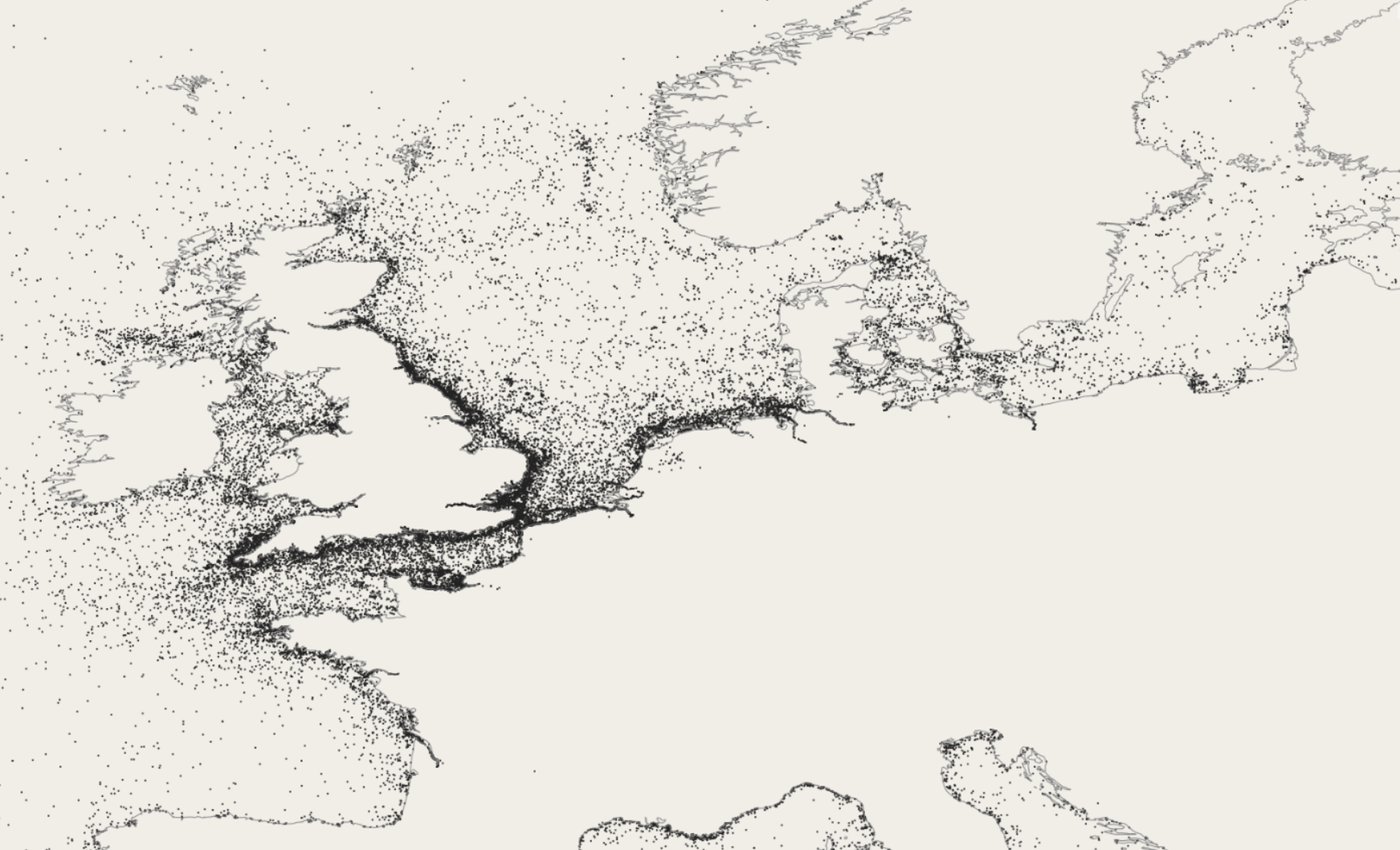
EMODnet Bathymetry Ship Wreck
The EMODnet Bathymetry Ship Wreck data service is a WMS service that provides a styled representation of know Sunken ships and other disused man-made objects in EMODnet waters. The WMS service is provided by the UK company Oceanwise Ltd. The service is restricted and can only be accessed in the EMODnet data portal.
Simple
- Date (Publication)
- Citation identifier
- EMODnet_Bathy_Ship_Wreck
- Point of contact
-
Organisation name Individual name Electronic mail address Role EMODnet Bathymetry Consortium
Point of contact
- Access constraints
- Creative Commons Attribution 4.0 International
- Use constraints
- Other restrictions
- Other constraints
-
DO NOT USE FOR NAVIGATION
- Spatial representation type
- Vector
- Language
- English
- Character set
- UTF8
- Topic category
-
- Oceans
))
- Distribution format
-
Name Version
- OnLine resource
-
Protocol Linkage Name WWW:LINK
https://tiles.emodnet-bathymetry.eu/ EMODnet Bathymetry WMTS service
WWW:LINK
https://emodnet.ec.europa.eu/geoviewer EMODnet viewer
- Hierarchy level
- Dataset
Domain consistency
Conformance result
- Title
-
RÈGLEMENT (UE) N o 1089/2010 DE LA COMMISSION du 23 novembre 2010 portant modalités d'application de la directive 2007/2/CE du Parlement européen et du Conseil en ce qui concerne l'interopérabilité des séries et des services de données géographiques
- Date (Publication)
- 2010-12-08
- Explanation
-
See the referenced specification
Metadata
- File identifier
- fabe8997-8d97-4fd6-b267-8bfb10510da1 XML
- Metadata language
- Français
- Character set
- UTF8
- Hierarchy level
- Dataset
- Date stamp
- 2025-05-16T09:40:25.381748Z
- Metadata standard name
-
ISO 19115-3 - SEXTANT
- Metadata standard version
-
1.0
)))
