Identificatie
| Versiedatum |
2018-10-25
|
| Type versiedatum |
Creatie: Aanmaakdatum of opnamedatum van de dataset. |
| Type versiedatum |
Wijziging: Datum van wijziging, controle, verbetering van dataset. |
| Dataset identificator |
181101-Gulf-of-Cadiz |
Inhoud
| Organisatie |
ICM-CSIC/ Institute of Marine Sciences |
| Telefoon |
+34 932 309500 |
| Adres |
Paseo Marítimo de la Barceloneta, 37-49 |
| Plaats |
Barcelona |
| Postcode |
08003 |
| Land |
Spain |
| E-mail |
secredir@icm.csic.es
|
| Connectiepunt URL |
http://www.icm.csic.es
|
| Rol |
Producent: Partij die de data heeft aangemaakt. |
| Organisatie |
ICM-CSIC/ Institute of Marine Sciences |
| Telefoon |
+34 932 309500 |
| Adres |
Paseo Marítimo de la Barceloneta, 37-49 |
| Plaats |
Barcelona |
| Postcode |
08003 |
| Land |
Spain |
| E-mail |
secredir@icm.csic.es
|
| Connectiepunt URL |
http://www.icm.csic.es
|
| Rol |
Beheerder: Partij die verantwoordelijkheid heeft geaccepteerd en zorg draagt voor het beheer
van de data. |
| Parameter Discovery Vocabulary (P02) |
Bathymetry and Elevation
|
| SeaDataNet device categories |
multi-beam echosounders
|
| Positioning devices |
Differential Global Positioning System receivers
|
| Vertical Datum |
Lowest Astronomical Tide
|
| Project name |
EMODnet HRSM
|
| Thèmes Sextant |
/Physical Environment/Bathymetry/Digital Terrain Model
|
| GDI-Vlaanderen Trefwoorden |
Metadata GDI-Vl-conform
|
| Ruimtelijk schema dataset(serie) |
grid: Grid data wordt gebruikt om geografische
data te representeren. |
| Grondresolutie |
0.015625 Arc minute |
| Taal |
Engels |
| Karakterset |
UTF-8: 8-bit variabele grootte universele karakterset, gebaseerd op ISO/IEC 10646 |
| Categorie(ën) |
Oceanen
|
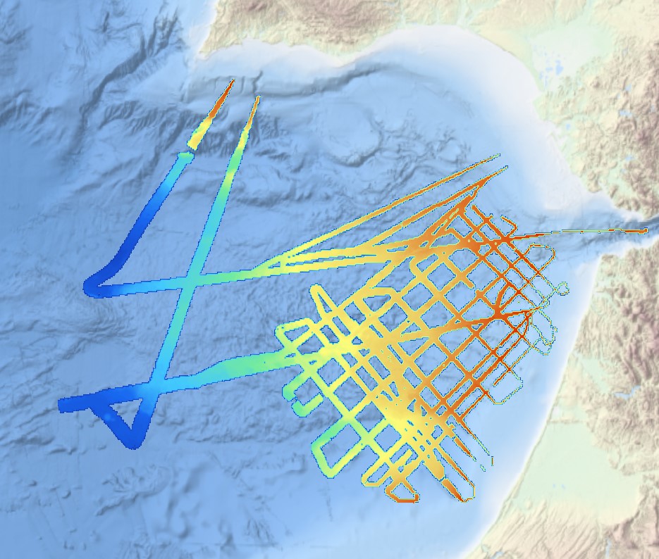
| Omschrijving geografische begrenzing |
|
| Identificator geografische begrenzing |
|
| Omschrijving geografische begrenzing |
|
| Identificator geografische begrenzing |
|
| Omschrijving geografische begrenzing |
|
| Minimum x-coordinaat |
-9.94218639 |
| Maximum x-coordinaat |
-5.31913898 |
| Minimum y-coordinaat |
34.34829843 |
| Maximum y-coordinaat |
37.2140216 |
|
| Identificator geografische begrenzing |
|
Referentiesysteem
| Unieke code |
WGS 84 (EPSG:4326) |
| Codespace |
EPSG |
Kwaliteit
| Niveau kwaliteitsinformatie |
Dataset: Informatie heeft betrekking op de dataset. |
| Niveau kwaliteitsinformatie |
Software: Informatie heeft betrekking op een computerprogramma of code. |
| Niveau kwaliteitsinformatie |
Kenmerktype: Informatie heeft betrekking op een kenmerktype. |
| Beschrijving niveau kwaliteitsinformatie |
software |
| Waarde |
2 - MBES low frequency (lower than 100kHz) (similar than 1+2%d) |
|
| Algemene beschrijving herkomst |
EMODnet processing methodology using Globe software |
Toegangs- en gebruiksbeperkingen
| (Juridische) toegangsbeperking |
Creative Commons Attribution 4.0 International: Creative Commons Attribution 4.0 International |
| (Juridische) gebruiksbeperking |
anders: Restrictie niet opgenomen in lijst. |
| Overige beperkingen |
DO NOT USE FOR NAVIGATION |
|
|
|
Distributie
| Distributieformaat |
NetCDF
|
| Organisatie |
UTM-CSIC/Marine Technology Unit |
| Telefoon |
+34 932 309500 |
| Adres |
Paseo Maritimo de la Barceloneta, 37-49 |
| Plaats |
Barcelona |
| Postcode |
08003 |
| Land |
Spain |
| E-mail |
info@utm.csic.es
|
| Connectiepunt URL |
http://www.utm.csic.es/
|
| Rol |
Verdeler: Partij die de data verstrekt. |
|
|
|
Meta-metadata
 EMODnet Product Catalogue