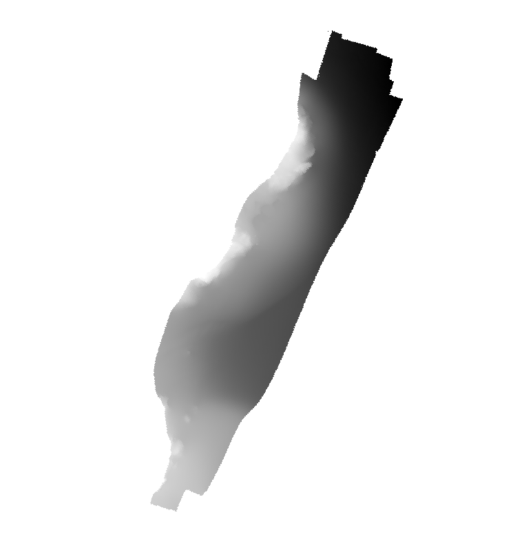
Multibeam bathymetry showing submarine terraces in the seafloor southeast of Tvärminne Zoological Station in southern Finland archipelago. Detailed information about the depth and shape of the seafloor is provided by the acquired multibeam bathymetry. This information is commonly used to study, for example, general seafloor geology, glacial morphology, bottom habitats, and bottom current activities.
Grid:
Grid data is used to represent geographic data
Spatial resolution
Denominator
10000
Spatial resolution
Distance
0.5 meter
Language
English
Character set
UTF8:
8-bit variable size UCS Transfer Format, based on ISO/IEC 10646
Topic category code
Reference System Information
Unique resource identifier
EPSG:32634
Codespace
EPSG
Hierarchy level
Dataset:
Information applies to the dataset
Hierarchy level
Feature:
Information applies to a feature
Hierarchy level
Software:
Information applies to a computer program or routine
Hierarchy level
Property type:
Information applies to a property type
Hierarchy level
Dataset:
Information applies to the dataset
Other
software
Absolute external positional accuracy
Quantitative result
Record
3 - < 20 m
Absolute external positional accuracy
Quantitative result
Record
4 - MBES High frequency (higher that 100kHz) (1+0.5%d)
Lineage
Statement
no information
Lineage
Statement
The multibeam bathymetry is provided in the form of a compiled Digital Terrain Model with a cell-spacing of 50x50 cm. The processing of the raw data was carried out using the Qimera software by QPS.
mdLegalAndSecurityConstraintsSection
Resource constraints
Legal constraints
Access constraints
Creative Commons Attribution 4.0 International:
Creative Commons Attribution 4.0 International
Use constraints
Creative Commons Attribution 4.0 International:
Creative Commons Attribution 4.0 International
 EMODnet Product Catalogue
}})