 EMODnet product catalogue
EMODnet Human Activities, Aggregate Extraction
The dataset on aggregate extractions in the European seas was created in 2014 by AZTI for the European Marine Observation and Data Network (EMODnet). It is the result of the aggregation and harmonization of datasets provided by several sources from all across Europe. It is available for viewing and download on EMODnet web portal (Human Activities, https://emodnet.ec.europa.eu/en/human-activities).
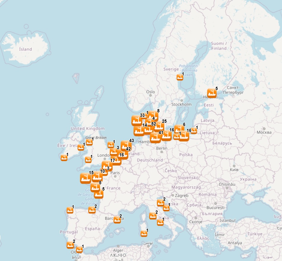
The dataset contains points representing aggregate extraction sites, by year (although some data are indicated by a period of years), in the following countries: Belgium, Denmark, Finland, France, Germany, Ireland, Italy, Lithuania, Poland, Portugal, Spain, Sweden, The Netherlands and United Kingdom. Where available, each point has the following attributes: Id (Identifier), Position Info (e.g.: Estimated, Original, Polygon centroid of dredging area, Estimated polygon centroid of dredging area), Country, Sea basin, Sea, Name of the extraction area, Area of activity (km2), Year (the year when the extraction took place; when a time period is available, the first year of the period is indicated), Permitted Amount (m3) (permitted amount of material to be extracted, in m3), Permitted Amount (t) (permitted amount of material to be extracted, in tonnes), Requested Amount (m3) (requested amount of material to be extracted, in m3), Requested Amount (t) (requested amount of material to be extracted, in tonnes), Extracted Amount (m3) (extracted amount of material, in m3), Extracted Amount (t) (extracted amount of material, in tonnes), Extraction Type (Marine sediment extraction), Purpose (e.g.: Commercial, Others, N/A), End Use (e.g.: Beach nourishment, Construction, Reclamation fill, N/A), Material type (e.g.: sand, gravel, maerl), Notes, Link to Web Sources.
In 2018, a feature on areas for aggregate extractions was included. It contains polygons representing areas of seabed licensed for exploration or extraction of aggregates, in the following countries: Belgium, Denmark, Estonia, Finland, France, Germany, Italy, Lithuania, Poland, Portugal, Russia, Spain, Sweden, The Netherlands and United Kingdom. Where available, each polygon has the following attributes: Id (Identifier), Area code, Area name, Country, Sea basin, Sea, Starting year (the year when the license starts), End year (the year when the license ends), Site Type (exploration area, extraction area, extraction area (in use)), License status (Active, not active, expired, unknown), Material type (e.g.: sand, gravel, maerl), Notes, Distance to coast (in metres), Link to Web Sources.
In the 2024 update, extraction data until 2023 and new areas have been included.
Simple
- Date (Publication)
- 2014-06-20
- Date (Revision)
- 2024-10-14
- Date (Creation)
- 2014-06-17
- Citation identifier
- EMODnet_HA_AggregatesExtraction_20241014
- Point of contact
-
Organisation name Individual name Electronic mail address Role AZTI
Author Denmark - Ministry of Environment and Food of Denmark, Nature Agency
Resource provider United Kingdom - The Crown Estate (Minerals and Dredging)
Resource provider Italy - Regione Lazio, Direzione ambiente, Centro di Monitoraggio GIZC / ISPRA
Resource provider Belgium - MUMM-Managenet Unit of the Norht Sea Mathematical Models, The Royal Belgian Institute of Natural Sciences
Resource provider Spain - Ministerio para la Transición Ecológica y el Reto Demográfico (MITECO), Dirección General de la Costa y el Mar
Resource provider France - IFREMER
Resource provider ICES-Working Group on the Effects of Extraction of Marine Sediments on the Marine Ecosystem (WGEXT)
Resource provider HELCOM - Map and Data service (Extraction of sand and gravel)
Resource provider Belgium - Belgian Federal Government, FPS Economy (Offshore sand and gravel extraction, Control)
Resource provider France - Plateforme ouverte des données publiques françaises: Données maillées représentant l'intensité de l'activité d'extraction de granulats à l'échelle métropolitaine (grille 1' par 1') - Carpediem 03/08/2018
Resource provider Germany - Landesportal Schleswig-Holstein
Resource provider Portugal - Instituto Hidrográfico (IH)
Resource provider Portugal - Portuguese Environmental Agency
Resource provider The Netherlands - Rijkswaterstaat - Ministry of Infrastructure and Water Management - Wingebieden op de Noordzee
Resource provider Belgium - Flemish Institute for the Sea
Resource provider Denmark - Miljøstyrelsen - The Danish Environmental Protection Agency (Råstofindvinding på havet)
Resource provider Germany - Federal Maritime and Hydrographic Agency of Germany, BSH - CONTIS GeoSeaPortal
Resource provider Germany - NIBIS® KARTENSERVER. Landesamt für Bergbau, Energie und Geologie (LBEG)
Resource provider Poland - Biuletyn Informacji Publicznej (BIP), Ministerstwo Środowiska
Resource provider Spain - Sistema de Información sobre el Medio Marino (InfoMAR)
Resource provider Adriatic Atlas - SHAPE IPA project
Resource provider AZTI
Author
-
GEMET - INSPIRE themes, version 1.0
-
-
Mineral resources
-
- Use limitation
-
Re-use of content for commercial or non-commercial purposes is permitted free of charge, provided that the sources (both EMODnet - Human Activities, and primary sources) are acknowledged. EMODnet - Human Activities accepts no responsibility or liability whatsoever for the re-use of content accessible on its website.
- Access constraints
- Other restrictions
- Other constraints
-
No limitation
- Spatial representation type
- Vector
- Language
- English
- Topic category
-
- Utilities communication
))
- Begin date
- 1932-01-01
- End date
- 2051-12-31
- Reference system identifier
- EPSG:4326
- Reference system identifier
- ISO 19108 calendar
- Distribution format
-
Name Version unknown
unknown
- Transfer size
- 0
- OnLine resource
-
Protocol Linkage Name WWW:LINK-1.0-http--link
https://emodnet.ec.europa.eu/en/human-activities EMODnet Human Activities
OGC:WMS-1.3.0-http-get-map
https://ows.emodnet-humanactivities.eu/wms? aggregateareas
OGC:WMS-1.3.0-http-get-map
https://ows.emodnet-humanactivities.eu/wms? aggregates
OGC:WFS
https://ows.emodnet-humanactivities.eu/wfs? emodnet:aggregateareas
OGC:WFS
https://ows.emodnet-humanactivities.eu/wfs? emodnet:aggregates
WWW:DOWNLOAD-1.0-http--download
https://ows.emodnet-humanactivities.eu/geonetwork/srv/api/records/fde45abd-7bf3-4f05-869c-d1ce77f4ac63/attachments/EMODnet_HA_AggregatesExtraction_20241014.zip EMODnet_HA_AggregatesExtraction_20241014.zip
- Hierarchy level
- Dataset
Conformance result
- Title
-
COMMISSION REGULATION (EC) No 1205/2008 of 3 December 2008 implementing Directive 2007/2/EC of the European Parliament and of the Council as regards metadata
- Date (Publication)
- 2008-12-04
- Explanation
-
See the referenced specification
Conformance result
- Title
-
Corrigendum to INSPIRE Metadata Regulation published in the Official Journal of the European Union, L 328, page 83
- Date (Publication)
- 2009-12-15
- Explanation
-
See the referenced specification
Conformance result
- Title
-
Commission Regulation (EU) No 1089/2010 of 23 November 2010 implementing Directive 2007/2/EC of the European Parliament and of the Council as regards interoperability of spatial data sets and services
- Date (Publication)
- 2010-12-08
- Explanation
-
See the referenced specification
- Statement
-
Data were retrived from different sources. Validation and quality assurance remain up to primary data sources, while harmonization is carried out by AZTI. The harmonisation process consisted of identifying a set of attributes common to all the different datasets, thus creating a single data model. To do so, it was necessary to define a homogenous set of variables for each attribute. Therefore, raw data attributes may use a different terminology, although the information contained remains basically the same. When the extraction site was not georrefered in the original dataset, coordinates were estimated based on the available information (e.g., the name of the area). For further information on validation and quality assurance, it is suggested that primary data sources are contacted. Generally speaking data are to be considered very reliable, because they come from national sources officially in charge for their collection.
Metadata
- File identifier
- fde45abd-7bf3-4f05-869c-d1ce77f4ac63 XML
- Metadata language
- English
- Character set
- UTF8
- Hierarchy level
- Dataset
- Date stamp
- 2024-11-11T15:44:13.208833Z
- Metadata standard name
-
ISO19115
- Metadata standard version
-
2003/Cor.1:2006
- Metadata author
-
Organisation name Individual name Electronic mail address Role AZTI
Point of contact AZTI
Point of contact
)))
