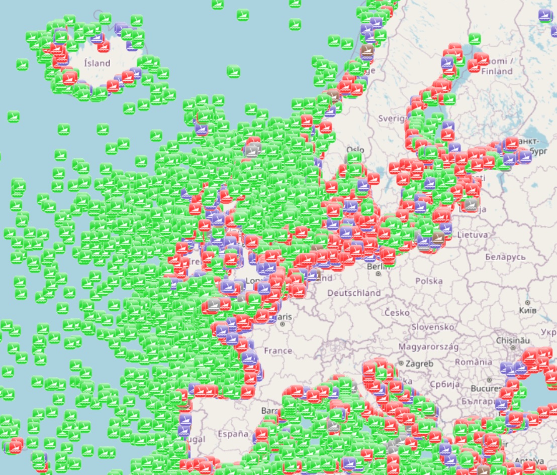
EMODnet Human Activities, Worldwide wrecks locations (UK Hydrographic Office)
The dataset is a subset of the UK Hydrographic Office wrecks and obstructions data set. It contains over 67,000 charted, uncharted, live and dead wrecks from around the world. Where available each point has the following attributes: Wreck Id, Wreck category, Status, Position, Latitude, Longitude, Horizontal datum, Position method, Depth, Depth method, Depth quality, Depth accuracy, Water depth, Water level, Vertical datum, Name, Type, Flag, Length, Width, Draught, Sonar length, Sonar width, Shadow height, Orientation, Tonnage, Tonnage type, Cargo, Conspic visual, Conspic radar, Date sunk, Bottom texture, Scour dimensions, Debris field, Original sensor, Last sensor, Original detection, Last detection, Origin, Markers, Circumstances of loss, Surveying details, General comments, Last amended. The original dataset is updated on a quarterly basis and is made available free of charge under an Open Government Licence, which can be accessed here: https://www.nationalarchives.gov.uk/doc/open-government-licence/version/3/.
owner : {{md.getOwnername()}}
{{'mdStatusRecord' | translate}}: {{('mdStatus-' + md.mdStatus) | translate}}
- Identification
- Content
- ReferenceSystem
- Quality
- DomainConsistancy
- Constraints
- Distribution
- Meta-metadata
- ObjectCatalogue
| Date | 2024-12-26 |
|---|---|
| Date type | Creation: Date identifies when the resource was brought into existence |
| Unique resource identifier | Emodnet_HA_Heritage_WW_Wrecks_20241226 |
mdConstraintsSection
Resource constraints
|
|||||
Point of contact
| Organisation name | AND-International |
|---|---|
| Electronic mail address | severine.renault@and-international.com |
| Electronic mail address | safa.souidi@and-international.com |
| Role | Author: Party who authored the resource |
Point of contact
| Organisation name | UK Hydrographic Office |
|---|---|
| Role | Resource provider: Party that supplies the resource |
Descriptive keywords
| Spatial representation type | Vector: Vector data is used to represent geographic data |
|---|
Spatial resolution
| Denominator | 100000 |
|---|
| Language | English |
|---|---|
| Topic category code |
|
Reference System Information
| Unique resource identifier |
|---|
Reference System Information
| Unique resource identifier |
|---|
| Hierarchy level | Dataset: Information applies to the dataset |
|---|
Lineage
| Statement | Depending on the source of information, the amount of information available on a specific wreck varies. More specific information on the metadata and quality of data can be found on the sources website. |
|---|
Domain consistency
Conformance result
|
|||||||
mdLegalAndSecurityConstraintsSection
Resource constraints
|
|||||
| Distribution format | unknown (Version: unknown) | ||||||||||||||||||||||||||||||||||||||||
|---|---|---|---|---|---|---|---|---|---|---|---|---|---|---|---|---|---|---|---|---|---|---|---|---|---|---|---|---|---|---|---|---|---|---|---|---|---|---|---|---|---|
Transfer options
|
|||||||||||||||||||||||||||||||||||||||||
| File identifier | 108ef240-fa6e-4b83-8569-09b509e2959d | ||||||||
|---|---|---|---|---|---|---|---|---|---|
| Metadata language | English | ||||||||
| Character set | MD_CharacterSetCode_utf8: MD_CharacterSetCode_utf8 | ||||||||
| Hierarchy level | Dataset: Information applies to the dataset | ||||||||
| Date stamp | 2025-01-20T12:07:40.521689Z | ||||||||
| Metadata standard name | ISO19115 | ||||||||
| Metadata standard version | 2003/Cor.1:2006 | ||||||||
Contact
|
|||||||||
Overviews

extent
- geoDesc
- {{d}}
- geoBox
-
- geoDescCode
- {{mdView.current.record.geoDescCode}}
tempExtent
- creationDate
- publicationDate
- revisionDate
- tempExtentBegin
Associated resources
Not available
 EMODnet Product Catalogue
}})