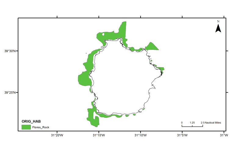
Azores: Flores rock substrate
Flores rock substrate from seismic subbottom profiles interpretation. (Bates, C.R., 2005. Sub-Bottom Profiling for Sand Resource Assessment, Flores Island, Azores. Team Internal Report 05-04)
owner : {{md.getOwnername()}}
{{'mdStatusRecord' | translate}}: {{('mdStatus-' + md.mdStatus) | translate}}
- Identification
- Content
- ReferenceSystem
- Quality
- DomainConsistancy
- Constraints
- Distribution
- Meta-metadata
- ObjectCatalogue
| Alternate title | PT100004 |
|---|---|
| Date | 2012-10-17T16:25:00 |
| Date type | Publication: Date identifies when the resource was issued |
| Edition | Version 1.0 |
| Purpose | Research supported by MeshAtlantic project |
|---|---|
| Status | Historical archive: Data has been stored in an offline storage facility |
Point of contact
| Individual name | Patricia Amorim & Fernando Tempera |
|---|---|
| Organisation name | DOP/IMAR University of the Azores |
| Delivery point | Rua Prof. Dr. Frederico Machado, 4 |
| City | HORTA |
| Postal code | 9900-361 |
| Country | Portugal |
| Electronic mail address | pamorim@uac.pt; tempera@uac.pt |
| Role | Point of contact: Party who can be contacted for acquiring knowledge about or acquisition of the resource |
| Maintenance and update frequency | Not planned: There are no plans to update the data |
|---|
Descriptive keywords
| GEMET - INSPIRE themes, version 1.0 | |
|---|---|
| GDI-Vlaanderen Trefwoorden | Metadata GDI-Vl-conform |
| Other keywords | Azores |
| Other keywords | Marine habitat mapping |
| Spatial representation type | Vector: Vector data is used to represent geographic data |
|---|
Spatial resolution
| Denominator | 200000 |
|---|
| Character set | UTF8: 8-bit variable size UCS Transfer Format, based on ISO/IEC 10646 |
|---|---|
| Topic category code |
|
Reference System Information
| Unique resource identifier | WGS 1984 |
|---|
| Hierarchy level | Dataset: Information applies to the dataset |
|---|
mdLegalAndSecurityConstraintsSection
Resource constraints
|
|||||
| Distribution format | Shapefile (Version: ESRI ArcGIS 10) | ||||||||||||||||||||||||||||||||
|---|---|---|---|---|---|---|---|---|---|---|---|---|---|---|---|---|---|---|---|---|---|---|---|---|---|---|---|---|---|---|---|---|---|
Transfer options
|
|||||||||||||||||||||||||||||||||
| File identifier | e1622d30-6b02-4e92-bed5-838bcff956c4 | ||||||||||||||
|---|---|---|---|---|---|---|---|---|---|---|---|---|---|---|---|
| Character set | UTF8: 8-bit variable size UCS Transfer Format, based on ISO/IEC 10646 | ||||||||||||||
| Date stamp | 2020-01-15T12:21:50 | ||||||||||||||
| Metadata standard name | ISO 19115:2003/19139 | ||||||||||||||
| Metadata standard version | 1.0 | ||||||||||||||
Contact
|
|||||||||||||||
Overviews

thumbnail

large_thumbnail
extent
- geoDesc
- {{d}}
- geoBox
-
- geoDescCode
- {{mdView.current.record.geoDescCode}}
tempExtent
- creationDate
- publicationDate
- revisionDate
- tempExtentBegin
Associated resources
Not available
 EMODnet Product Catalogue
}})