To understand the full benefits of EMODnet, users are kindly asked to describe how EMODnet supports them in their daily work and activities.
If you have developed an application using EMODnet products that you would like to share with us or if you use EMODnet data for other purposes, submit your use case by contacting secretariat@emodnet.ec.europa.eu.
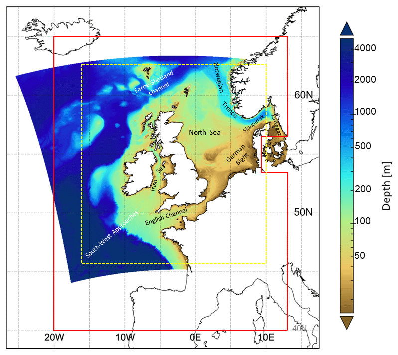
The Met Office provides forecasts of the ocean properties for the European North West Shelf through the Copernicus - Marine Environment Monitoring Service. In 2018, the forecast resolution was upgraded from ~7 to ~1.5 km. Validation at the basin scale and using typical metrics with daily means penalises the high-resolution system and does not reflect the superior performance of the high-resolution system. High resolution observations in selected areas of the model domain were crucial to demonstrate the improvement of the finer resolution model.
The EMODnet River data service provided by EMODnet Physics will support the LAMBDA (LAnd-Marine Boundary Development and Analysis) project to demonstrate the quality of modelling results produced by the watershed models. The EMODnet river service will enhance the Copernicus Marine Environment Monitoring Service (CMEMS) by aiding in watershed models validation and quality control thus improving their forecast services.