 EMODnet Product Catalogue
UK Admiralty Chart Datum
Type of resources
Available actions
Topics
Keywords
Contact for the resource
Provided by
Years
Representation types
Scale 1:
Resolution
-
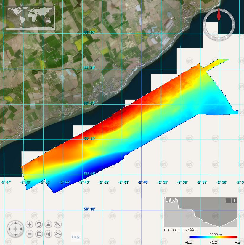
This BGS marine multibeam survey took place in May/June 2013 in the area of Isle of May, Anstruther and the Firth of Forth on board the RV White Ribbon. The survey was carried out by the British Geological Survey (BGS). Sea floor bathymetry data were collected using a Kongsberg EM3002D multibeam system to IHO Order 1A. Bathymetric data on MV White Ribbon was acquired by the British Geological Survey (BGS) using a Kongsberg EM3002D dual head, multibeam echosounder system (MBES). Data were acquired using the Kongsberg SIS operating system, logging raw .ALL files. Offline data processing was performed using CARIS HIPS and SIPS 7.1 SP2
-
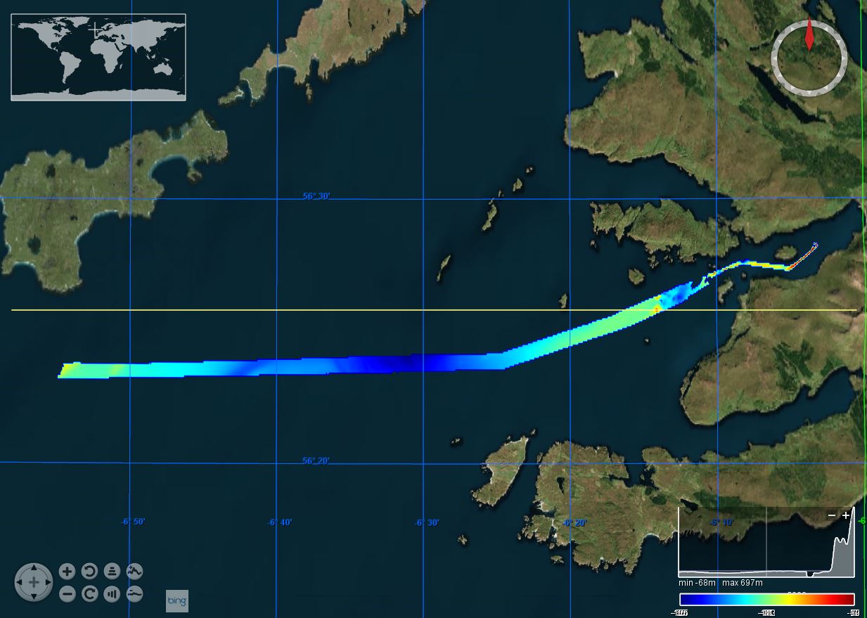
This marine geophysical and multibeam survey was undertaken by British Geological Survey on behalf of Marine Scotland utilising the Northern Lighthouse Board vessel NLV Polestar, it took place in July/August 2012 off south-west Tiree. The purpose was to further our understanding of Scotland’s marine environment, increase the efficiency of use of public resources, enhance the safety of those at sea and contribute to new policy priorities such as marine protected areas, wider conservation measures, marine planning and renewable. Bathymetric data was collected using a Kongsberg EM3002D dual head, multibeam system. Data was acquired using a Kongsberg SIS operating system, logging raw .ALL files. This data was processed offline by BGS using CARIS HIPS and SIPS 7.1 SP2.
-
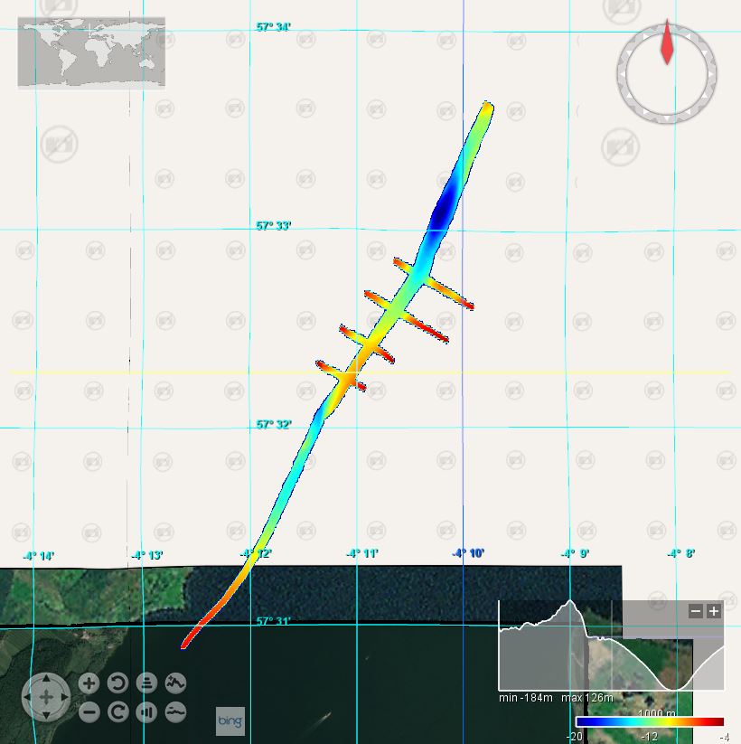
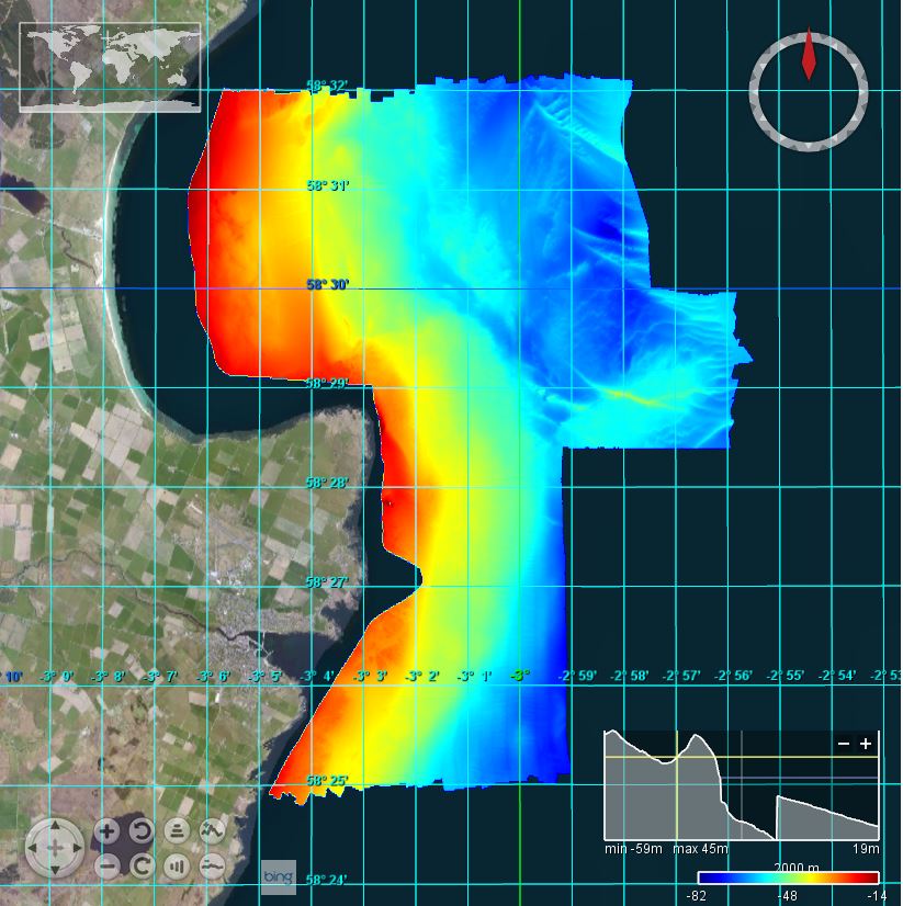
This British Geological Survey (BGS) marine geophysical and multibeam survey took place in January/Febuary 2012 in the area of the Moray Firth on board the RV White Ribbon. The purpose was to enable BGS to reconstruct the glacial history of the areas and place it in the wider context of the dynamics of the British Ice Sheet. Sea floor bathymetry data were collected using a Kongsberg EM3002D multibeam system.
-
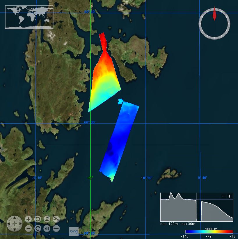
This marine multibeam survey took place in March 2012 in the area of Shetland on board the Northern Lighthouse Board vessel NLV Pole Star. The survey was carried out by the British Geological Survey (BGS) on behalf of Marine Scotland. Sea floor bathymetry data were collected using a Kongsberg EM3002D multibeam system.
-
This marine geophysical and multibeam survey was undertaken by British Geological Survey on behalf of Marine Scotland utilising the Northern Lighthouse Board vessel NLV Polestar, it took place in July/August 2012 off south-west Tiree. The purpose was to further our understanding of Scotland’s marine environment, increase the efficiency of use of public resources, enhance the safety of those at sea and contribute to new policy priorities such as marine protected areas, wider conservation measures, marine planning and renewable. Bathymetric data was collected using a Kongsberg EM3002D dual head, multibeam system. Data was acquired using a Kongsberg SIS operating system, logging raw .ALL files. This data was processed offline by BGS using CARIS HIPS and SIPS 7.1 SP2.
-
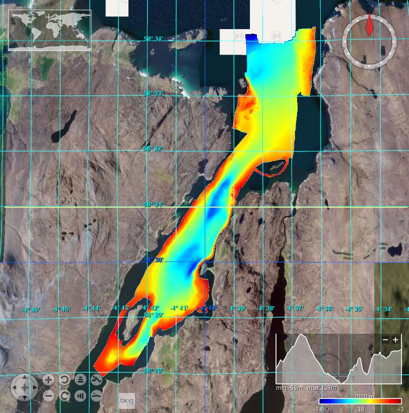
This British Geological Survey (BGS) marine multibeam survey took place in August 2010 in Loch Eriboll on board the RV White Ribbon. The aim was improve the geological understanding of the area and the interpretation of various sedimentary processes active on the seafloor. Loch Eriboll has played an important role in naval warfare and it is believed much material, including several vessels, has ended up on the floor of the loch. Having an accurate map of such obstacles can be used to update the archaeological records and mean better marine spatial planning for future users including aquaculture. Sea floor bathymetry data were collected using a Kongsberg EM3002D multibeam system.
-
This marine multibeam survey took place in August 2011 in the area around Noss Head and the Southern Trench in the Moray Firth on board the Northern Lighthouse Board vessel NLV Pole Star. The survey was carried out by the British Geological Survey (BGS) on behalf of Marine Scotland and Scottish Natural Heritage (SNH) for Marine Protected Area (MPAs) related studies. Sea floor bathymetry data were collected using a Kongsberg EM3002D multibeam system.
-
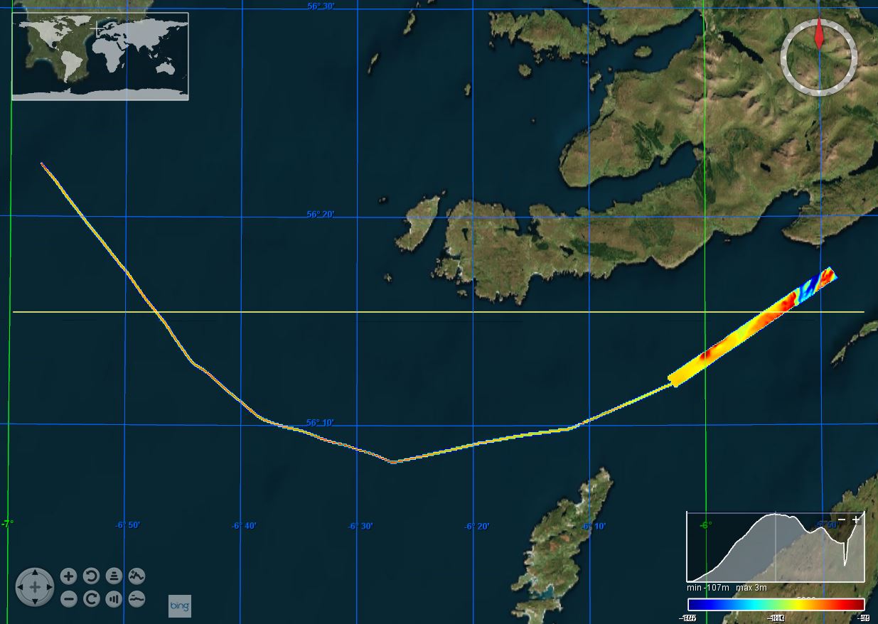
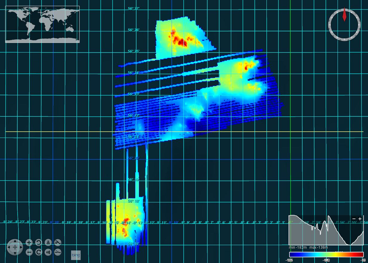
This marine multibeam survey took place in July 2011 in the area around the Isle of Canna on the west coast of Scotland on board the Northern Lighthouse Board vessel NLV Pole Star. The survey was carried out by the British Geological Survey (BGS) on behalf of Marine Scotland and Scottish Natural Heritage (SNH). Sea floor bathymetry data were collected using a Kongsberg EM3002D multibeam system.
-
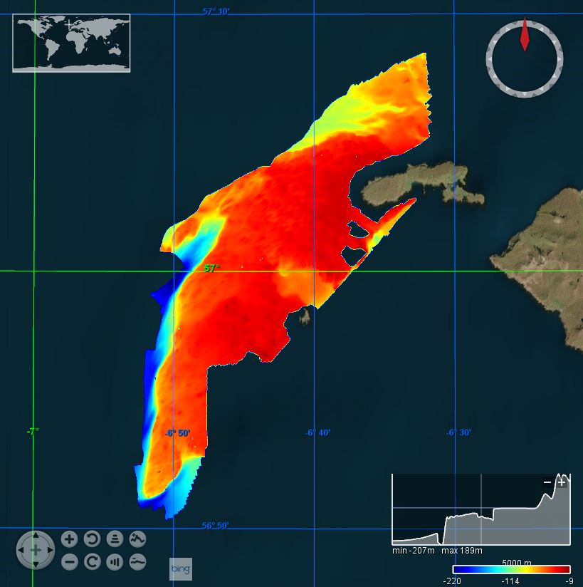
This marine multibeam and sampling survey was undertaken on Stanton Banks by the Joint Nature Conservation Committee (JNCC), Centre for Environment, Fisheries & Aquaculture Science (CEFAS) and British Geological Survey (BGS) in July/August 2012 on board the Northern Lighthouse Board vessel NLV Polestar. The survey was led by the JNCC and included a team from CEFAS who were involved in benthic sampling. A combination of surveys methods were employed, including seabed imagery (drop camera), day grabs and rock dredges. BGS collected sea floor multibeam bathymetry data using a Kongsberg EM3002D multibeam system.
-
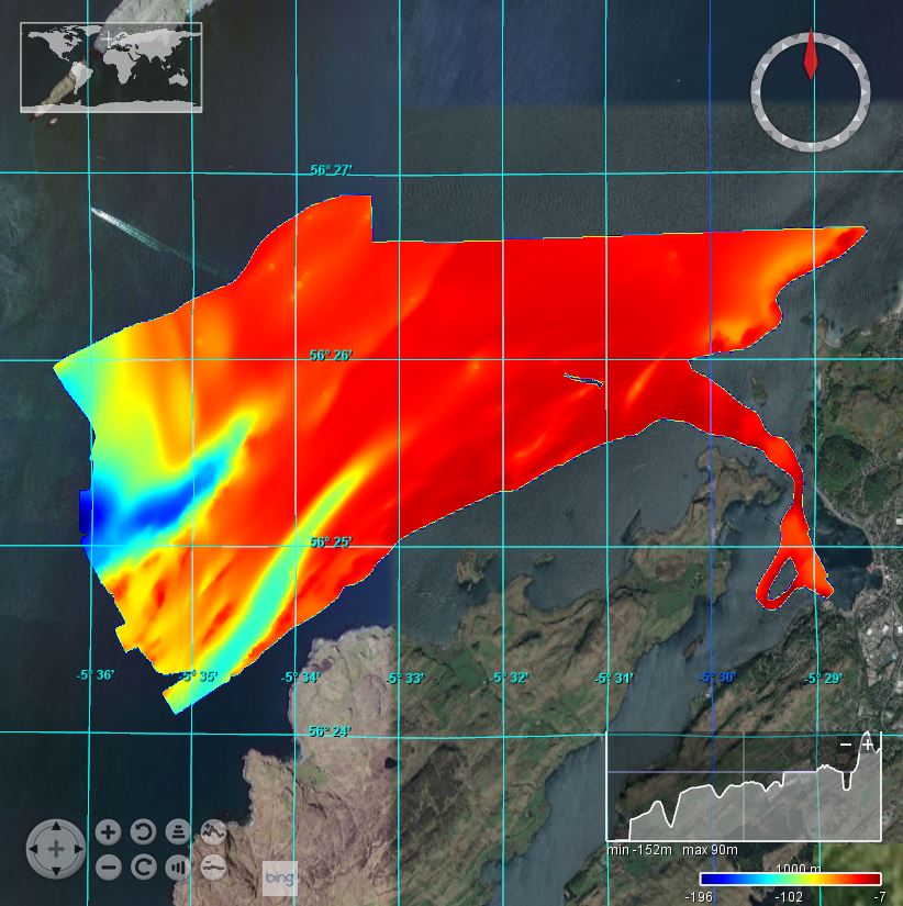
This British Geological Survey (BGS) marine multibeam and sampling survey took place over two separate periods (15-18 February and 24 February - 5 March 2011) in an area at the northern tip of the Firth of Lorne, Oban Bay on board the Northern Lighthouse Board vessel NLV Pole Star. Sea floor data were collected using an EM3002D multibeam system.