EMODnet Human Activities, Cultural Heritage, UNESCO World Heritage Convention
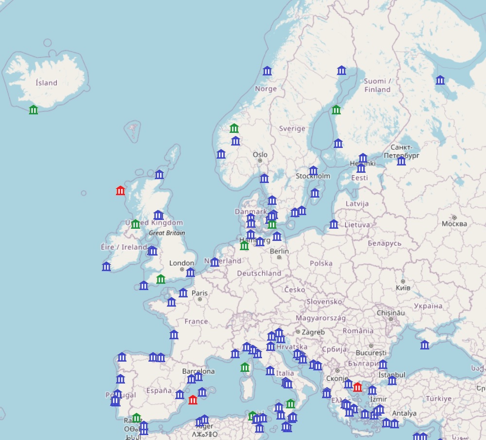
This dataset provides the location of coastal sites from the UNESCO World Heritage Convention list. It includes Unseco sites considered as coastal according to the definition of costal areas provided by the European Commission: coastal areas are local administrative units (LAUs) that are bordering or close to a coastline. A coastline is defined as the line where land and water surfaces meet (border each other). Coastal areas have at least 50% of their surface area within a distance of 10km from the coastline. The dataset includes the name of the sites, its code in the Unesco site database, the distance to coast, whether it is a cultural or natural site and a short description from the Unesco. It is available for viewing and download on the EMODnet web portal (Human Activities, https://emodnet.ec.europa.eu/en/human-activities).
Publication:
Date identifies when the resource was issued
Date
2024-06-18
Date type
Revision:
Date identifies when the resource was examined or re-examined and improved or
amended
Date
2024-06-18
Date type
Creation:
Date identifies when the resource was brought into existence
Unique resource identifier
EMODnet_HA_Heritage_UNESCO_WHL_20240618
mdConstraintsSection
Resource constraints
Constraints
Use limitation
The original data is provided by the UNESCO under the Creative Commons Attribution-ShareAlike 3.0 IGO license. Re-use of content for commercial or non-commercial purposes is permitted free of charge, provided that the sources (both EMODnet - Human Activities, and primary sources) are acknowledged. EMODnet - Human Activities accepts no responsibility or liability whatsoever for the re-use of content accessible on its website.
Resource provider:
Party that supplies the resource
Descriptive keywords
GEMET - INSPIRE themes, version 4.2.3
Protected area
GEMET - Themes, version 4.2.3
sustainable tourism
GEMET - Groups, version 4.2.3
ANTHROPOSPHERE (built environment, human settlements, land setup)
Spatial representation type
Vector:
Vector data is used to represent geographic data
Spatial resolution
Denominator
1000000
Language
English
Topic category code
Reference System Information
Unique resource identifier
EPSG:4326
Reference System Information
Unique resource identifier
ISO 19108 calendar
Hierarchy level
Dataset:
Information applies to the dataset
Lineage
Statement
Information on official UNESCO/WHC website is subject to change without prior notice. No further data validation is carried out by EMODnet.
Domain consistency
Conformance result
Specification
Title
COMMISSION REGULATION (EC) No 1205/2008 of 3 December 2008 implementing Directive 2007/2/EC of the European Parliament and of the Council as regards metadata
Date
2008-12-04
Date type
Publication:
Date identifies when the resource was issued
Explanation
See the referenced specification
Domain consistency
Conformance result
Specification
Title
Corrigendum to INSPIRE Metadata Regulation published in the Official Journal of the European Union, L 328, page 83
Date
2009-12-15
Date type
Publication:
Date identifies when the resource was issued
Explanation
See the referenced specification
Domain consistency
Conformance result
Specification
Title
Commission Regulation (EU) No 1089/2010 of 23 November 2010 implementing Directive 2007/2/EC of the European Parliament and of the Council as regards interoperability of spatial data sets and services
Date
2010-12-08
Date type
Publication:
Date identifies when the resource was issued
EMODnet Human Activities aims to facilitate access to existing marine data on activities carried out in EU waters, by building a single entry point for geographic information on human uses of the ocean.
 EMODnet Product Catalogue
}})