Esri shapefile
Type of resources
Available actions
Topics
Keywords
Contact for the resource
Provided by
Years
Formats
Representation types
Update frequencies
status
Scale 1:
Resolution
-
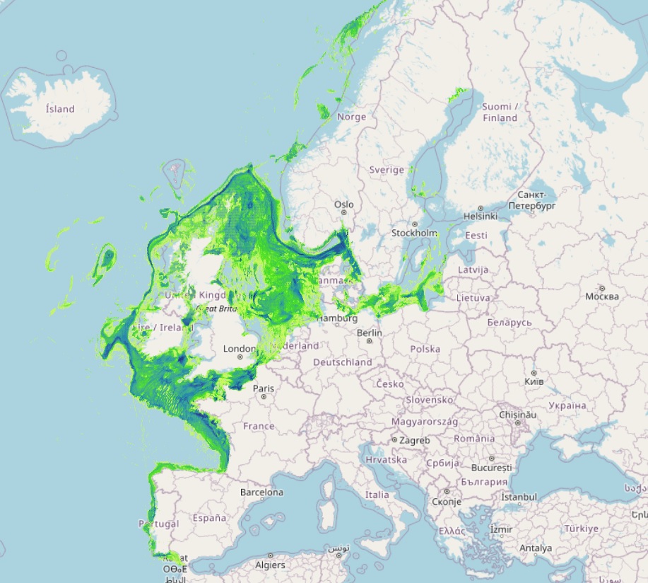
The datasets on fishing intensity in the EU waters by sea basin are created every year by the International Council for the Exploration of the Sea (ICES). In the 2020 Cogea started to collect and harmonize them according to the EMOdnet Human Activities dataset schema. The EMODnet dataset is updated yearly, as soon as new data from ICES Fishing Overviews are released, and is available for viewing and download on the EMODnet web portal (Human Activities, https://emodnet.ec.europa.eu/en/human-activities). Where and when available, the fisheries overview fishing intensity data concern: i) the spatial distribution of average annual fishing effort (mW fishing hours) by ecoregion (Azores, Bay of Biscay and the Iberian Coast, Baltic Sea, Barents Sea, Celtic Seas, Faroes, Greater North Sea, Icelandic Waters, Norwegian Sea and Oceanic Northeast Atlantic) and by gear type (Beam trawls, Bottom otter trawls, Bottom seines, Dredges, Pelagic trawls and seines, Static gears). Fishing effort data are only shown for vessels >12 m having vessel monitoring systems (VMS); ii) the average annual subsurface (top) and surface (bottom) mobile bottom contacting fishing gear (i.e. bottom otter trawls, bottom seines, dredges, beam trawls) disturbance by ecoregion in the Bay of Biscay and the Iberian Coast, Baltic Sea, Barents Sea, Celtic Seas, Faroes, Greater North Sea, Icelandic Waters, Norwegian Sea and Oceanic Northeast Atlantic, expressed as average swept-area ratios (SAR). Due to data confidentiality issues, VMS/logbook data are anonymized and aggregated in a 0.05×0.05 degree grid prior to submission to ICES, using the C-squares geocode system (polygons). The last data loaded into the database, from the ICES 2024 Fishing Overview update or revision (where available), report the 2019-2022 averages. Historical data area also included in the database, starting from the 2020 fishing overview, and reporting the 2015-2018, 2017-2020, 2018-2021, and 2019-2020 averages.
-
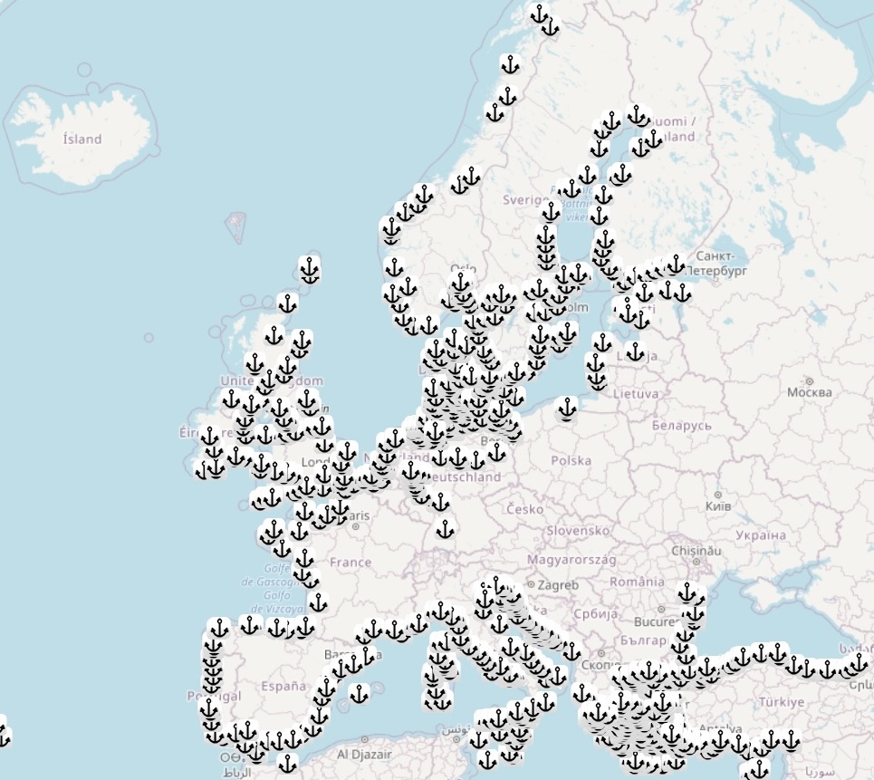
The dataset on maritime transport of goods, passengers and vessels in the European main ports was created in 2014 by Eurofish and Cogea for the European Marine Observation and Data Network (EMODnet). It is available for viewing and download on EMODnet web portal (Human Activities, https://emodnet.ec.europa.eu/en/human-activities). The dataset is the result of the harmonization and aggregation on annual basis of the quarterly Eurostat Maritime transport data, provided by port in the EU Member States, Montenegro, Norway, Turkey and the UK. Eurostat data have been related to the 'Ports 2013' EUROSTAT GISCO's points georeferenced dataset, when available, or to the ports locations coming from other sources, such as UN/LOCODE, Lloyd’s List, Marine Traffic, VESSEL TRACKER and ports' authorities. Goods traffic data are reported in thousands of tonnes by year, type of cargo and direction. Passengers traffic data are reported in thousands passengers (excluding cruise passengers) by direction and traffic type. Vessels traffic data are reported in unit and gross tonnage (thousands) of vessels by vessel size class and vessel type. Where available, the latest update includes data from the 1997 up to the 2024.
-

Multibeam echosounder data acquired during the INFOMAR national seabed mapping programme were the primary source of data used in the generation of this marine habitat map. The original classes assigned to the data were translated to the EUNIS habitat classification system as part of the MESH Atlantic project.
-
Data on marine habitats for the Celtic Sea generated from the collation of historical habitat data by Aquafact Environmental Consultants as part of the Strategic Environmental Assessment of the Irish and Celtic Seas, and published in the IOSEA 4 Report. The original classes assigned to the data were translated to the EUNIS habitat classification system as part of the MESH Atlantic project.
-

Multibeam echosounder data and seabed sampling data acquired during the INSS and INFOMAR national seabed mapping programmes were the primary sources of data used in the generation of this marine habitat map. The original classes assigned to the data were translated to the EUNIS habitat classification system as part of the MESH Atlantic project.
-
Targetted fishing ground for Nephrops norvegicus determined from Vessel Monitoring System data. The original classes assigned to the data were translated to the EUNIS habitat classification system as part of the MESH Atlantic project.
-

Data on marine habitats for the Irish Sea generated from the collation of historical sediment and biological data by Joint Nature Conservation Committee as part of the Irish Sea Pilot Project. The original classes assigned to the data were translated to the EUNIS habitat classification system as part of the MESH Atlantic project.
-

Classification of Kenmare Bay into marine habitats. The original classes assigned to the data were translated to the EUNIS habitat classification system as part of the MESH Atlantic project.
-

Multibeam echosounder data and seabed sampling data acquired during the INFOMAR national seabed mapping programme were the primary sources of data used in the generation of this marine habitat map. The original classes assigned to the data were translated to the EUNIS habitat classification system as part of the MESH Atlantic project.
-
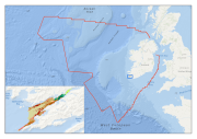
Multibeam echosounder data and seabed sampling data acquired during the 2011 MESH Atlantic survey were the primary sources of data used in the generation of this marine habitat map. Data on kinetic energy, derived from oceanographic models, and all of the interpreted survey data, were combined in a GIS environment and used to generate a EUNIS level 5 habitat map using the Maximum Likelihood Classification tool in ArcMap.
 EMODnet Product Catalogue