Tasman Sea
Type of resources
Available actions
Topics
Keywords
Contact for the resource
Provided by
Years
Representation types
-

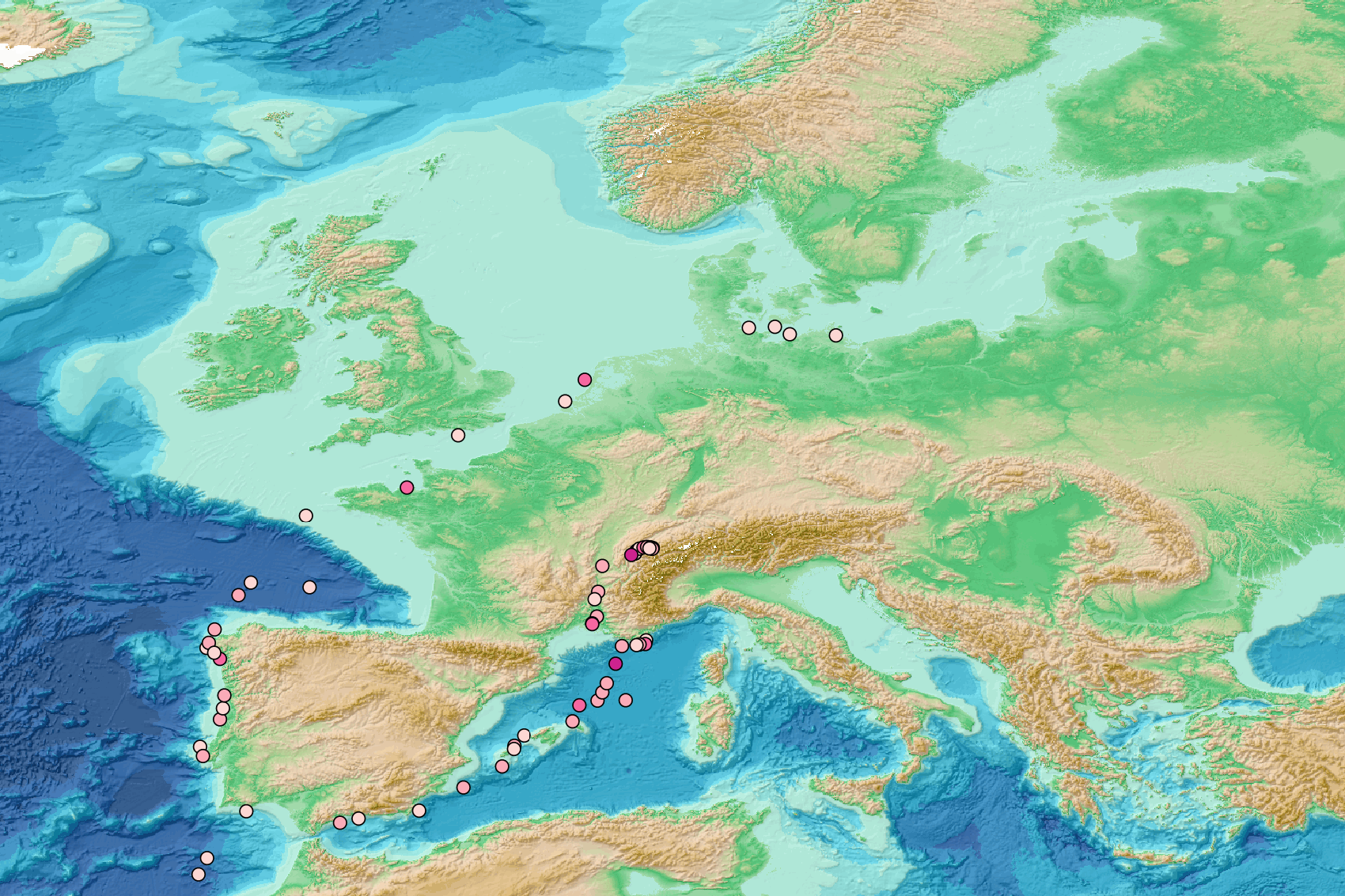
This visualization product displays the density of floating micro-litter per net normalized per km² per year from specific protocols different from research and monitoring protocols. EMODnet Chemistry included the collection of marine litter in its 3rd phase. Before 2021, there was no coordinated effort at the regional or European scale for micro-litter. Given this situation, EMODnet Chemistry proposed to adopt the data gathering and data management approach as generally applied for marine data, i.e., populating metadata and data in the CDI Data Discovery and Access service using dedicated SeaDataNet data transport formats. EMODnet Chemistry is currently the official EU collector of micro-litter data from Marine Strategy Framework Directive (MSFD) National Monitoring activities (descriptor 10). A series of specific standard vocabularies or standard terms related to micro-litter have been added to SeaDataNet NVS (NERC Vocabulary Server) Common Vocabularies to describe the micro-litter. European micro-litter data are collected by the National Oceanographic Data Centres (NODCs). Micro-litter map products are generated from NODCs data after a test of the aggregated collection including data and data format checks and data harmonization. A filter is applied to represent only micro-litter sampled according to a very specific protocol such as the Volvo Ocean Race (VOR) or Oceaneye. Densities were calculated for each net using the following calculation: Density (number of particles per km²) = Micro-litter count / (Sampling effort (km) * Net opening (cm) * 0.00001) When the number of microlitters or the net opening was not filled, the density could not be calculated. Percentiles 50, 75, 95 & 99 have been calculated taking into account data for all years. Warning: the absence of data on the map doesn't necessarily mean that they don't exist, but that no information has been entered in the National Oceanographic Data Centre (NODC) for this area.
-
Abstract: The 2015 VESPA voyage (Volcanic Evolution of South Pacific Arcs) was a seismic and rock dredging expedition to the Loyalty and Three Kings ridges and South Fiji Basin. In this paper we present 33 Ar/Ar, 23 micropaleontological and two U/Pb ages for igneous and sedimentary rocks from 33 dredge sites at 25-28°S in this previously little-studied part of the southwest Pacific Ocean. Igneous rocks include basalts, dolerites, basaltic andesites, trachyandesites and a granite. Successful Ar/Ar dating of altered and/or low-K basalts was achieved through careful sample selection and processing, detailed petrographic and element mapping of groundmass, and incremental heating experiments on both phenocryst and groundmass separates to interpret the complex spectra produced by samples having multiple K reservoirs. The Ar/Ar ages of most of the sampled lavas, irrespective of composition, are latest Oligocene to earliest Miocene (25-22 Ma), but two are Eocene (39-36 Ma). The granite has a U/Pb zircon age of 23.6±0.3 Ma. Ar/Ar lava ages based on dating are corroborated by microfossil ages and by detrital U/Pb zircon dating of a sandstone. In a southwest Pacific regional context, the VESPA lavas are part of a >4000 km long disrupted western belt of Eocene to Miocene subduction-related volcanic rocks. The belt includes arc rocks in Northland New Zealand, Northland Plateau, Three Kings Ridge, and Loyalty Ridge and, more speculatively, D’Entrecasteaux Ridge, West Torres Plateau and Rennell Ridge. This western belt is the product of superimposed Eocene and Oligocene-Miocene remnant volcanic arcs that were stranded along the edge of Zealandia as still-active arcs migrated east with the Pacific trench. The eastern belt of Eocene-Miocene volcanic arcs is more tectonically disrupted and less well-sampled than the western belt. Overall Eocene-Miocene SW Pacific arc development is explained in terms of west-dipping subduction and southward propagating tectonics. Plain word summary: Samples of lava from the seabed between New Zealand and New Caledonia have been dated using atomic clocks and fossils. Most lavas erupted in a big pulse of volcanic activity between 25 and 22 million years ago. They are part of a >4000 km long belt of now-extinct undersea volcanoes that lie between New Zealand and the Solomon Islands, and which were related to early subduction of the Pacific Plate under the Australian Plate. Important Note: This submission has been initially submitted to SEA scieNtific Open data Edition (SEANOE) publication service and received the recorded DOI. The metadata elements have been further processed (refined) in EMODnet Ingestion Service in order to conform with the Data Submission Service specifications.
 EMODnet Product Catalogue