 EMODnet Product Catalogue
UK Hydrographic Office
Type of resources
Available actions
Topics
Keywords
Contact for the resource
Provided by
Years
Formats
Representation types
Scale 1:
-
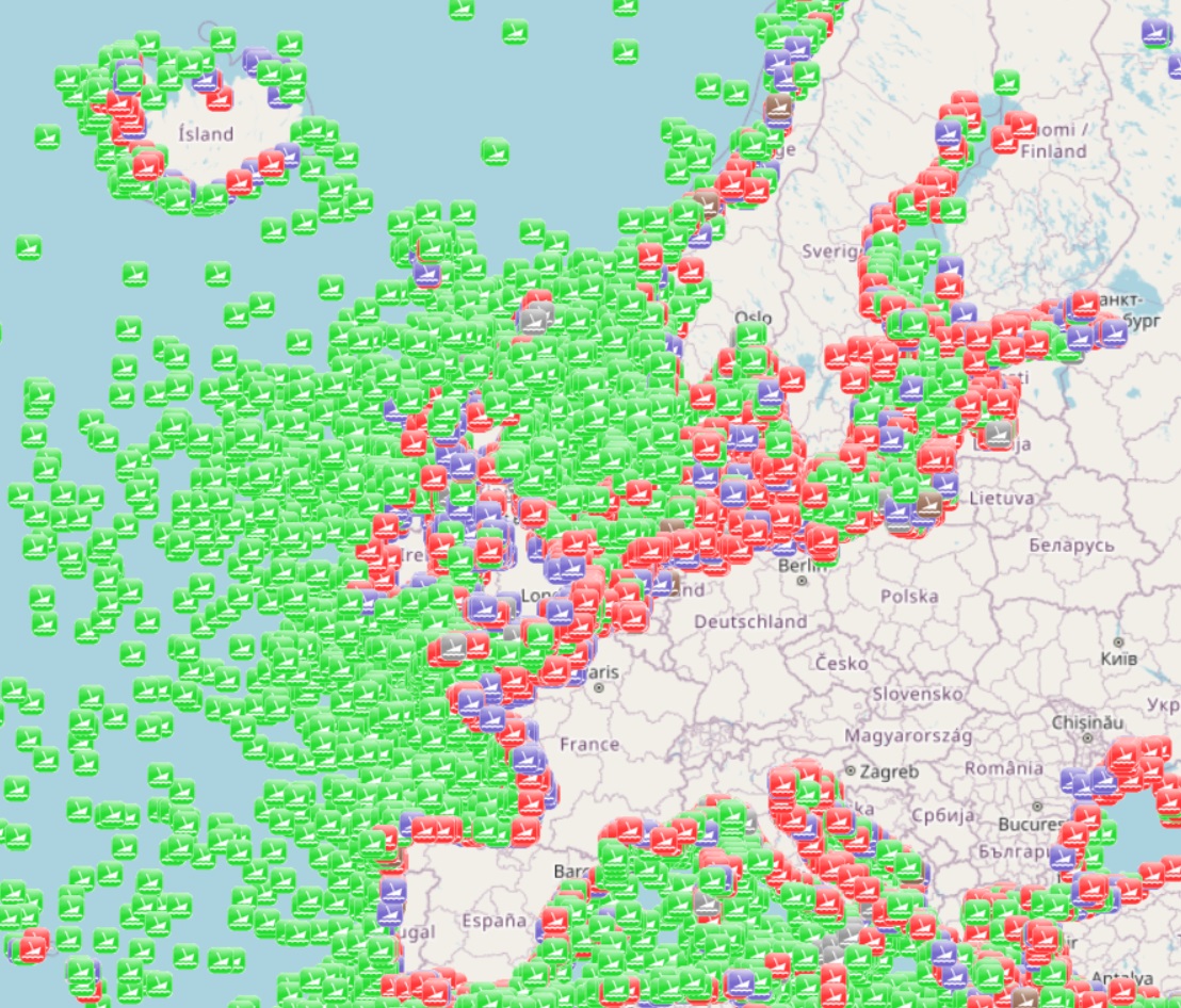
The dataset is a subset of the UK Hydrographic Office wrecks and obstructions data set. It contains over 67,000 charted, uncharted, live and dead wrecks from around the world. Where available each point has the following attributes: Wreck Id, Wreck category, Status, Position, Latitude, Longitude, Horizontal datum, Position method, Depth, Depth method, Depth quality, Depth accuracy, Water depth, Water level, Vertical datum, Name, Type, Flag, Length, Width, Draught, Sonar length, Sonar width, Shadow height, Orientation, Tonnage, Tonnage type, Cargo, Conspic visual, Conspic radar, Date sunk, Bottom texture, Scour dimensions, Debris field, Original sensor, Last sensor, Original detection, Last detection, Origin, Markers, Circumstances of loss, Surveying details, General comments, Last amended. The original dataset is updated on a quarterly basis and is made available free of charge under an Open Government Licence, which can be accessed here: https://www.nationalarchives.gov.uk/doc/open-government-licence/version/3/.