 EMODnet Product Catalogue
1 m
Type of resources
Available actions
Topics
Keywords
Contact for the resource
Provided by
Years
Formats
Representation types
Update frequencies
status
Scale 1:
Resolution
-
A biotope analysis of Strangford lough was conducted in 2015 as part of efforts to understand the distribution and extent of benthic habitats and associated marine life within this waterbody incorporating new and historical groundtruthing information alongside modern acoustic data.The analysis was conducted on both the main lough and the "Narrows" to the south. This dataset comprises the biotope complex output of the southern narrows. The map was originally presented in the Marine Habitat Classification for Britain & Ireland (http://jncc.defra.gov.uk/MarineHabitatClassification). This has been translated to the EUNIS habitat classification system for integration with other European datasets. For more information, see: AFBI, 2015. Bathymetric and Habitat Map for Strangford Lough (Special Area of Conservation and Marine Conservation Zone), Northern Ireland. Report to the Department of the Environment.
-
A biotope analysis of Strangford lough was conducted in 2015 as part of efforts to understand the distribution and extent of benthic habitats and associated marine life within this waterbody incorporating new and historical groundtruthing information alongside modern acoustic data. The analysis was conducted on both the main lough and the "Narrows" to the south. This dataset comprises the biotope complex output of the main lough. The map was originally presented in the Marine Habitat Classification for Britain & Ireland (http://jncc.defra.gov.uk/MarineHabitatClassification). This has been translated to the EUNIS habitat classification system for integration with other European datasets. For more information, see: AFBI, 2015. Bathymetric and Habitat Map for Strangford Lough (Special Area of Conservation and Marine Conservation Zone), Northern Ireland. Report to the Department of the Environment.
-
A biotope analysis of Dundrum bay was conducted in 2015 as part of efforts to understand the distribution and extent of benthic habitats and associated marine life within the Murlough special area of conservation incorporating new and historical groundtruthing information alongside modern acoustic data. The map was originally presented in the Marine Habitat Classification for Britain & Ireland (http://jncc.defra.gov.uk/MarineHabitatClassification). This has been translated to the EUNIS habitat classification system for integration with other European datasets. For more information, see: AFBI, 2015. Bathymetric and Habitat Map for Murlough Special Area of Conservation and offshore, Northern Ireland. Report to the Department of the Environment.
-

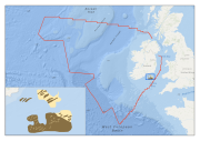
Multibeam echosounder data and seabed sampling data acquired during the INFOMAR national seabed mapping programme were the primary sources of data used in the generation of this marine habitat map. The original classes assigned to the data were translated to the EUNIS habitat classification system as part of the MESH Atlantic project.
-

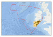
Multibeam echosounder data acquired during the INFOMAR national seabed mapping programme were the primary source of data used in the generation of this marine habitat map. The original classes assigned to the data were translated to the EUNIS habitat classification system as part of the MESH Atlantic project.
-

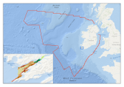
Multibeam echosounder data and seabed sampling data acquired during the INSS and INFOMAR national seabed mapping programmes were the primary sources of data used in the generation of this marine habitat map. The original classes assigned to the data were translated to the EUNIS habitat classification system as part of the MESH Atlantic project.
-
Multibeam echosounder data and seabed sampling data acquired during the INFOMAR national seabed mapping programme were the primary sources of data used in the generation of this habitat map for the Inshore Fisheries section of Bord Iascaigh Mhara. The original sediment classes assigned to the data were translated to the EUNIS habitat classification system as part of the MESH Atlantic project.
-
Data on marine habitats for the Celtic Sea generated from the collation of historical habitat data by Aquafact Environmental Consultants as part of the Strategic Environmental Assessment of the Irish and Celtic Seas, and published in the IOSEA 4 Report. The original classes assigned to the data were translated to the EUNIS habitat classification system as part of the MESH Atlantic project.
-

Multibeam echosounder data and seabed sampling data acquired during the INFOMAR national seabed mapping programme were the primary sources of data used in the generation of this marine habitat map. The original classes assigned to the data were translated to the EUNIS habitat classification system as part of the MESH Atlantic project.
-
Multibeam echosounder data and seabed sampling data acquired during the 2011 MESH Atlantic survey were the primary sources of data used in the generation of this marine habitat map. Data on kinetic energy, derived from oceanographic models, and all of the interpreted survey data, were combined in a GIS environment and used to generate a EUNIS level 5 habitat map using the Maximum Likelihood Classification tool in ArcMap.