bathymetric LiDARs
Type of resources
Available actions
Topics
Keywords
Contact for the resource
Provided by
Years
Formats
Representation types
Scale 1:
Resolution
-

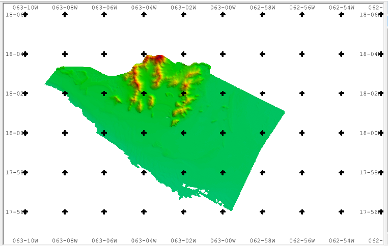
Lidar data taken on the Netherlands side of Sint Maarten, on land and shallow sea.
-
The covered sector is located in the south part of Romanian coast – sector Costinesti – Tuzla Cape. From geomorphological point of view, the sector consists of cliffs cut in loess covering Sarmatian limestone, with heights of about 20-30 m with narrow beaches interrupted by sand barriers closing the coastal lakes.
-
The covered sector is located in the south part of Romanian coast – sector 2 Mai – Vama Veche. From geomorphological point of view, the sector consists of cliffs cut in loess covering Sarmatian limestone, with heights of about 20-30 m with narrow beaches interrupted by sand barriers closing the coastal lakes.
-
The covered sector is located in the south part of Romanian coast – sector Olimp - Costinesti. From geomorphological point of view, the sector consists of cliffs cut in loess covering Sarmatian limestone, with heights of about 20-30 m with narrow beaches interrupted by sand barriers closing the coastal lakes.
-
The covered sector is located in the south part of Romanian coast – sector Aurora Cape - Olimp. From geomorphological point of view, the sector consists of cliffs cut in loess covering Sarmatian limestone, with heights of about 20-30 m with narrow beaches interrupted by sand barriers closing the coastal lakes.
-
The covered sector is located in the south part of Romanian coast – sector Olimp - Costinesti. From geomorphological point of view, the sector consists of cliffs cut in loess covering Sarmatian limestone, with heights of about 20-30 m with narrow beaches interrupted by sand barriers closing the coastal lakes.
-
The covered sector is located in the south part of Romanian coast – sector Tuzla Cape – Turcu Cape. From geomorphological point of view, the sector consists of cliffs cut in loess covering Sarmatian limestone, with heights of about 20-30 m with narrow beaches interrupted by sand barriers closing the coastal lakes.
 EMODnet Product Catalogue