 EMODnet Product Catalogue
Hydrography
Type of resources
Available actions
Topics
Keywords
Contact for the resource
Provided by
Years
Formats
Representation types
Update frequencies
status
Scale 1:
Resolution
-
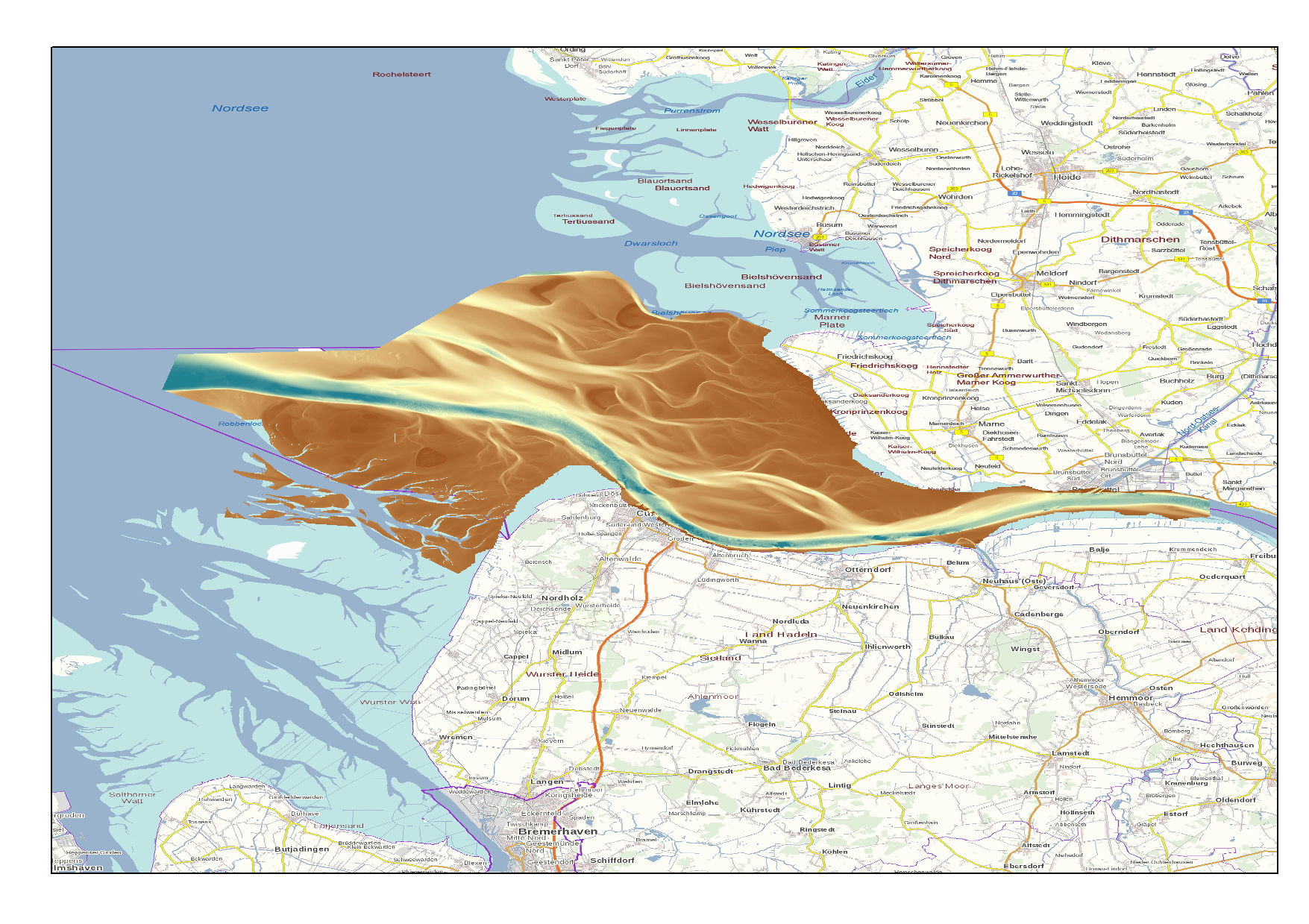
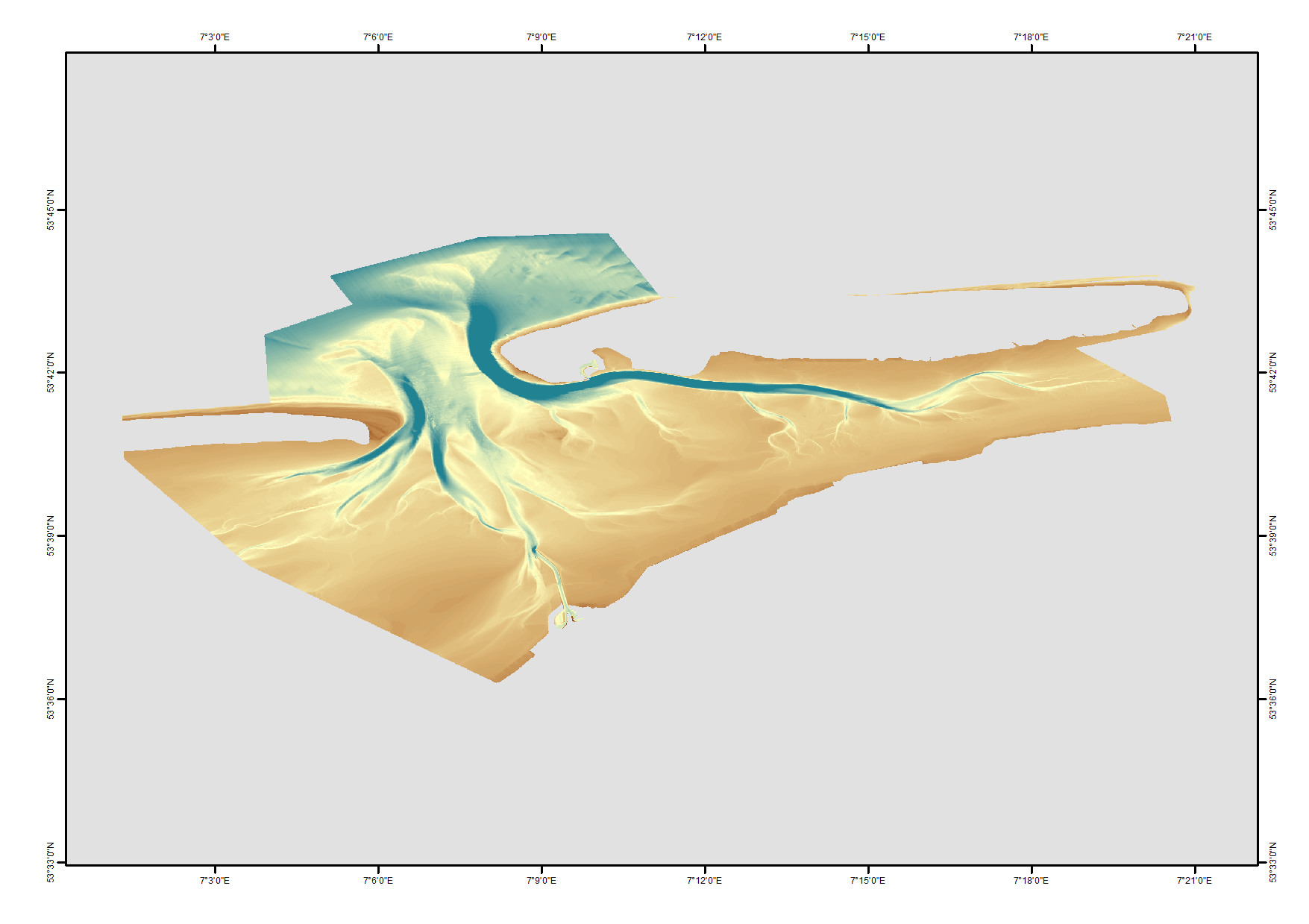
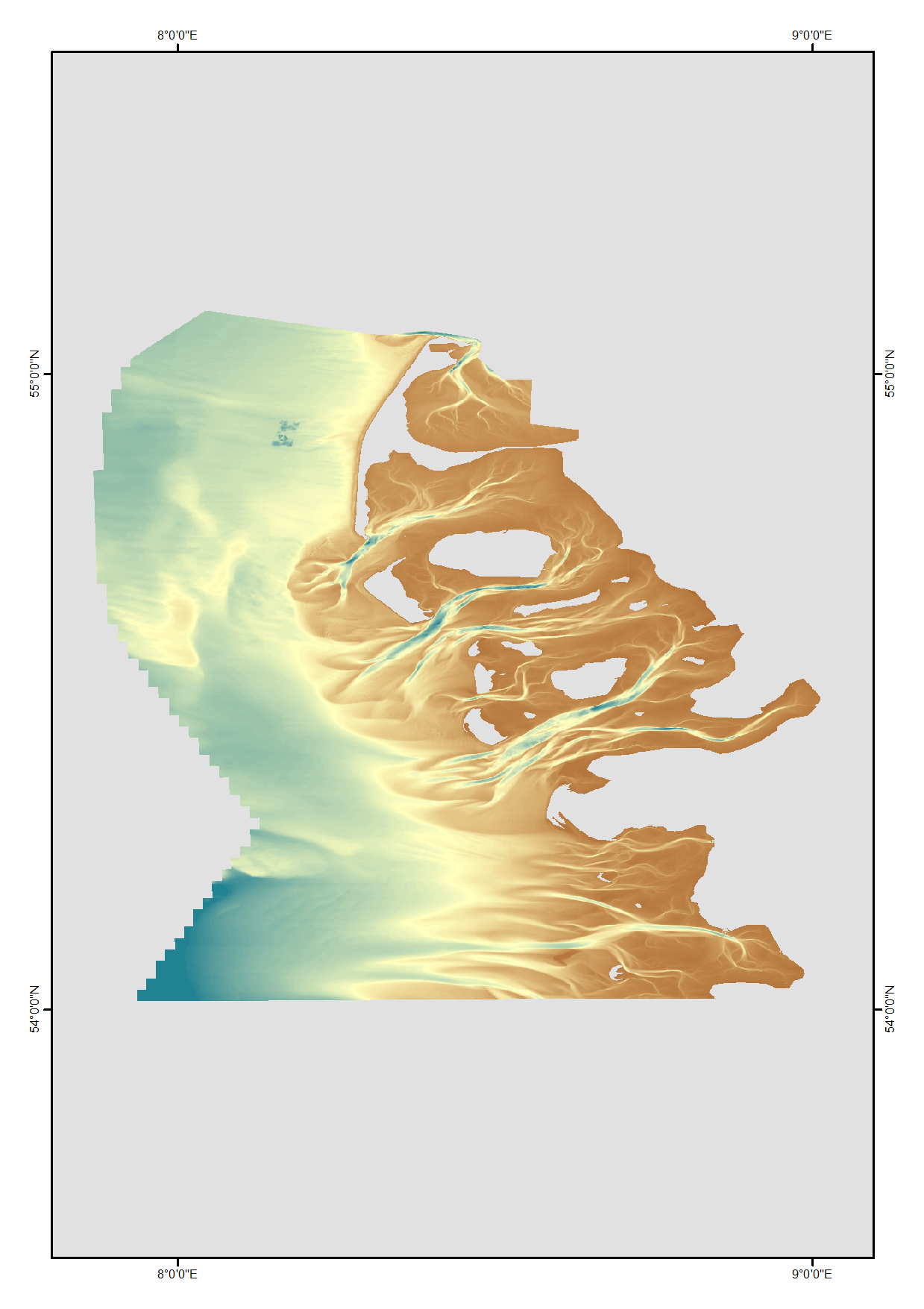
High Resolution DTM of the German Elbe Approach.
-
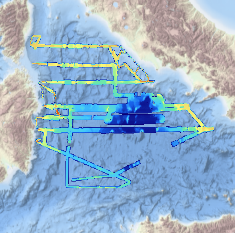
Multibeam bathymetry collected from Asköfjärden and Fifång Deep, east of Askö Island in southern Stockholm archipelago. The data were collected with Stockholm University research vessels (RV) Electra and Skidbladner between 2012 and 2018 for multiple purposes. Some of the data were collected as a part of a course in marine geophysical mapping at Stockholm University. The processing of the raw data was carried out using the Qimera software by QPS. The data have been cleared for public release by the Swedish Maritime Administration.
-
High resolution composite DTM based on single beam, multi beam and Lidar covering Norderney and waters in proximty. All data was acquired in the year 2016. Data used:SDN:CPRD:1850_DGM_Norderney_2016
-
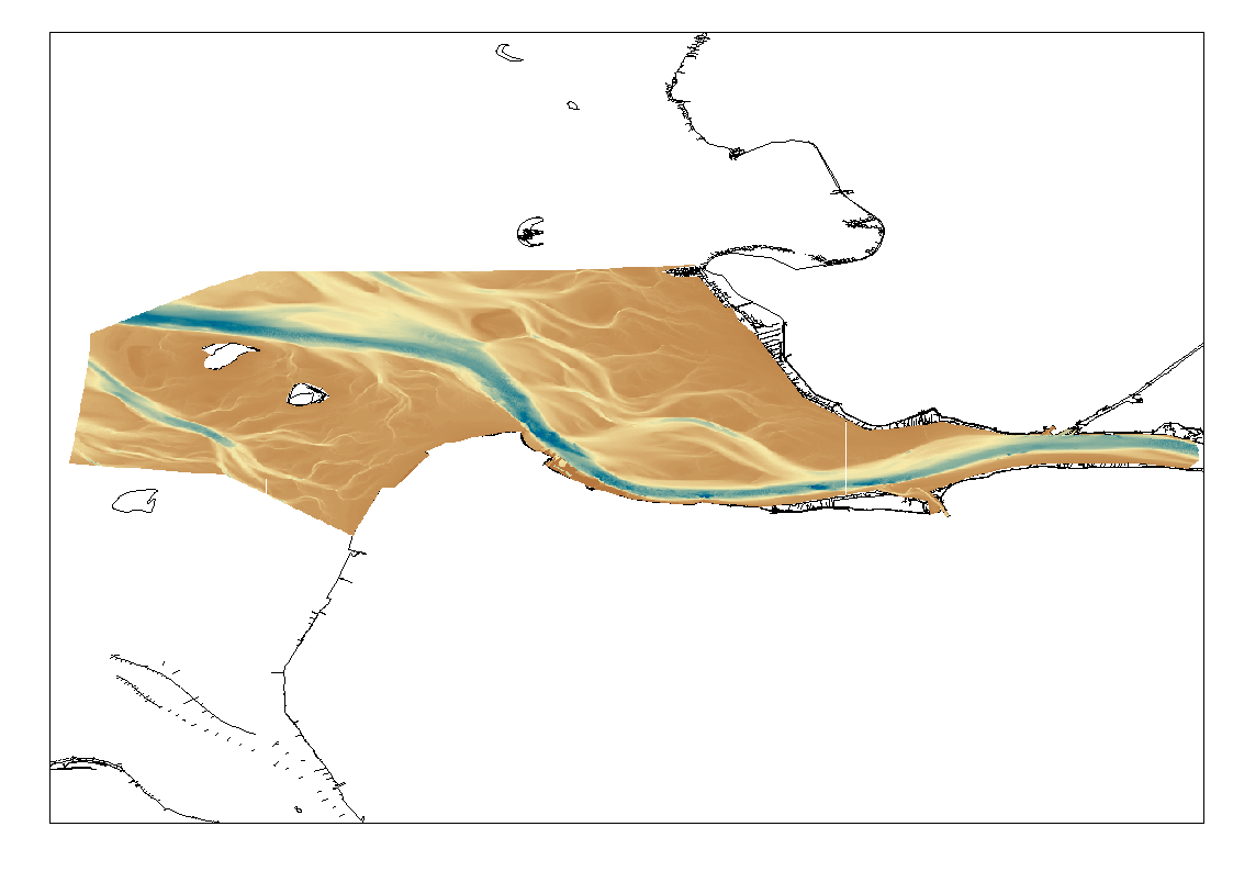
High Resolution DTM of the German Elbe Approach.
-
Satellite-derived bathymetry for the Venice Lagoon
-
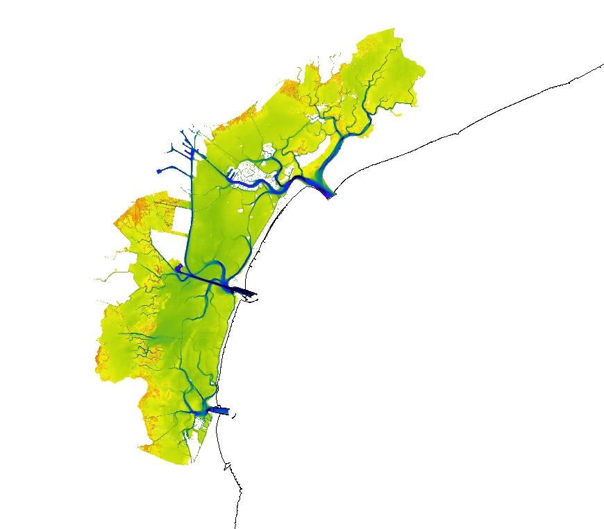
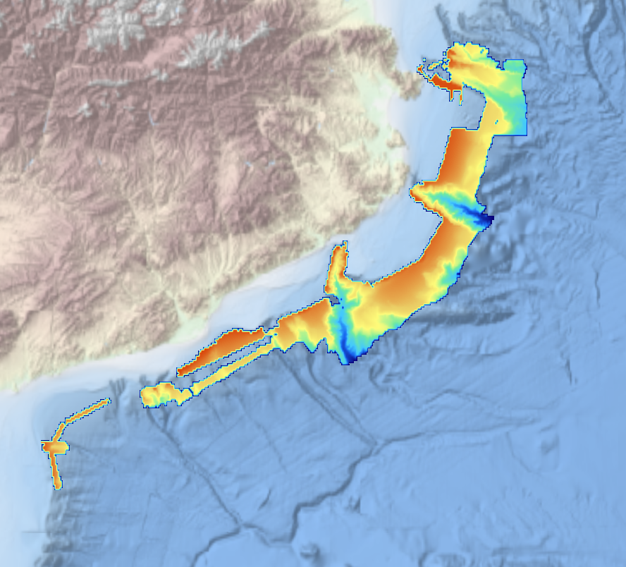
High resolution digital terrain model of the North Frisian waters based on survey data from various sources such as single-beam, multi-beam and Lidar.
-
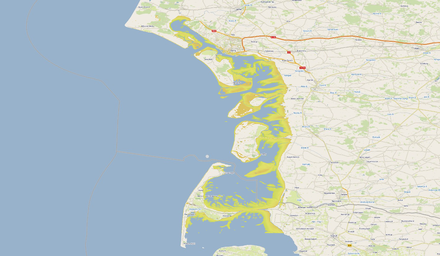
Satellite-derived intertidal bathymetry for the Danish Wadden on the West coast of Denmark
-
This Digital Terrain Model (DTM) is a high resolution bathymetry dataset that covers MEDOC survey. Multibeam data acquired in 2010 on board the R/V Sarmiento de Gamboa using an Atlas Hydrosweep DS-3 multi-beam echosounder.
-
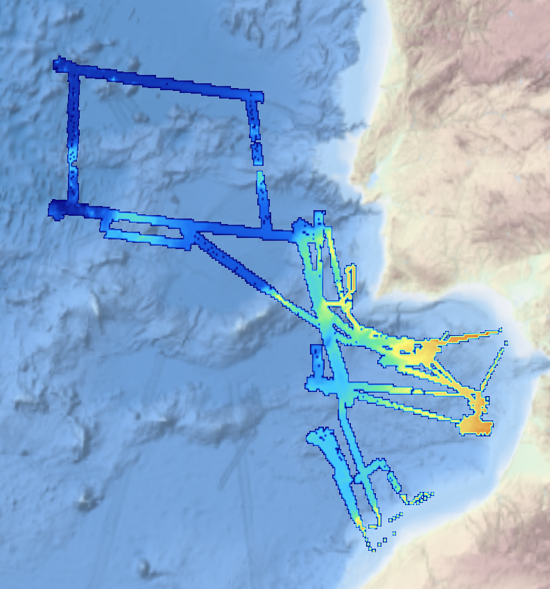
This composite Digital Terrain Model (cDTM) is a high resolution bathymetry dataset that covers bathymetry surveys INDEMARES-2, ABIDES-2, ABIDES-3, ABIDES-ROV and ABIDES-5 . Multibeam data acquired in 2010, 2017 and 2018 on board the R/V Garcia del Cid using a Elac Seabeam 1050D echosounder and in 2017 on board the Sarmiento de Gamboa using an Atlas Hydrosweep DS-3 multi-beam echosounder.
-
This composite Digital Terrain Model (cDTM) is a high resolution bathymetry dataset that covers bathymetry surveys INSIGHT_LEG1, FRAME-OBS, FRAME-MCS and INSIGHT_LEG2 . Multibeam data acquired in 2018 and 2019 on board the R/V Sarmiento de Gamboa using an Atlas Hydrosweep DS-3 multi-beam echosounder.