 EMODnet Product Catalogue

Type of resources
Available actions
Topics
Keywords
Contact for the resource
Provided by
Years
Formats
Representation types
status
Service types
Scale 1:
Resolution
-
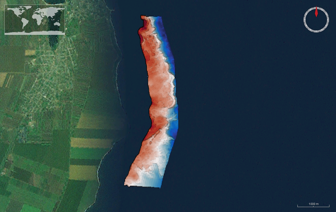
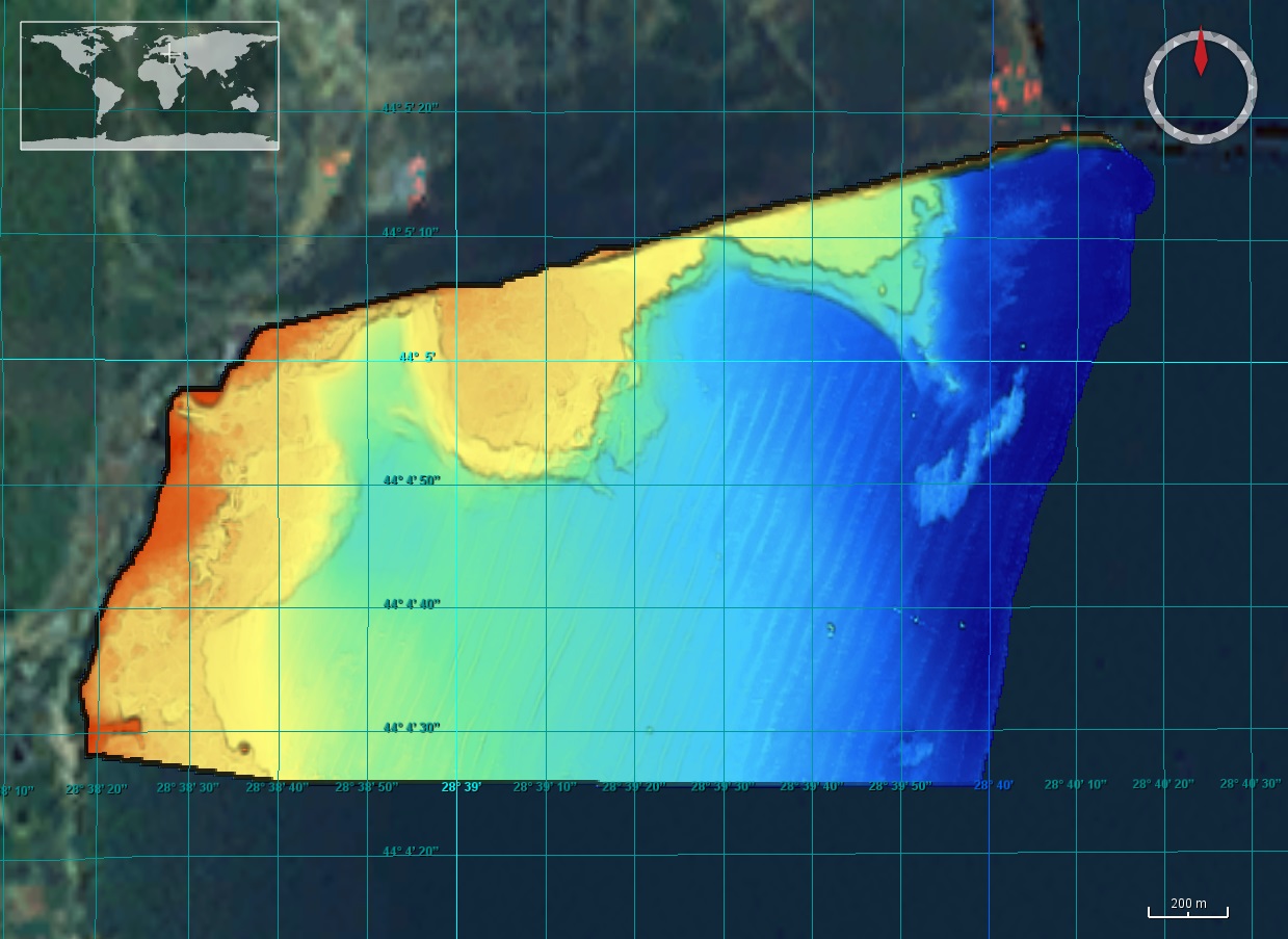
The DTM is produced with Kongsberg multibeam echosounder survey, acquired in March 2020 by Marine Research Ltd. The resolution is 1/256 arc-minutes (~7.2m). It is located at Tuzla, Romania, on the coastal region of the Black Sea. Depths are referenced to the Local Sea Level - Marea Neagra 1975 and the coordinates are expressed into the WGS84 reference frame.
-
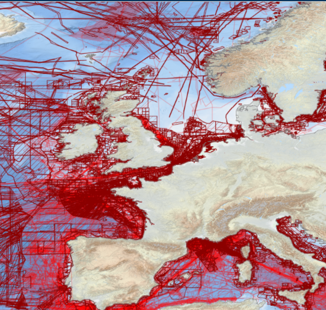
EMODnet Bathymetry has adopted the CDI Data Discovery & Access service as developed and operated by SeaDataNet, the pan-European network of NODCs, to bring together and provide access to available high resolution bathymetric survey data sets from many data providers, such as National Hydrographic Institutes, Research Institutes, and Survey companies. All bathymetric survey data are described with INSPIRE compliant metadata, following the CDI metadata profile, based on ISO 19115 – 19139 standards. This way, the CDI service gives users a highly detailed insight in the availability and geographical spreading of bathymetric survey data sets that are acquired and managed by an increasing group of data providers and for which users can request access for downloading. The CDI metadata are public domain and freely available for all users. However, a major part of the survey data sets is not freely available and requires negotiation with the data owners. The SeaDataNet CDI search, shopping and tracking mechanism facilitates identifying and requesting access to these background data sets from data providers. Note that all data sets are used internally with permission of the data owners for contributing to the EMODnet Digital Terrain Model (DTM) for the European sea regions. The service URL is : https://geo-service.maris.nl/emodnet_bathymetry/wfs?service=WFS&request=GetCapabilities. The layer in the Map Viewer facilitates users to view the locations of the CDI entries and to retrieve details of individual surveys by clicking on the map. From there users are linked to the actual CDI Data Discovery and Access service (https://cdi-bathymetry.seadatanet.org/search) for performing more queries and submitting requests for data access.
-
The data were acquired with a Simrad EM710 Multi Beam echosounder onboard the R/V Urania in order to cover the outer Malta Plateau and upper Malta Escarpment for a geological survey in the framework of EU FP7 project EUROFLEETS. The data were published in: Micallef, A., Georgiopoulou, A., Le Bas, T., Mountjoy, J.J., Huvenne, V., Lo Iacono, C., 2013. The Malta-Sicily Escarpment: Mass Movement dynamics in a sediment-undersupplied margin, in: Krastel, S., Berhmann, J.H., Volker, D., Stipp, M., Berndt, C., Urgeles, R., Chaytor, J.D., Huhn, K., Strasser, M., Harbitz, C.B. (Eds.), Submarine Mass Movements and Their Consequences. Springer International Publishing, Switzerland, pp. 317-328.
-
The data were acquired with a Simrad EM3002-D Multi Beam echosounder onboard the R/V Hercules as part of a habitat mapping survey in the framework of RICS funded project. The data were published in: Micallef, A., Le Bas, T.P., Huvenne, V.A.I., Blondel, P., Hühnerbach, V., Deidun, A., 2012. A multi-method approach for benthic habitat mapping of shallow coastal areas with high resolution multibeam data. Continental Shelf Research 39-40, 14-26.
-
The DTM is produced with Kongsberg multibeam echosounder survey, acquired in March 2020 by Marine Research Ltd. The resolution is 1/256 arc-minutes (~7.2m). It is located at 23 August, Romania, on the coastal region of the Black Sea. Depths are referenced to the Local Sea Level - Marea Neagra 1975 and the coordinates are expressed into the WGS84 reference frame.
-
The DTM is produced with Kongsberg multibeam echosounder survey, acquired in 2015 by Marine Research Ltd. The resolution is 1/256 arc-minutes (~7.2m). It is located south of Constanta Port, Romania, on the coastal region of the Black Sea. Depths are referenced to the Mean Sea Level and the coordinates are expressed into the WGS84 reference frame.
-
The data were acquired with Reson SeaBat 7150 and 8111 multibeam echosounder systems on board the R/V OGS Explora in order to cover the Malta Escarpment for a geological survey in the framework of EU FP7 project SCARP.
-
The data were acquired with Reson SeaBat 7150 and 8111 multibeam echosounder systems on board the R/V OGS Explora in order to cover the Malta Escarpment for a geological survey in the framework of EU FP7 project SCARP.
-
Satellite-derived bathymetry for the Venice Lagoon
-
Multibeam bathymetry collected from Asköfjärden and Fifång Deep, east of Askö Island in southern Stockholm archipelago. The data were collected with Stockholm University research vessels (RV) Electra and Skidbladner between 2012 and 2018 for multiple purposes. Some of the data were collected as a part of a course in marine geophysical mapping at Stockholm University. The processing of the raw data was carried out using the Qimera software by QPS. The data have been cleared for public release by the Swedish Maritime Administration.