Ukrainian scientific center of Ecology of Sea
Type of resources
Available actions
Topics
Keywords
Contact for the resource
Provided by
Years
Formats
Representation types
Resolution
-
The data contain information collected during the implementation of the ACCOBAMS Project “Identification and initial assessment of cetacean groupings in coastal waters of the north-western Black Sea, Ukrainian sector” 2016-2017 on the occurrence of the cetaceans in the north-western part of the Black Sea including photo identification surveys and linear-transect surveys of density and abundance.
-
This nation-wide dataset contains data on cetacean strandings recorded on the Ukrainian coast of the Black sea by researchers from a few institutions and personally reported by local residents and visitors, with photographs. Creation of the dataset was recommended by the Research Council on Marine Mammal Protection and the Ministry of Ecology and National Resources of Ukraine. Some field activities in 2017 were funded by the ACCOBAMS (project "Identification and initial assessment of cetacean groupings in coastal waters of the north-western Black Sea, Ukrainian sector")
-
This dataset contains data on cetacean strandings collected from 1999 to 2014 on the coastal areas of the Black sea and the Sea of Azov. Observations were conducted by Pavel Gol’din and Karina Vishnyakova, with the help provided by D. Markov, E. Gladilina, E. Gol’din, V. Sokhin, E. Kushnir, V. Serbin, Yu. Lyashenko, L. Godlevska, A. Nadolny, M. Kovalyova, O. Savenko, N. Kukharev and other colleagues and volunteers who took part in the field excursions and provided information on strandings.
-
Within the "Support MSFD implementation in the Black Sea through establishing a regional monitoring system of cetaceans (D1) and noise monitoring (D11) for achieving GES", financed by European Commission - No. 110661/2018/794677/SUB/ENV.C2, a dedicated aerial survey for marine mammals using distance line transect methods was performed in 2019 in territorial and EEZs of the six Black Sea riparian countries.
-
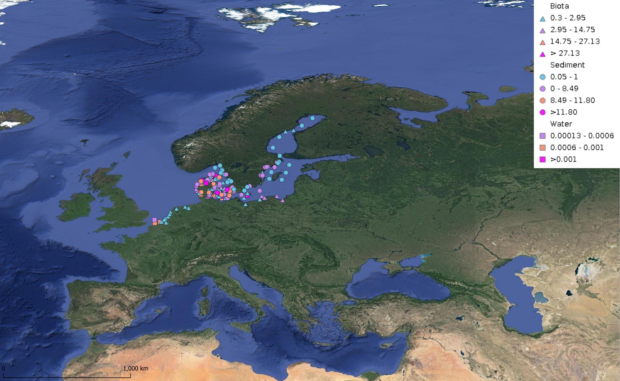
This product displays for Triphenyltin, median values since 2012 that have been measured per matrix and are present in EMODnet regional contaminants aggregated datasets, v2024. The median values ranges are derived from the following percentiles: 0-25%, 25-75%, 75-90%, >90%. Only "good data" are used, namely data with Quality Flag=1, 2, 6, Q (SeaDataNet Quality Flag schema). For water, only surface values are used (0-15 m), for sediment and biota data at all depths are used.
-
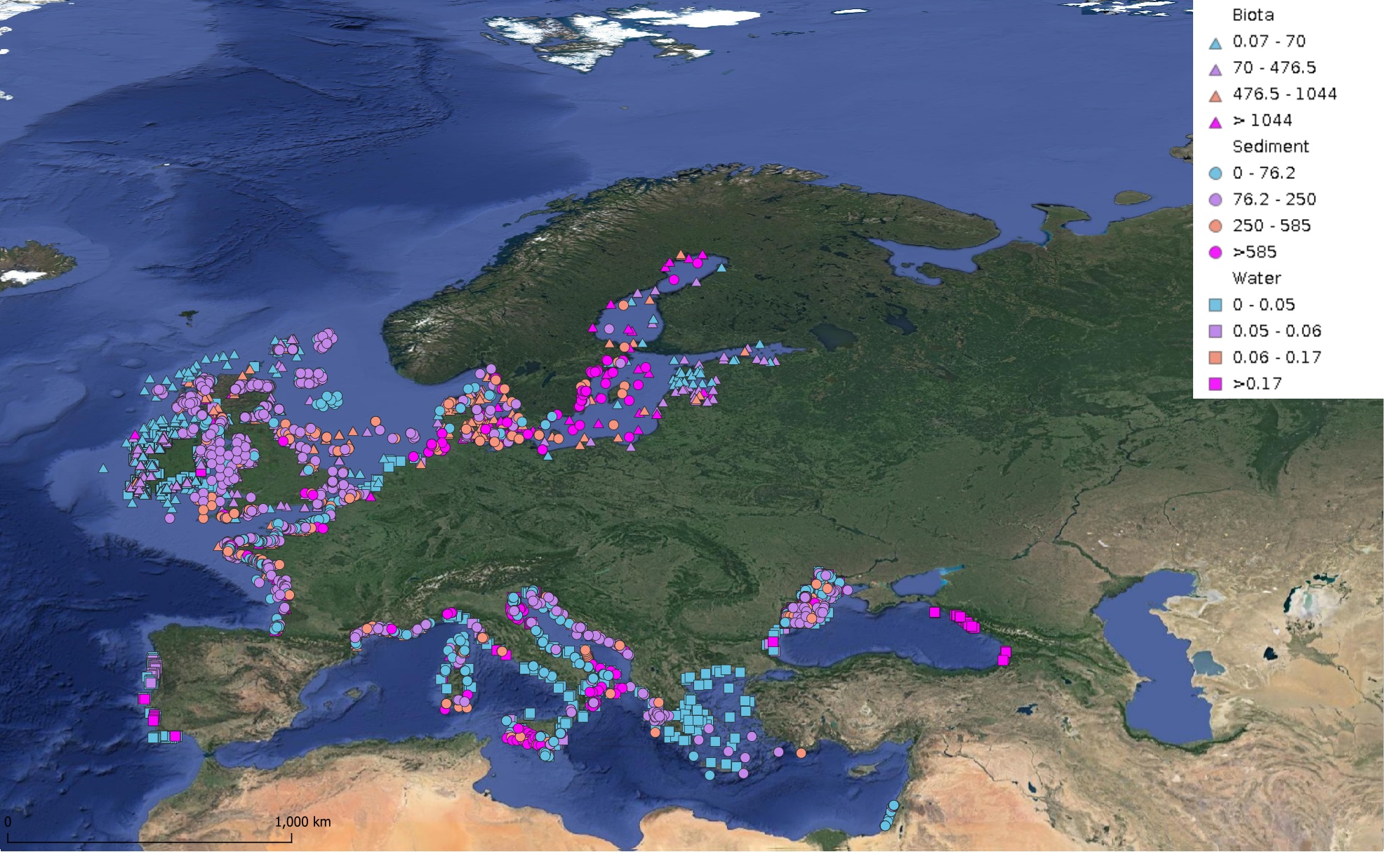
This product displays for Cadmium, median values since 2012 that have been measured per matrix and are present in EMODnet regional contaminants aggregated datasets, v2024. The median values ranges are derived from the following percentiles: 0-25%, 25-75%, 75-90%, >90%. Only "good data" are used, namely data with Quality Flag=1, 2, 6, Q (SeaDataNet Quality Flag schema). For water, only surface values are used (0-15 m), for sediment and biota data at all depths are used.
-
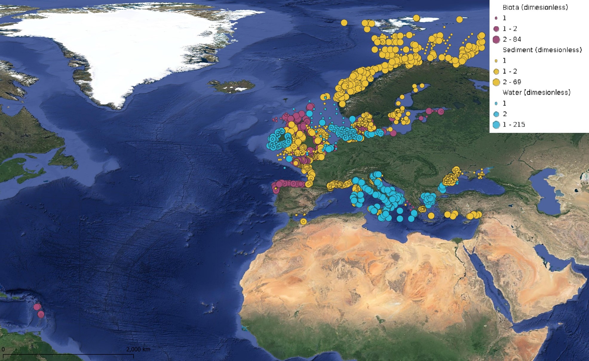
This product displays for Fluoranthene, positions with values counts that have been measured per matrix for each year and are present in EMODnet regional contaminants aggregated datasets, v2024. The product displays positions for every available year.
-
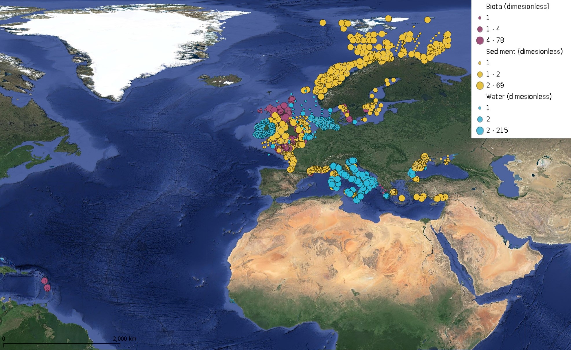
This product displays for Naphthalene, positions with values counts that have been measured per matrix for each year and are present in EMODnet regional contaminants aggregated datasets, v2024. The product displays positions for every available year.
-
pyrene_per_2024.jpeg)
This product displays for Benzo(a)pyrene, positions with percentages of all available data values per group of animals that are present in EMODnet regional contaminants aggregated datasets, v2024. The product displays positions for all available years.
-
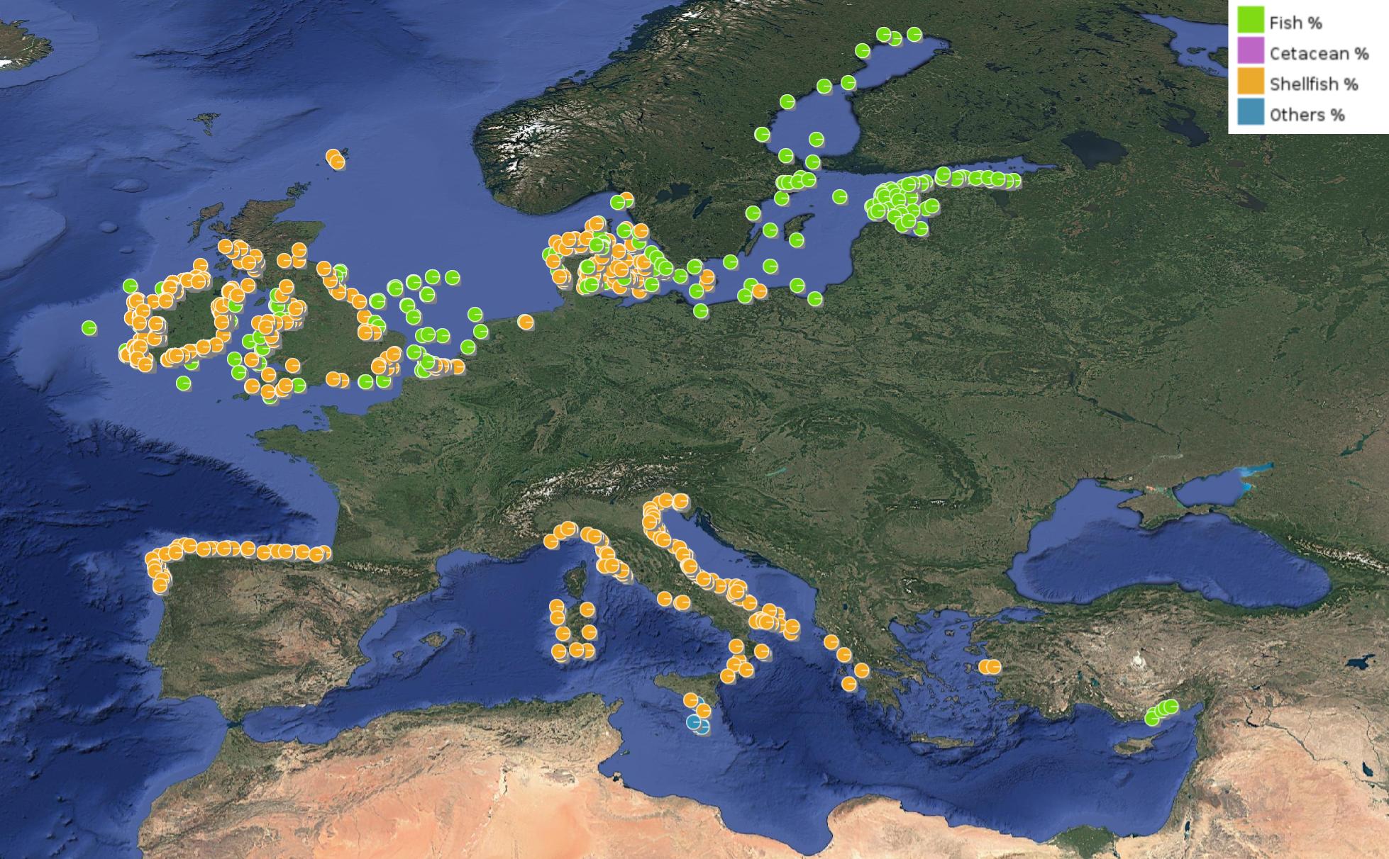
This product displays for Hexachlorobenzene, positions with percentages of all available data values per group of animals that are present in EMODnet regional contaminants aggregated datasets, v2024. The product displays positions for all available years.
 EMODnet Product Catalogue