 EMODnet Product Catalogue
planningCadastre
Type of resources
Available actions
Topics
Keywords
Contact for the resource
Provided by
Years
Formats
Representation types
Scale 1:
Resolution
-
The dataset on the shellfish protected areas under the Water Framework Directive (WFD) was created in 2023 by AND-International for the European Marine Observation and Data Network (EMODnet). The Directive (Article 6, paragraphs 1 and 2) requires Member States to designate areas which require specific protection of their surface water and groundwater, or for the conservation of habitats and species directly depending on water. According to Annex IV (ii) of the WFD, these areas should include areas designated for the protection of economically significant aquatic species (shellfish in this case). This dataset compiles the designated areas as provided by national sources (The Department of Housing, Planning, Community and Local Government of Ireland and The Ministry for Ecological Transition and Demography in Spain) and it is available for viewing and download on EMODnet web portal (Human Activities, https://emodnet.ec.europa.eu/en/human-activities). Each polygon has the following attributes: area ID (in EMODnet), country, area name, designation date, ID from the source.
-
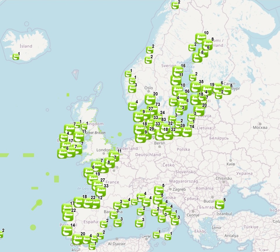
The dataset on offshore dredge dumping sites in the European seas was created in 2015 by CETMAR for the European Marine Observation and Data Network (EMODnet). It is the result of the aggregation and harmonization of datasets provided by several sources. It is updated every year and is available for viewing and download on EMODnet web portal (Human Activities, https://emodnet.ec.europa.eu/en/human-activities). The dataset contains points and/or (where available) polygons representing offshore dredge dumping sites in the following countries: Belgium, Bulgaria, Cyprus, Denmark, Estonia, Finland, France, Germany, Greece, Iceland, Ireland, Italy, Latvia, Lithuania, Malta, Norway, Poland, Portugal, Russia, Spain, Sweden and United Kingdom. Each point and polygon has the following attributes (where available): INDEX_ID, Site name, Country, Dredge ID, Dredged material, Year of operation, Information provider, Distance to coast (m) and Distance from centroid to coast (m)(This last attribute only appears for polygon data). The distance to coast (EEA coastline shapefile) has been calculated using the UTM WGS84 Zone projected coordinate system where data fall in.
-
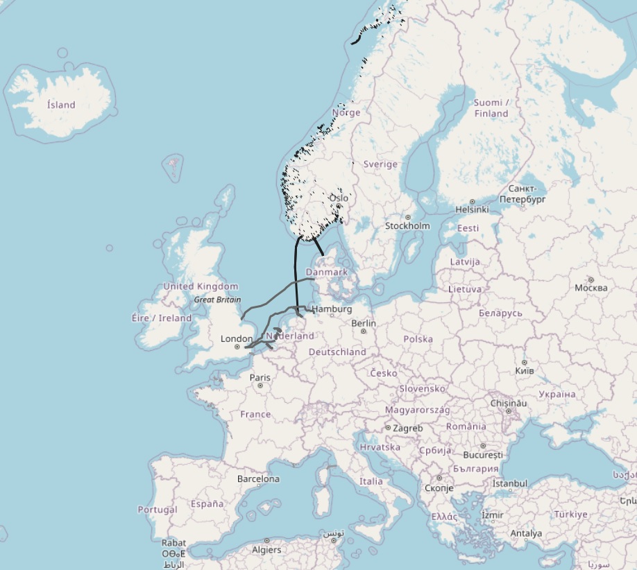
The dataset on subsea power cables in the European waters was created in 2014 by Cogea for the European Marine Observation and Data Network (EMODnet). It is the result of the aggregation of datasets provided by several EU and non-EU sources. It is updated every year, and is available for viewing and download on the EMODnet web portal (Human Activities, https://emodnet.ec.europa.eu/en/human-activities). The dataset contain lines representing actual cable routes locations. Compared with the previous version, this version now includes the German high voltage cables.
-
The dataset on subsea telecommunication cables in the European waters was created in 2014 by Cogea for the European Marine Observation and Data Network (EMODnet). It is the result of the aggregation of datasets provided by several EU and non-EU sources. It is updated every year, and is available for viewing and download on the EMODnet web portal (Human Activities, https://emodnet.ec.europa.eu/en/human-activities). The dataset contain lines representing actual cable routes locations. Compared with the previous version, this version includes an update of the German cables.
-
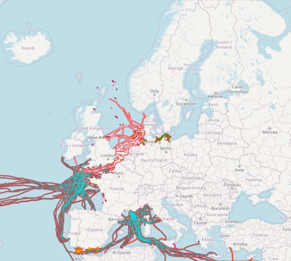
The dataset on offshore active licences for Oil and Gas exploitation and exploration in the European seas was created in 2014 by Cogea for the European Marine Observation and Data Network (EMODnet). It is the result of the aggregation and harmonization of datasets provided by several EU and non-EU sources. It is available for viewing and download on EMODnet web portal (Human Activities, https://emodnet.ec.europa.eu/en/human-activities). The dataset contains polygons representing the currently active licences in the following countries: Croatia, Cyprus, Denmark, Germany, Ireland, Italy, Malta, Netherlands, Norway, Poland, Spain and United Kingdom. Where available each polygon has the following attributes: country, code, name, type (exploitation, exploration, exploitation and exploration, other), licensing round (it includes also pending applications in Spain), area (square km), area info (it indicates if the area value is original from the source or has been calculated), valid from, valid to, operator or administrator, notes. Currently there are no active licenced areas in the French and Portuguese waters and no data available for other countries.