 EMODnet Product Catalogue
KML
Type of resources
Available actions
Topics
Keywords
Contact for the resource
Provided by
Years
Formats
Representation types
Scale 1:
Resolution
-
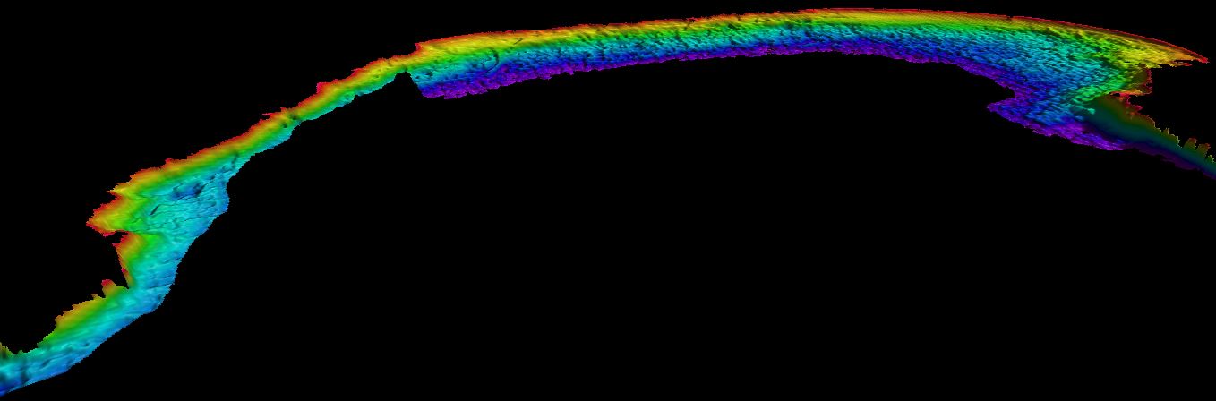
Data provides bathymetric information based on Landsat 8 satellite at 15 m resolution. Data were processed by the Modular and Inversion System (MIP) by EOMAP GmbH Co.KG. MIP is designed for the physically based assessment of hydro-biological parameters from multi- and hyperspectral remote sensing data. Supplemental_Information: EOMAPs Satellite Derived Bathymetry (SDB) method relies on the reflected light energy which is measured at the satellite sensor in space. In order to measure the water column thickness, the sea bottom reflection must be separated from all other simultaneously measured portions of light. Other contributors of light scattered to the sensor are atmospheric molecules and aerosols, adjacent scattering from land, the water surface reflection, and light scattered and absorbed due to particular properties of water constituents and the pure water itself. The pure water itself also absorbs light in a spectrally specific manner and therefore leaves unique signatures in the signal while the light passes through the water column and returns after reflection at the sea bottom. This property is relevant to estimate water depth from optical satellite imagery. As many properties can vary over space and time, effective correction, regularization and retrieval algorithms must be applied to avoid instable results. EOMAP developed and maintains these unique algorithm and its workflows for almost 2 decades. The maximum depth the system is able to sense is related to the complex interaction of radiance of bottom material, incident sun angle and intensity, and the type and quantity of organics or sediments in the water column. As a rule-of-thumb, satellite derived bathymetry should be capable of sensing bottom to depths equal to one to one point five times the Secchi depth. no-data-value optically deep water: -9999
-
Data provides bathymetric information based on Landsat 8 satellite at 15m resolution. Data were processed by the Modular and Inversion System (MIP) by EOMAP GmbH Co.KG. MIP is designed for the physically based assessment of hydro-biological parameters from multi- and hyperspectral remote sensing data. Supplemental_Information: EOMAPs Satellite Derived Bathymetry (SDB) method relies on the reflected light energy which is measured at the satellite sensor in space. In order to measure the water column thickness, the sea bottom reflection must be separated from all other simultaneously measured portions of light. Other contributors of light scattered to the sensor are atmospheric molecules and aerosols, adjacent scattering from land, the water surface reflection, and light scattered and absorbed due to particular properties of water constituents and the pure water itself. The pure water itself also absorbs light in a spectrally specific manner and therefore leaves unique signatures in the signal while the light passes through the water column and returns after reflection at the sea bottom. This property is relevant to estimate water depth from optical satellite imagery. As many properties can vary over space and time, effective correction, regularization and retrieval algorithms must be applied to avoid instable results. EOMAP developed and maintains these unique algorithm and its workflows for almost 2 decades. The maximum depth the system is able to sense is related to the complex interaction of radiance of bottom material, incident sun angle and intensity, and the type and quantity of organics or sediments in the water column. As a rule-of-thumb, satellite derived bathymetry should be capable of sensing bottom to depths equal to one to one point five times the Secchi depth. no-data-value optically deep water: -9999