 EMODnet Product Catalogue
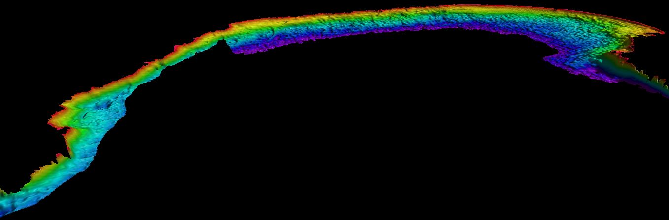
cameras
Type of resources
Available actions
Topics
Keywords
Contact for the resource
Provided by
Years
Formats
Representation types
Scale 1:
Resolution
-
Aerial surveys with bird observations around the off shore wind farm Borssele (North Sea). It is acquired for gaining insight in spatio-temporal behavior of patterns of birds. RWS case number: 31163291.
-
Species abundance and seagrass cover. Calculated from photo quadrats and video recorded by divers along seabed transects surveyed by divers as part of GENIALG monitoring surveys. Seaweed farm located in Ventry Harbour, Co. Kerry (Ireland). The samples were collected at seven different time points along the growing season in 2018 and 2019. Samples collected as part of the GENIALG project (project ID: 727892, GENIALG - GENetic diversity exploitation for Innovative Macro-ALGal biorefinery, http://genialgproject.eu/). GENIALG was funded by the European Union Horizon2020 programme. The remit of the work was assessing the environmental footprint and ecosystem services provided by seaweed aquaculture in Europe to provide best practice advice to industry.
-
Gironde estuary environmental parameters and SPM maps generated from 41 Landsat-8/OLI and Sentinel-2/MSI images acquired over the period 2013-2018. Except bathymetry and daily river discharge data, that are accessible on public platforms, the dataset includes all of the time seris used in the publication: Analysis of suspended sediment variability in a large highly-turbid estuary using a 5-year-long remotely-sensed data archive at high resolution, Journal of Geophysical Research: Oceans, (DOI:10.1029/2019JC015417)-[https://doi.org/10.1029/2019JC015417]. Important Note: This submission has been initially submitted to SEA scieNtific Open data Edition (SEANOE) publication service and received the recorded DOI. The metadata elements have been further processed (refined) in EMODnet Ingestion Service in order to conform with the Data Submission Service specifications.
-
Data provides bathymetric information based on Landsat 8 satellite at 15 m resolution. Data were processed by the Modular and Inversion System (MIP) by EOMAP GmbH Co.KG. MIP is designed for the physically based assessment of hydro-biological parameters from multi- and hyperspectral remote sensing data. Supplemental_Information: EOMAPs Satellite Derived Bathymetry (SDB) method relies on the reflected light energy which is measured at the satellite sensor in space. In order to measure the water column thickness, the sea bottom reflection must be separated from all other simultaneously measured portions of light. Other contributors of light scattered to the sensor are atmospheric molecules and aerosols, adjacent scattering from land, the water surface reflection, and light scattered and absorbed due to particular properties of water constituents and the pure water itself. The pure water itself also absorbs light in a spectrally specific manner and therefore leaves unique signatures in the signal while the light passes through the water column and returns after reflection at the sea bottom. This property is relevant to estimate water depth from optical satellite imagery. As many properties can vary over space and time, effective correction, regularization and retrieval algorithms must be applied to avoid instable results. EOMAP developed and maintains these unique algorithm and its workflows for almost 2 decades. The maximum depth the system is able to sense is related to the complex interaction of radiance of bottom material, incident sun angle and intensity, and the type and quantity of organics or sediments in the water column. As a rule-of-thumb, satellite derived bathymetry should be capable of sensing bottom to depths equal to one to one point five times the Secchi depth. no-data-value optically deep water: -9999
-
Data provides bathymetric information based on Landsat 8 satellite at 15m resolution. Data were processed by the Modular and Inversion System (MIP) by EOMAP GmbH Co.KG. MIP is designed for the physically based assessment of hydro-biological parameters from multi- and hyperspectral remote sensing data. Supplemental_Information: EOMAPs Satellite Derived Bathymetry (SDB) method relies on the reflected light energy which is measured at the satellite sensor in space. In order to measure the water column thickness, the sea bottom reflection must be separated from all other simultaneously measured portions of light. Other contributors of light scattered to the sensor are atmospheric molecules and aerosols, adjacent scattering from land, the water surface reflection, and light scattered and absorbed due to particular properties of water constituents and the pure water itself. The pure water itself also absorbs light in a spectrally specific manner and therefore leaves unique signatures in the signal while the light passes through the water column and returns after reflection at the sea bottom. This property is relevant to estimate water depth from optical satellite imagery. As many properties can vary over space and time, effective correction, regularization and retrieval algorithms must be applied to avoid instable results. EOMAP developed and maintains these unique algorithm and its workflows for almost 2 decades. The maximum depth the system is able to sense is related to the complex interaction of radiance of bottom material, incident sun angle and intensity, and the type and quantity of organics or sediments in the water column. As a rule-of-thumb, satellite derived bathymetry should be capable of sensing bottom to depths equal to one to one point five times the Secchi depth. no-data-value optically deep water: -9999