 EMODnet Product Catalogue
Keyword
EMODnetHRSM2
Type of resources
Available actions
Topics
Keywords
Contact for the resource
Provided by
Years
Formats
Representation types
Scale 1:
Resolution
From
1
-
1
/
1
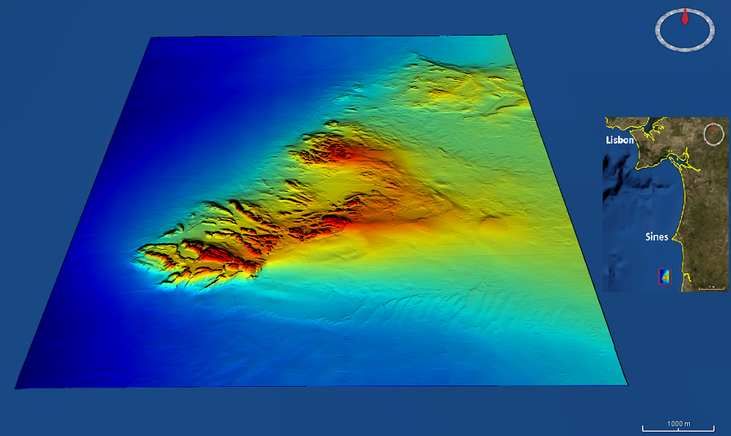
-
High resolution (1/256 minute ~ 7m) bathymetry dataset from the Mineplat 3 cruise onboard IPMA RV Noruega. Portugal southern continental shelf, off Alentejo coast, 8 to 20 June, 2018. Depths between 80 and 160m. High resolution multichannel seismics and magnetic data acquisition performed during the daytime and multibeam mapping 24h/24h, with a Reson T50-P multibeam echosounder. Depths are referenced to the Portuguese Chart Datum (2m below MSL), horizontal coordinates in the WGS84 reference frame. Position and attitude data (GNSS+Inertial via Applanix OceanMaster POSMV) was pos-processed with POSPAC.