 EMODnet Product Catalogue
HELCOM
Type of resources
Available actions
Topics
Keywords
Contact for the resource
Provided by
Years
Formats
Representation types
Scale 1:
Resolution
-
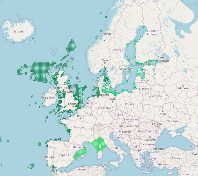
The dataset on Marine Protected Areas (MPAs) established under the framework of the Regional Sea Conventions (RSCs) was created in 2023 by Cogea for the European Marine Observation and Data Network (EMODnet). It is based on spatial data provided by HELCOM, by SPA/RAC and MedPAN through the MAPAMED database, and by OSPAR. It is available for viewing and download on EMODnet web portal (Human Activities, https://emodnet.ec.europa.eu/en/human-activities). The dataset displays all the MPAs as officially reported by the respective Contracting Parties to the Helsinky Convention, to the Barcelona Convention and to the Convention for the Protection of the Marine Environment of the North-East Atlantic. The RSCs MPAs are established in order to promote the cooperation in the management and conservation of natural areas, as well as in the protection of threatened species and their habitats. Each RSC MPA may be established in the marine and coastal zones subject to the sovereignty or jurisdiction of the Parties and in areas situated partly or wholly on the high sea. Thus, the dataset covers the MPAs Beyond National Jurisdiction (ABNJ) and the MPAs in following countries: Albania, Algeria, Belgium, Cyprus, Denmark, Estonia, Finland, France, Germany, Iceland, Ireland, Italy, Latvia, Lebanon, Lithuania, Monaco, Morocco, Netherlands, Norway, Poland, Portugal, Russia, Slovenia, Spain, Sweden, Tunisia, and the United Kingdom. Where available each polygon has the following attributes: Regional Sea Convention (Barcelona, HELCOM, OSPAR), code, name (english and/or original), country, designation, IUCN category (Ia, Ib, II, IV, V, not applicable, not assigned, not reported), area sqkm (reported, calculated), marine area sqkm (reported, calculated), status (adopted/designated, managed or partly managed, proposed), establishement year, management authorithy, site link. For further information please visit the data providers websites. This dataset covers the last updated versions released in the 2021 and 2022 by HELCOM and MAPAMED, and in the 2024 by OSPAR.
-
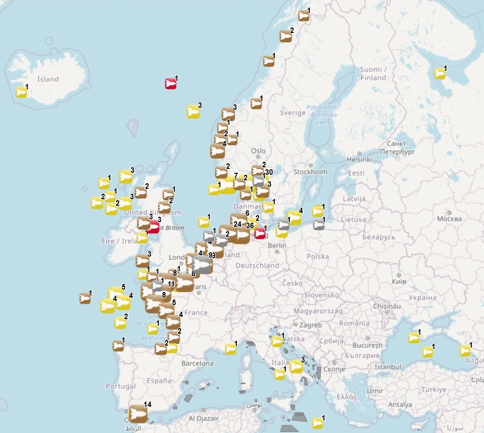
The dataset on dumped munitions in the European seas was created in 2018 by CETMAR for the European Marine Observation and Data Network (EMODnet). It is the result of the aggregation and harmonization of datasets provided by several sources. It is updated every year and is available for viewing and download on EMODnet web portal (Human Activities, https://emodnet.ec.europa.eu/en/human-activities). The dataset contains points and/or (where available) polygons representing dumped munitions sites in the European sea basins. Each point and/or polygon has the following attributes (where available): Munition type (Conventional and/or Chemical, and/or Unknown), Munition description, Information provider, Update date and Distance to coast (metres). The distance to coast (EEA coastline shapefile) has been calculated using the UTM WGS84 Zone projected coordinate system where data fall in.
-
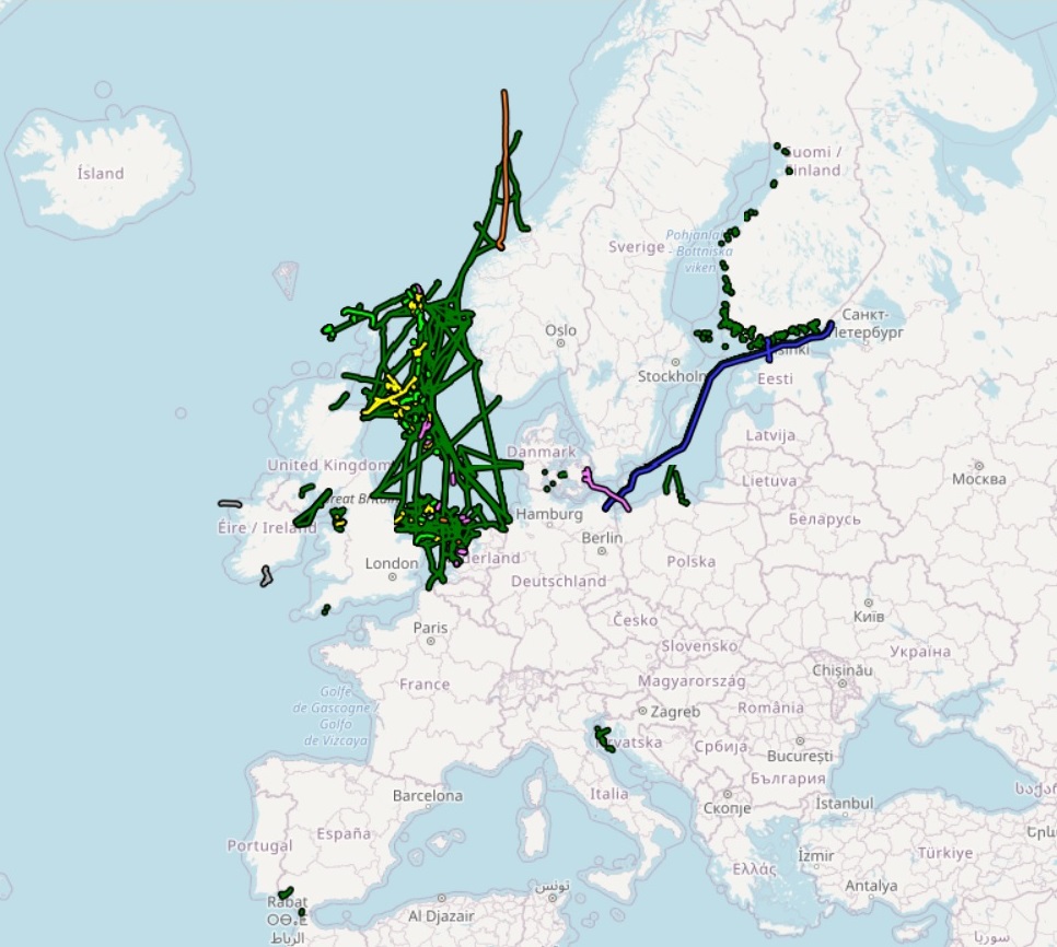
The dataset on offshore pipelines in the European waters was created in 2017 by Cogea for the European Marine Observation and Data Network (EMODnet). It is the result of the aggregation and harmonization of datasets provided by several several EU and non-EU sources. It is updated every year, and is available for viewing and download on the EMODnet web portal (Human Activities, https://emodnet.ec.europa.eu/en/human-activities). The dataset contains lines representing the actual routes of offshore pipelines (where available) in the following countries: Croatia, Denmark, Estonia, Finland, Germany, Ireland, Netherlands, Norway, Poland, Russia, Spain (Andalucía), Sweden and United Kingdom. Each line has the following harmonized attributes (where available): code, name, status (abandoned, active, application submitted, not in use, planned, pre-commissioning, proposed, under construction), medium (air, chemical glycol, chemical methanol, chemical n/a, condensate, control, cooling water, gas, geothermal heating, hydraulic, mixed hydrocarbons, oil, other fluid, sewage, water), operator, size (inches), length (metres), year, from and to locality or facility, country code, country name and notes. Compared with the previous version, this new version includes updated data from German BSH-CONTIS source.
-
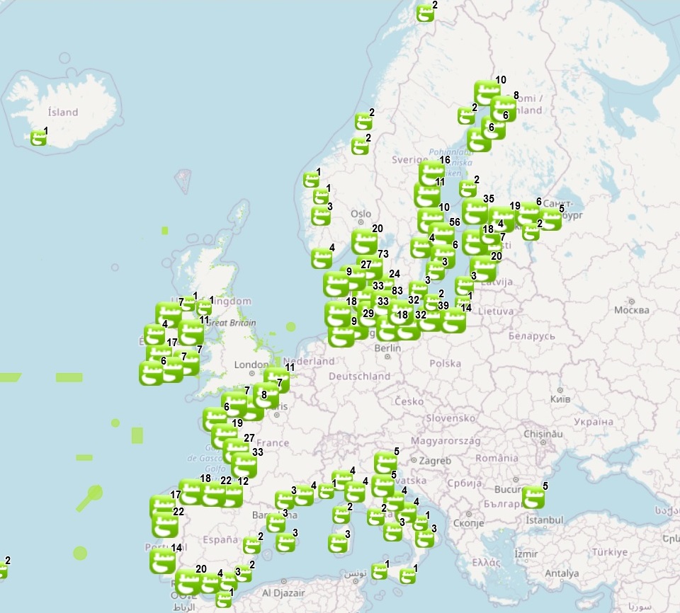
The dataset on offshore dredge dumping sites in the European seas was created in 2015 by CETMAR for the European Marine Observation and Data Network (EMODnet). It is the result of the aggregation and harmonization of datasets provided by several sources. It is updated every year and is available for viewing and download on EMODnet web portal (Human Activities, https://emodnet.ec.europa.eu/en/human-activities). The dataset contains points and/or (where available) polygons representing offshore dredge dumping sites in the following countries: Belgium, Bulgaria, Cyprus, Denmark, Estonia, Finland, France, Germany, Greece, Iceland, Ireland, Italy, Latvia, Lithuania, Malta, Norway, Poland, Portugal, Russia, Spain, Sweden and United Kingdom. Each point and polygon has the following attributes (where available): INDEX_ID, Site name, Country, Dredge ID, Dredged material, Year of operation, Information provider, Distance to coast (m) and Distance from centroid to coast (m)(This last attribute only appears for polygon data). The distance to coast (EEA coastline shapefile) has been calculated using the UTM WGS84 Zone projected coordinate system where data fall in.