 EMODnet Product Catalogue
1000
Type of resources
Available actions
Topics
Keywords
Contact for the resource
Provided by
Years
Formats
Representation types
Scale 1:
Resolution
-
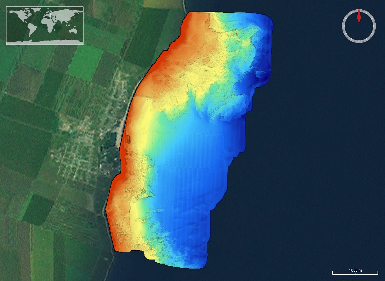
The DTM is produced with Kongsberg multibeam echosounder survey, acquired in 2015 by Marine Research Ltd. The resolution is 1/256 arc-minutes (~7.2m). It is located in Costinesti, Romania, on the coastal region of the Black Sea. Depths are referenced to the Mean Sea Level and the coordinates are expressed into the WGS84 reference frame.
-
The DTM is produced with Kongsberg multibeam echosounder survey, acquired in March 2020 by Marine Research Ltd. The resolution is 1/256 arc-minutes (~7.2m). It is located at 23 August, Romania, on the coastal region of the Black Sea. Depths are referenced to the Local Sea Level - Marea Neagra 1975 and the coordinates are expressed into the WGS84 reference frame.
-
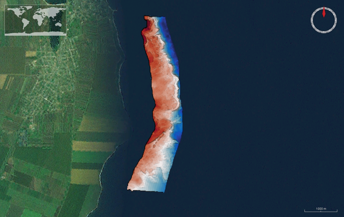
The DTM is produced with Kongsberg multibeam echosounder survey, acquired in 2015 by Marine Research Ltd. The resolution is 1/256 arc-minutes (~7.2m). It is located north of Mangalia Port, Romania, on the coastal region of the Black Sea. Depths are referenced to the Mean Sea Level and the coordinates are expressed into the WGS84 reference frame.
-
The DTM is produced with Kongsberg multibeam echosounder survey, acquired in 2015 by Marine Research Ltd. The resolution is 1/256 arc-minutes (~7.2m). It is located south of Constanta Port, Romania, on the coastal region of the Black Sea. Depths are referenced to the Mean Sea Level and the coordinates are expressed into the WGS84 reference frame.
-
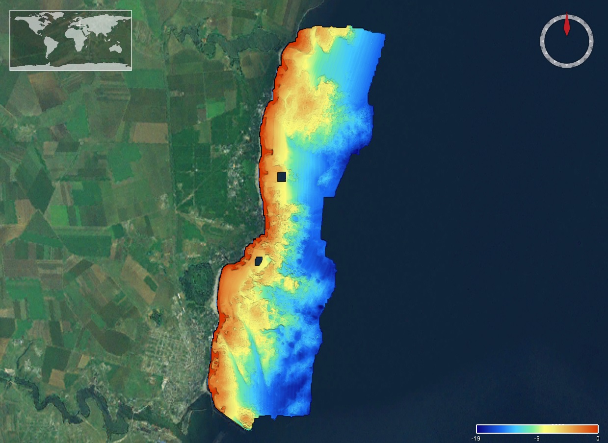
The DTM is produced with Kongsberg multibeam echosounder survey, acquired in March 2020 by Marine Research Ltd. The resolution is 1/256 arc-minutes (~7.2m). It is located at Tuzla, Romania, on the coastal region of the Black Sea. Depths are referenced to the Local Sea Level - Marea Neagra 1975 and the coordinates are expressed into the WGS84 reference frame.
-
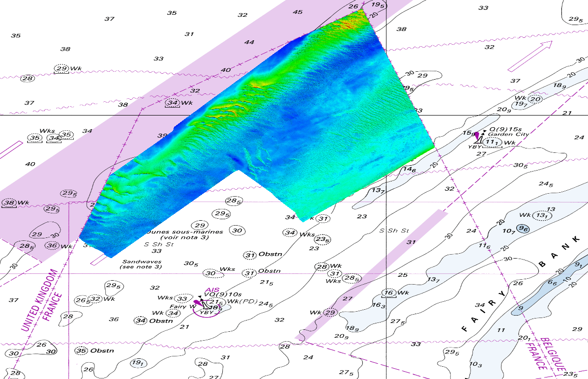
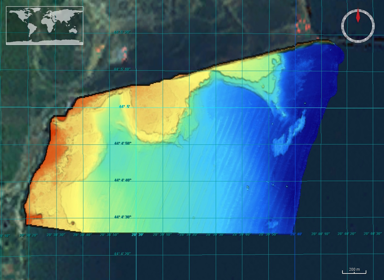
The DTM is produced from the S201502800-1 multibeam echosounder survey, acquired in 2015. The resolution is 1/1024 arc-minutes (~4m). It is located in front of Dunkirk (France) with depths from -16.4m to -43.3m. Depths are referenced to the Lowest Astronomical Tide and the coordinates are expressed into the WGS84 reference frame. Data and metadata associated to the survey are available on the website http://diffusion.shom.fr/pro/lots-bathy.html. The DTM is not to be used for navigation.
-
Seabed habitat map (Habitat Directive classification system) performed by Andromede Oceanologie & Stareso within the framework of CARTHAM ("cartographie des habitats marins") project coordinated by the French Biodiversity Agency (Agence fran├ºaise pour la biodiversit├®, AFB). Digital data sources: sonar (2010), bathymetry (2010), orthos (2007), historical data (2011, 2001, 1997), GPS (2011-2012) Ground truth data sources (2011-2012): diving, direct human observations, sea-viewer Map confidence rated by Ifremer : 86%
-
Seabed habitat map (Habitat Directive classification system) performed by Andromede Oceanologie & Stareso within the framework of CARTHAM ("cartographie des habitats marins") project coordinated by the French Biodiversity Agency (Agence fran├ºaise pour la biodiversit├®, AFB). Digital data sources: sonar (2010), bathymetry (2010), orthos (2007), historical data (2011, 2001, 1997) Ground truth data sources: none Map confidence rated by Ifremer: 61%
-
Seabed habitat map (EUNIS classification system) performed by Andromede Oceanologie & Stareso within the framework of CARTHAM ("cartographie des habitats marins") project coordinated by the French Biodiversity Agency (Agence fran├ºaise pour la biodiversit├®, AFB). Digital data sources: sonar (2010), bathymetry (2010), orthos (2007), historical data (2011, 2001, 1997), GPS (2011-2012) Ground truth data sources (2011-2012): diving, direct human observations, sea-viewer Map confidence rated by Ifremer : 86%
-
Seabed habitat map (EUNIS classification system) performed by Andromede Oceanologie & Stareso within the framework of CARTHAM ("cartographie des habitats marins") project coordinated by the French Biodiversity Agency (Agence fran├ºaise pour la biodiversit├®, AFB). Digital data sources: sonar (2010), bathymetry (2010), orthos (2007), historical data (2011, 2001, 1997) Ground truth data sources: none Map confidence rated by Ifremer : 61%