 EMODnet Product Catalogue
Keyword
Seafloor mapping
Type of resources
Available actions
Topics
Keywords
Contact for the resource
Provided by
Formats
Representation types
Update frequencies
status
Scale 1:
From
1
-
1
/
1
-
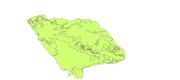
Map derived from the work presented by F.Tempera and coleagues on the Condor seamount, near Faial Island in the Azores. High-resolution datasets collected by multibeam and acoustic backscatter surveys were used to produce fine-scale seafloor nature and morpho-tectonic interpretations of the seamount, collected from various acoustic surveys from 2008 to 2010. submitted in Fernando Tempera, Ana Hip├│lito, Jos├® Madeira, Sara Vieira, Aldino S. Campos, Neil C. Mitchell, Condor seamount (Azores, NE Atlantic): A morpho-tectonic interpretation, Deep-Sea Research II, http://dx.doi.org/10.1016/j. dsr2.2013.09.016