 EMODnet Product Catalogue
notPlanned
Type of resources
Available actions
Topics
Keywords
Contact for the resource
Provided by
Years
Formats
Representation types
Update frequencies
status
Scale 1:
Resolution
-
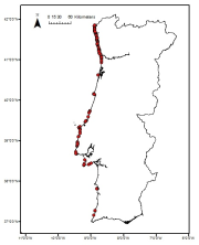
Cymodocea nodosa meadows distribution in the south of Portugal from historical data. Data provided by the Life Project BIOMARES and published in: ÔÇ£Seagrasses in Portugal: A most endangered marine habitatÔÇØ. Aquatic Botany. doi:10.1016/j.aquabot.2011.08.007. ÔÇ£Estimation of available seagrass meadows area in Portugal for transplanting purposes ÔÇØ. Journal of Coastal Research (2009) :SI 56 (1100-1104)
-
Zostera noltii meadows distribution in the Portuguese mainland from historical data. Data provided by the Life Project BIOMARES and published in: ÔÇ£Seagrasses in Portugal: A most endangered marine habitatÔÇØ. Aquatic Botany. doi:10.1016/j.aquabot.2011.08.007. ÔÇ£Estimation of available seagrass meadows area in Portugal for transplanting purposes ÔÇØ. Journal of Coastal Research (2009) :SI 56 (1100-1104)
-
Maerl beds distribution in the Portuguese mainland from historical data. Data published in: ÔÇ£Present distribution of maerl beds in the Atlantic Iberian PeninsulaÔÇØ. Museologia Scientifica e Naturalista. Volume Speciale 2009
-
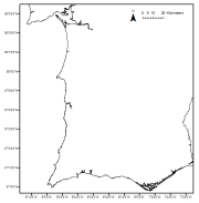
Saccorhiza polyschides distribution in the Portuguese mainland from historical data. Data provided by the Project FindKelp and published in: ÔÇ£Findkelp, a GIS-based Community Participation Project to Assess Portuguese Kelp Conservation StatusÔÇØ. Journal of Coastal Research (2009) :SI 56 (1469-1473)
-
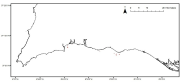
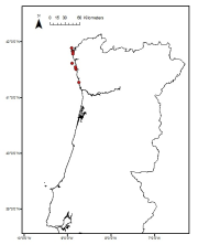
Laminaria ochroleuca distribution in the Portuguese mainland from historical data. Data provided by the Project FindKelp and published in: ÔÇ£Findkelp, a GIS-based Community Participation Project to Assess Portuguese Kelp Conservation StatusÔÇØ. Journal of Coastal Research (2009) :SI 56 (1469-1473)
-
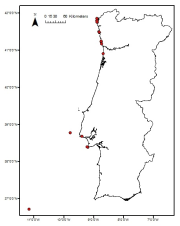
Laminaria hyperborea distribution in the Portuguese mainland from historical data. Data provided by the Project FindKelp and published in: ÔÇ£Findkelp, a GIS-based Community Participation Project to Assess Portuguese Kelp Conservation StatusÔÇØ. Journal of Coastal Research (2009) :SI 56 (1469-1473)
-
Zostera marina meadows distribution in the Portuguese mainland from historical data. Data provided by the Life Project BIOMARES and published in: ÔÇ£Seagrasses in Portugal: A most endangered marine habitatÔÇØ. Aquatic Botany. doi:10.1016/j.aquabot.2011.08.007. ÔÇ£Estimation of available seagrass meadows area in Portugal for transplanting purposes ÔÇØ. Journal of Coastal Research (2009) :SI 56 (1100-1104)
-
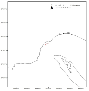
Data were collected in the framework for the stablishment of the Capo Milazzo AMP. The study was founded by MATTM. The map was constructed by using acustic data, direct observations by ROV and satellite images.
-
Point data on Laminaria hyperborea, collected from different sources in the Nordic countries, were used to model the kelp forest distribution by fitting boosted regression trees to the compiled data. The predictors were distance to shore, slope, curvature, aspect, salinity, temperature, light, current speed, sea ice concentration and wave fetch. The aim of the project was to model the distribution of kelp forests in the Nordic countries in order to identify their ecosystem functions and services, including their role in the carbon cycle.
-
The project had the aim to map intertidal and subtidal habitats at the Sore Sunnmore area on the West coast of Norway. We collected data points in the intertidal and in the seaweed, kelp and red algae bed in the subtidal. These data were used to model the distribution of different habitats. Habitat data was analysed (using the R package mlogit for Multinomial Logit Models, CRAN - Package mlogit (r-project.org)) against modelled depth, seabed light, salinity, temperature and wave exposure. 30 habitats were modelled, which again was transformed into composite maps, identifying the most dominant habitat/species.