300000
Type of resources
Available actions
Topics
Keywords
Contact for the resource
Provided by
Years
Formats
Representation types
Update frequencies
status
Scale 1:
Resolution
-
This marine multibeam survey took place in August 2011 in the area around Noss Head and the Southern Trench in the Moray Firth on board the Northern Lighthouse Board vessel NLV Pole Star. The survey was carried out by the British Geological Survey (BGS) on behalf of Marine Scotland and Scottish Natural Heritage (SNH) for Marine Protected Area (MPAs) related studies. Sea floor bathymetry data were collected using a Kongsberg EM3002D multibeam system.
-

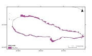
Interpretation of backscatter mosaics and seismic sub-bottom profiles. Tempera, F., M. McKenzie, I. Bashmachnikov, M. Puotinen, R.S. Santos & R. Bates (2012). Predictive modelling of dominant macroalgae abundance on temperate island shelves (Azores, northeast Atlantic). In Baker, E. and P. Harris (eds.). pp 169-182. Seafloor Geomorphology as Benthic Habitat: Geohab Atlas of Seafloor Geomorphic Features and Benthic Habitats. Elsevier, London. Quartau, R., F. Curado, S. Bouriak, J.H. Monteiro and L. Pinheiro, 2003. Projecto GEMAS ÔÇô Localiza├º├úo e distribui├º├úo de areias em redor da ilha do Pico (Campanha FAPI2-2002). Relat├│rio T├®cnico INGMARDEP 16/2003, Dept. Geologia Marinha - INETI, I.P., Lisboa.
-

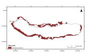
Interpretation of seismic sub-bottom profiles. Quartau, R., F. Curado, H. Duarte & C. Pinto, 2006. Projecto GEMAS ÔÇô Localiza├º├úo e distribui├º├úo de areias em redor da ilha de S. Miguel. Relat├│rio T├®cnico INGMARDEP 02/2006, Dept. Geologia Marinha - INETI, I.P., Lisboa.
-

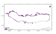
Interpretation of seismic sub-bottom profiles. Quartau, R., F. Curado, H. Duarte & C. Pinto, 2006. Projecto GEMAS ÔÇô Localiza├º├úo e distribui├º├úo de areias em redor da ilha de S. Miguel. Relat├│rio T├®cnico INGMARDEP 02/2006, Dept. Geologia Marinha - INETI, I.P., Lisboa.
 EMODnet Product Catalogue