 EMODnet Product Catalogue
FAO
Type of resources
Available actions
Topics
Keywords
Contact for the resource
Provided by
Years
Formats
Representation types
-

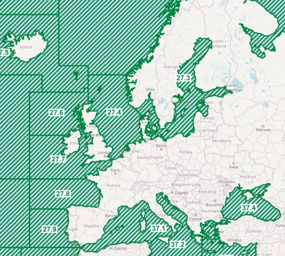
The dataset on fishing effort in the EU waters was created in 2020 by Cogea for the European Marine Observation and Data Network (EMODnet). It is updated every year and is available for viewing and download on the EMODnet web portal (Human Activities, https://emodnet.ec.europa.eu/en/human-activities). The dataset is the result of the elaboration of the 'STECF 22-06 - EU Fleet Economic and Transversal data_fleet segment (Version 1.1)' of the Scientific, Technical and Economic Committee for Fisheries (STECF) of the EU Commission (JRC). Aggregated STECF data have been related to georeferenced FAO's fishing statistical areas (27, 34 and 37, at all levels) and to Geographical subareas (GSAs) of the FAO's General Fisheries Commission for the Mediterranean (GFCM). Where and when available, data on Days at sea, Fishing days, Gross Tonnage fishing days, kW fishing days are provided for each FAO fishing statistical area and GSA by year of reference, Country, fishing technology and vessel length classes. With this update the dataset covers now a time series from 2008 to 2021.
-
The dataset on fish catches in the European waters by FAO statistical areas was created in 2015 by Cogea for the European Marine Observation and Data Network (EMODnet). It is the result of the aggregation of EUROSTAT's fish catches datasets fish_ca_atl 27, fish_ca_atl 34, fish_ca_atl 37, fish_ca_atl271, fish_ca_atl272, fish_ca_atl34_h and fish_ca_atl37_h. It is available for viewing and download on EMODnet web portal (Human Activities, https://emodnet.ec.europa.eu/en/human-activities). EUROSTAT data have been related to FAO's georeferenced fishing areas (polygons) for statisticl purposes (FAO, 2020. FAO Statistical Areas for Fishery Purposes. In: FAO Fisheries and Aquaculture Department). Tonnes live weight is provided for each fish species caught (3-alpha code and english or scientific name if the english one is not available), by EUMOFA's larger aggregations such as EUMOFA's Commodity Groups and Main Commercial Species (see 'Species_Eumofa_ASFIS_2023' table), by year of reference and country (code and name). The dataset is updated yearly and it covers a time series from 1950 to 2021, where available. Compared with the previous version this new one's schema have been updated.