 EMODnet Product Catalogue
single-beam echosounders
Type of resources
Available actions
Topics
Keywords
Contact for the resource
Provided by
Years
Formats
Representation types
Scale 1:
Resolution
-
Satellite-derived bathymetry for the Venice Lagoon
-
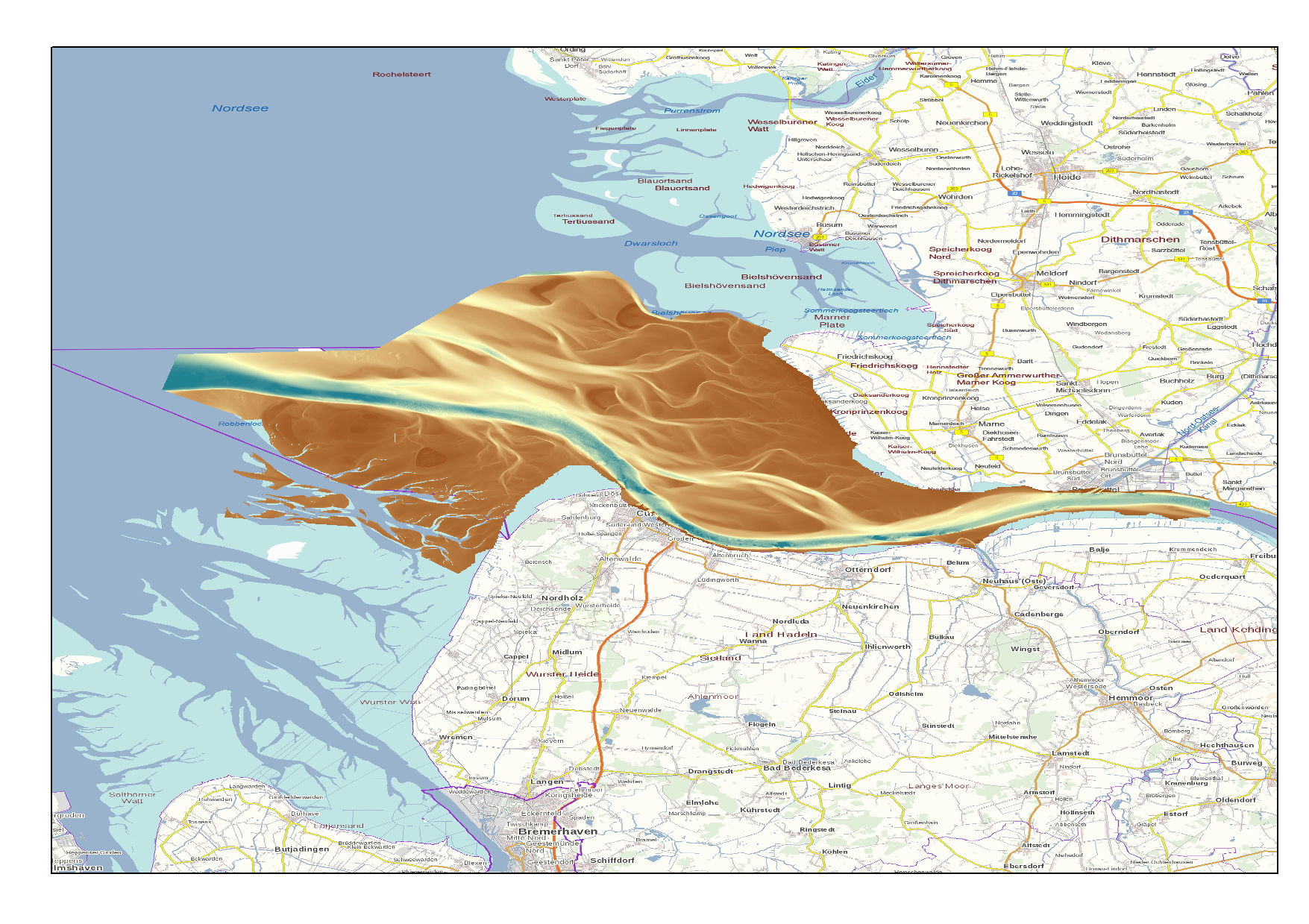
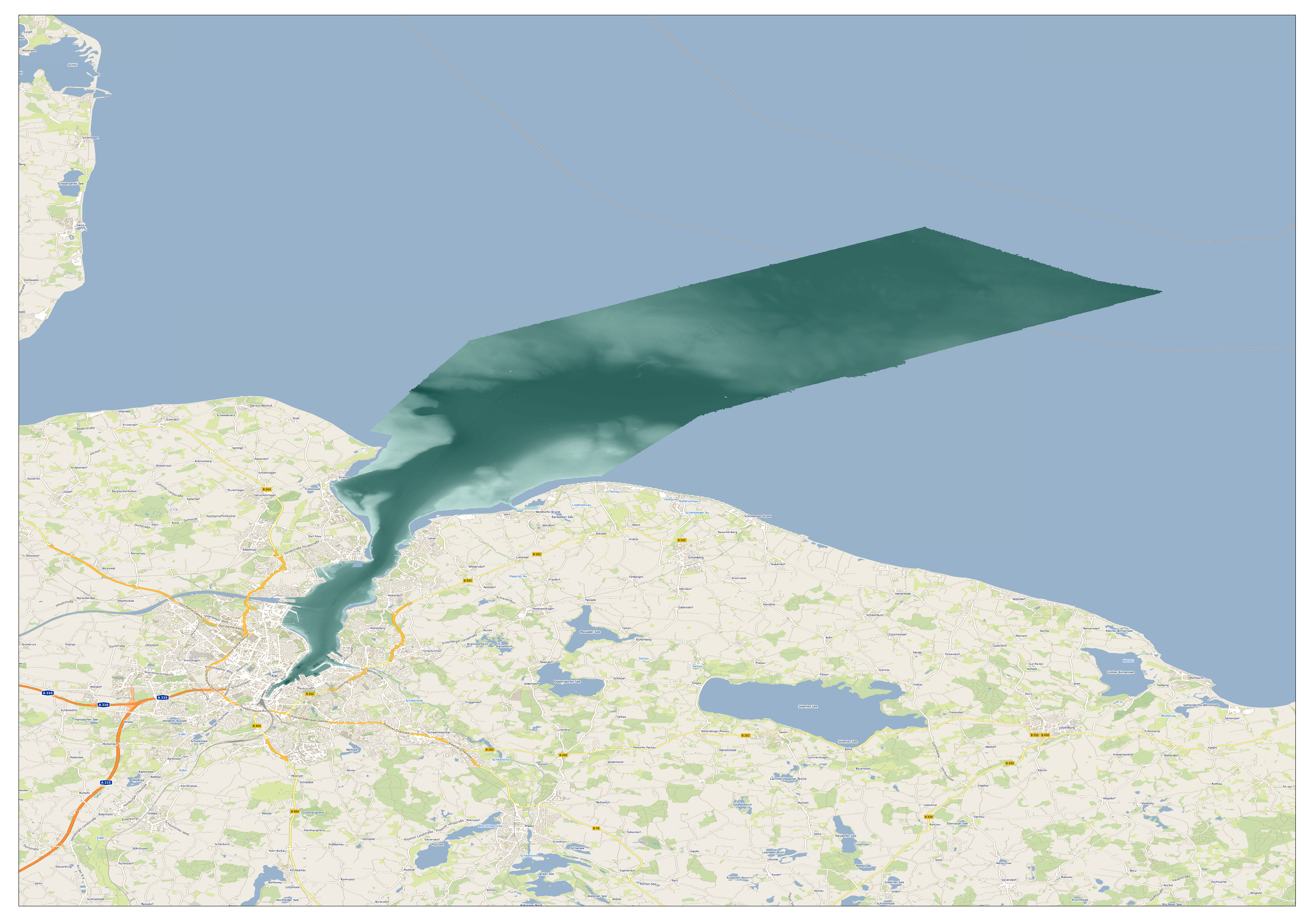
High Resolution DTM of the German Elbe Approach.
-
Multibeam bathymetry collected from Asköfjärden and Fifång Deep, east of Askö Island in southern Stockholm archipelago. The data were collected with Stockholm University research vessels (RV) Electra and Skidbladner between 2012 and 2018 for multiple purposes. Some of the data were collected as a part of a course in marine geophysical mapping at Stockholm University. The processing of the raw data was carried out using the Qimera software by QPS. The data have been cleared for public release by the Swedish Maritime Administration.
-
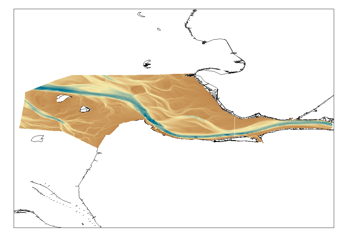
High Resolution DTM of the German Elbe Approach.
-
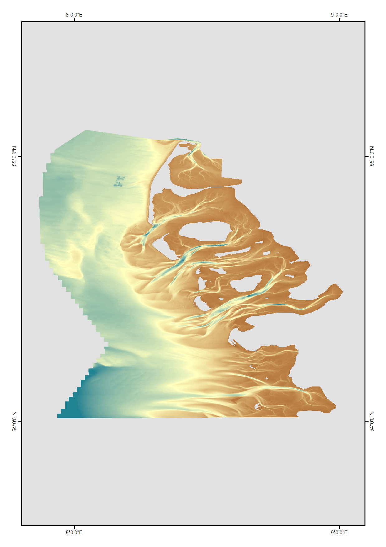
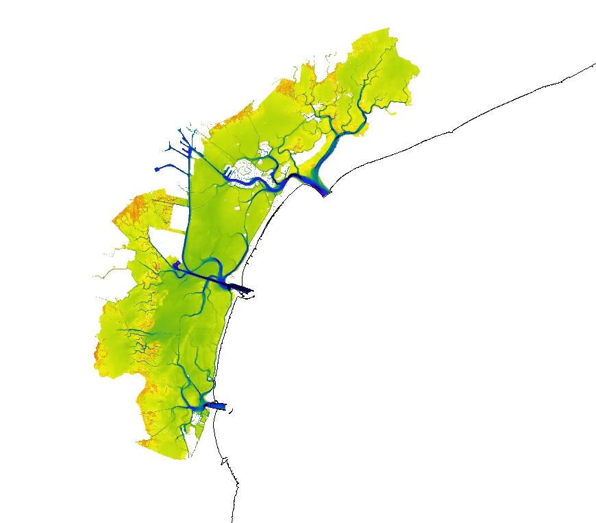
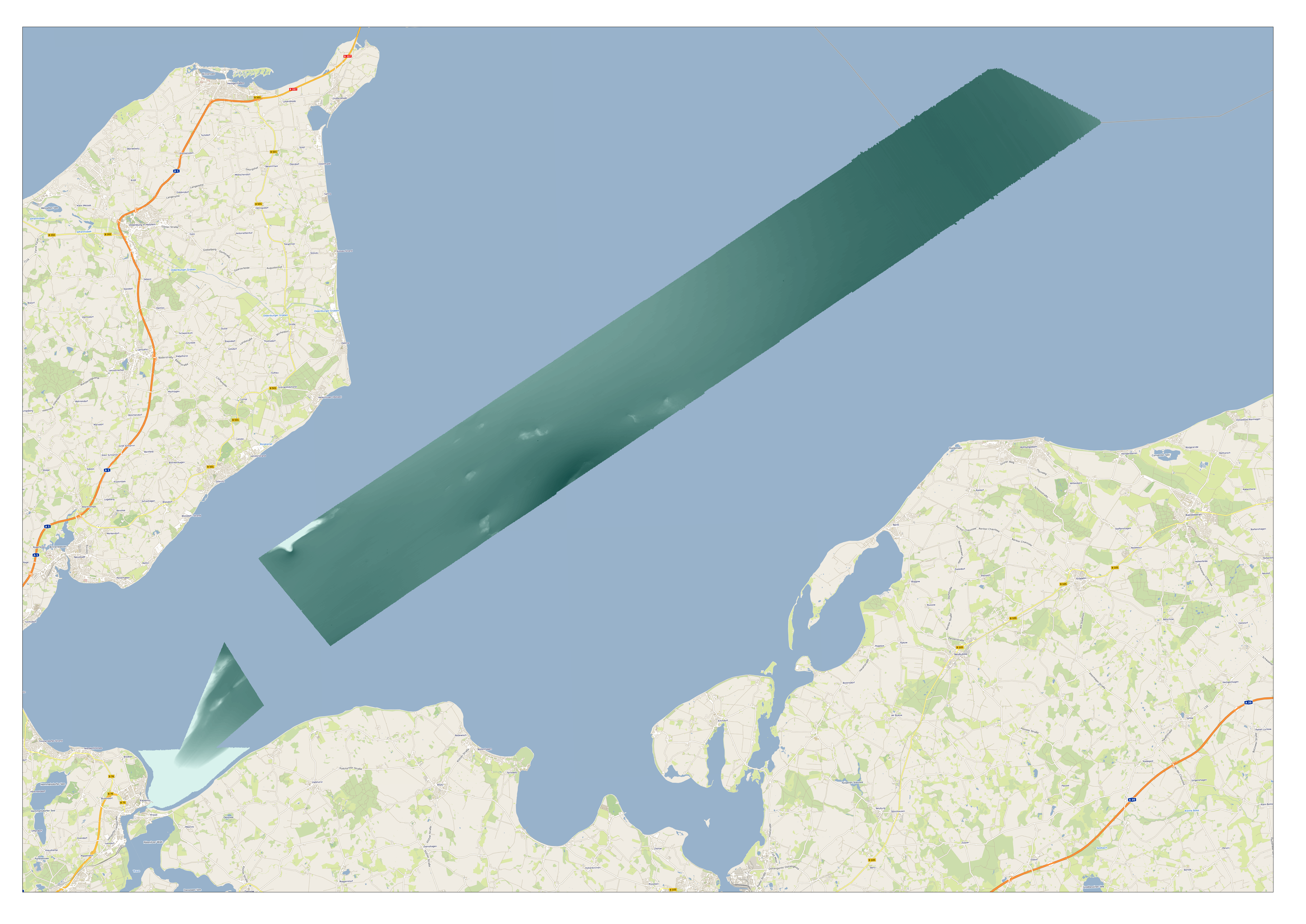
High resolution digital terrain model of the North Frisian waters based on survey data from various sources such as single-beam, multi-beam and Lidar.
-
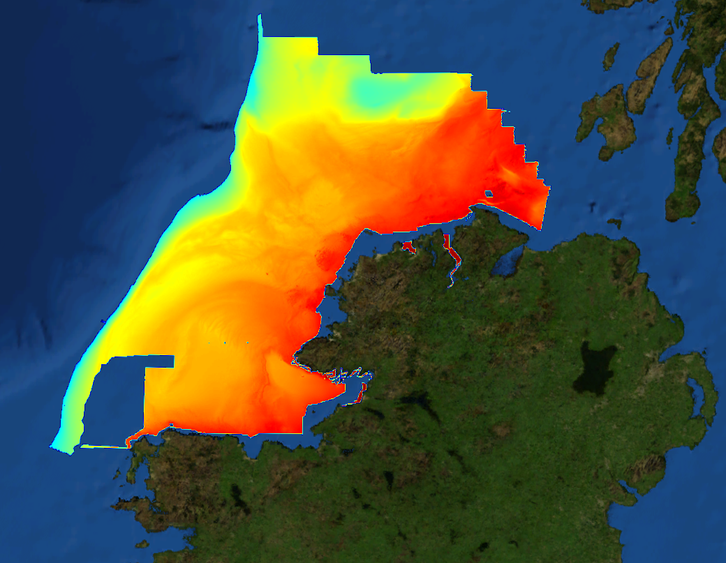
This composite Digital Terrain Model (cDTM) is a high resolution bathymetry dataset highlighting measurement of depth of water in the ocean. This cDTM covers the North Atlantic Ocean off the coast of County Donegal in Ireland. The EMODnet high resolution DTM covers bathymetry surveys completed between 2002 and 2016. Bathymetric data collected on board research vessels using multi-beam and single-beam echosounder instrumentation. Raw bathymetry processed within CARIS software to produce bathymetry products subsequently converted to NetCDF cDTM for EMODnet. Acquisition, processing and product delivery follows IHO standard s44 Edition 5. cDTM is composed of eighteen (18) images “merged simply” using GLOBE software. INFOMAR (Integrated Mapping for the Sustainable Development of Ireland’s Marine Resource) is a twenty year programme to map the physical, chemical and biological features of Ireland’s seabed established in 2006. INFOMAR is funded by the Department of Communications, Climate Action and Environment (DCCAE), and delivered by joint management partners Geological Survey Ireland and the Marine Institute. The programme is the successor to the Irish National Seabed Survey (INSS) which ran between 1999 and 2005. INFOMAR concentrates on creating integrated mapping products related to the seabed.
-
GEMS Survey Ltd. (GEMS) were contracted by Forewind Limited to undertake a bathymetric and geophysical survey of the Tranche A development area and two met mast locations (which were later revised) within the Dogger Bank Zone, in addition to a cable reconnaissance from Tranche A to the Yorkshire coastline. This survey was carried out between 8 July 2010 and 26 December 2010. The primary objectives of the survey were to produce sufficiently high resolution bathymetric and geophysical data and interpretations to allow regional interpretation for planning and modelling purposes; for met mast design to commence and to provide high quality data to inform further benthic and environmental surveys. GEMS supplied interpreted datasets compatible with ESRI ArcGIS software. The GIS data included bathymetry, sidescan sonar mosaics, seabed features, sediments and obstructions.
-
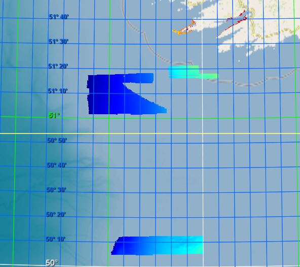
This composite Digital Terrain Model (cDTM) is a high resolution bathymetry dataset highlighting measurement of depth of water in the ocean. This cDTM covers the Celtic Sea off the coast of South West County Cork in Ireland. The EMODnet high resolution DTM covers bathymetry surveys completed between 2021 and 2022. Bathymetric data collected on board research vessels using multi-beam and single-beam echosounder instrumentation. Raw bathymetry processed within CARIS software to produce bathymetry products subsequently converted to NetCDF cDTM for EMODnet. Acquisition, processing and product delivery follows IHO standard s44 Edition 5. cDTM is composed of two (2) images “merged simply” using GLOBE software. INFOMAR (Integrated Mapping for the Sustainable Development of Ireland’s Marine Resource) is a twenty year programme to map the physical, chemical and biological features of Ireland’s seabed established in 2006. INFOMAR is funded by the Department of Communications, Climate Action and Environment (DCCAE), and delivered by joint management partners Geological Survey Ireland and the Marine Institute. The programme is the successor to the Irish National Seabed Survey (INSS) which ran between 1999 and 2005. INFOMAR concentrates on creating integrated mapping products related to the seabed.
-
High resolution composite DTM based on multi beam surveys. All data acquired in the years 2013-2020.
-
High resolution composite DTM based on multi beam surveys. All data acquired in the years 2014-2018.