 EMODnet Product Catalogue
5000
Type of resources
Available actions
Topics
Keywords
Contact for the resource
Provided by
Years
Formats
Representation types
Update frequencies
status
Scale 1:
Resolution
-
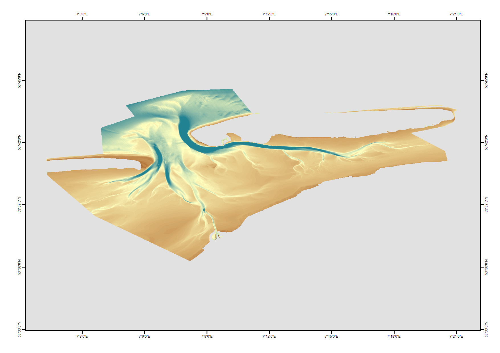
High resolution digital terrain model of the North Frisian waters based on survey data from various sources such as single-beam, multi-beam and Lidar.
-
Bathymetric data resulting from hydrographic surveys for cartographic purposes and/or port management. Surveys carried out in accordance with the IHO S-44 standard.
-
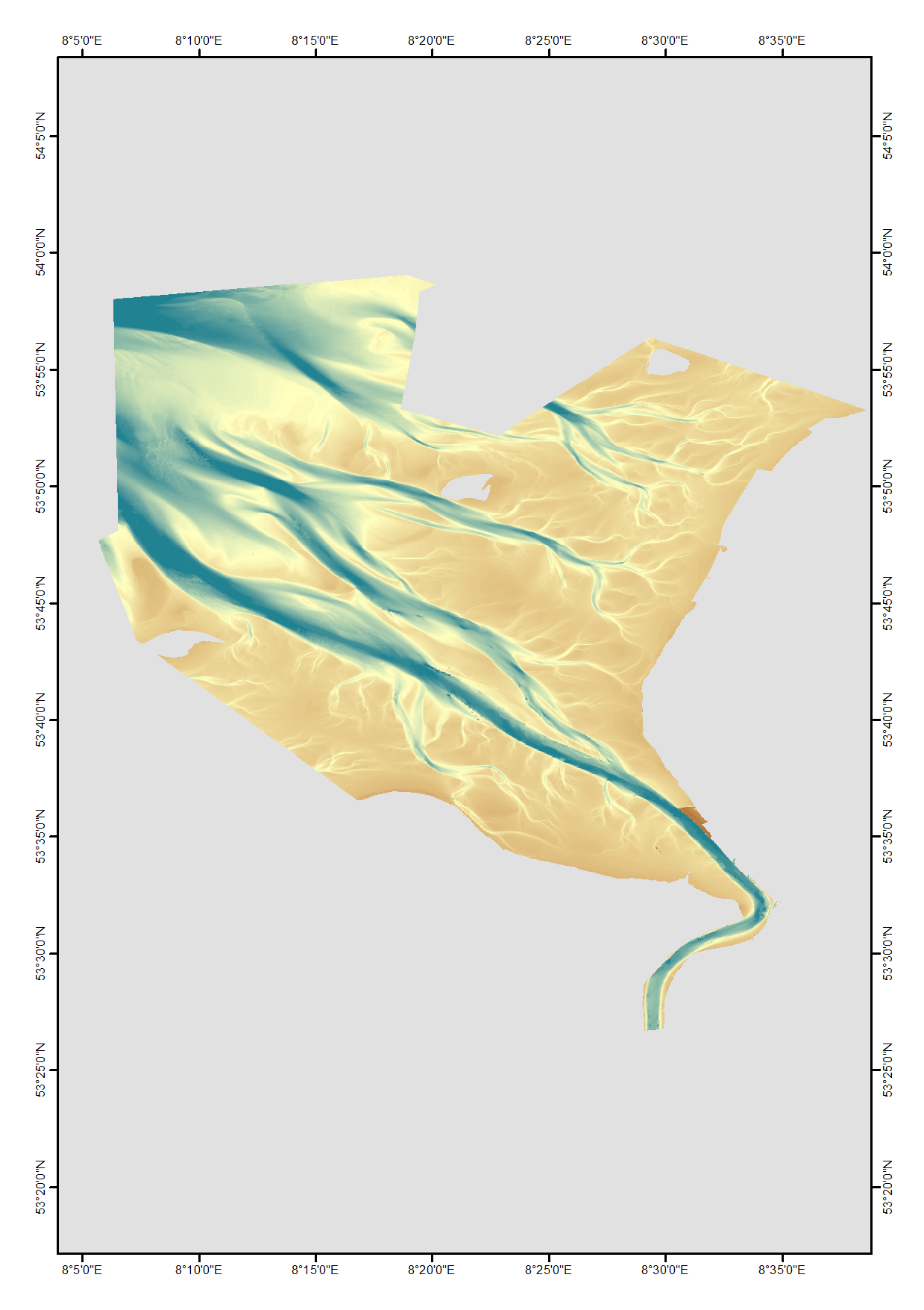
High resolution composite DTM based on single beam, multi beam and Lidar covering the Weser and Weser approach. All data acquired in the years 2010-2017.
-
High resolution composite DTM based on single beam, multi beam and Lidar covering Norderney and waters in proximty. All data was acquired in the year 2016. Data used:SDN:CPRD:1850_DGM_Norderney_2016
-
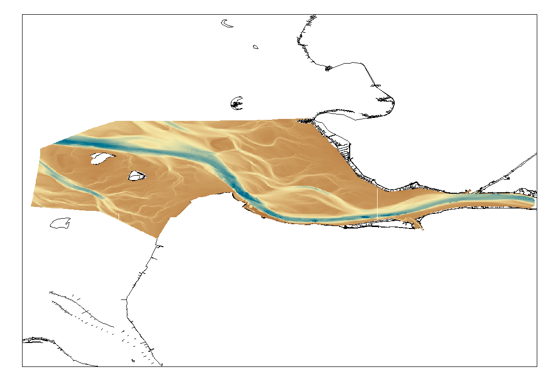
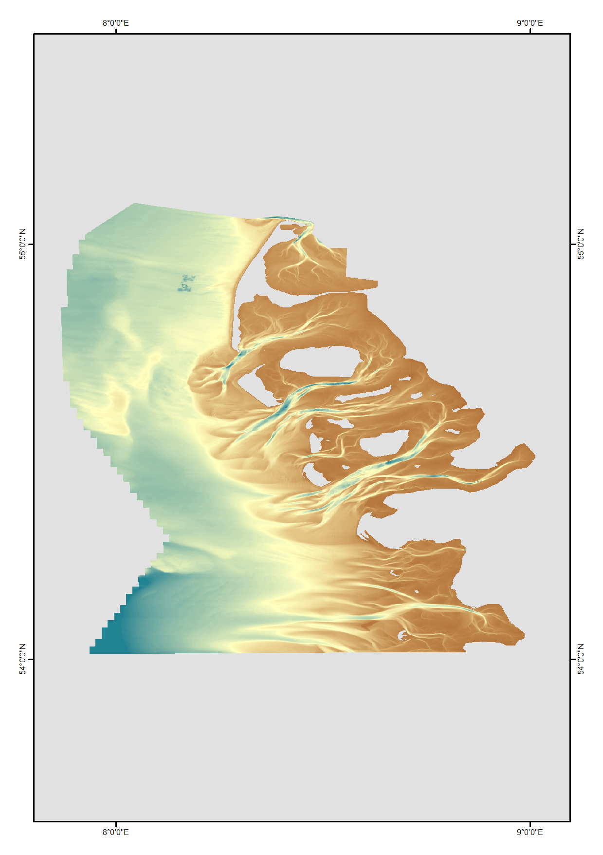
High Resolution DTM of the German Elbe Approach.
-
The data were acquired with a Simrad EM3002-D Multi Beam echosounder onboard the R/V Hercules as part of a habitat mapping survey in the framework of RICS funded project. The data were published in: Micallef, A., Le Bas, T.P., Huvenne, V.A.I., Blondel, P., Hühnerbach, V., Deidun, A., 2012. A multi-method approach for benthic habitat mapping of shallow coastal areas with high resolution multibeam data. Continental Shelf Research 39-40, 14-26.
-
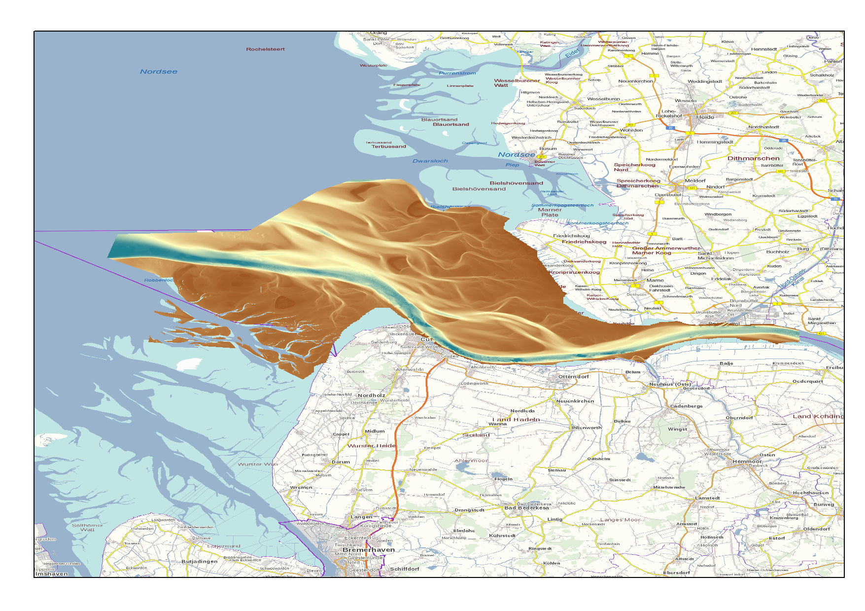
High Resolution DTM of the German Elbe Approach.
-
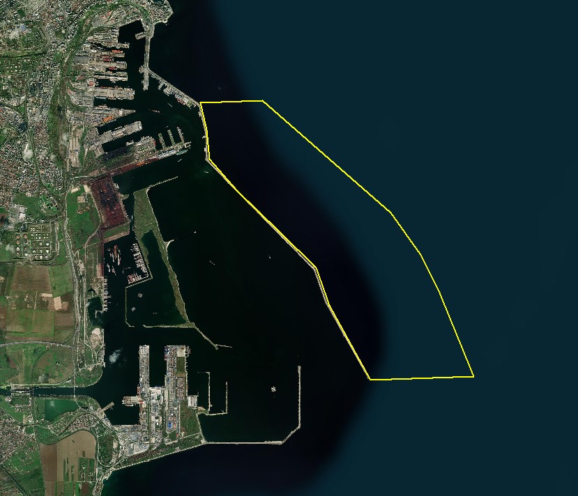
The DTM is produced with Kongsberg multibeam echosounder survey, acquired in August 2021 by Marine Research Ltd. The resolution is 1/256 arc-minutes (~7.2m). It is located at Constanta Harbour, Romania, on the coastal region of the Black Sea. Depths are referenced to the Local Sea Level - Marea Neagra 1975 and the coordinates are expressed into the WGS84 reference frame.
-
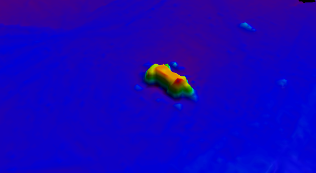
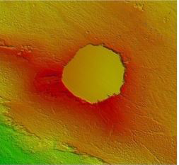
BalticSea_Maritime_Administration_Latvia Wreck found using MBES technique
-
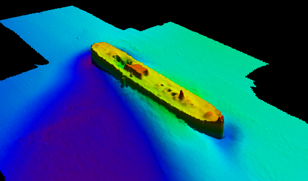
BalticSea_Maritime_Administration_Latvia Wreck found using MBES technique