 EMODnet Product Catalogue
Inva
Type of resources
Available actions
Topics
Keywords
Contact for the resource
Provided by
Years
Formats
Representation types
Scale 1:
Resolution
-
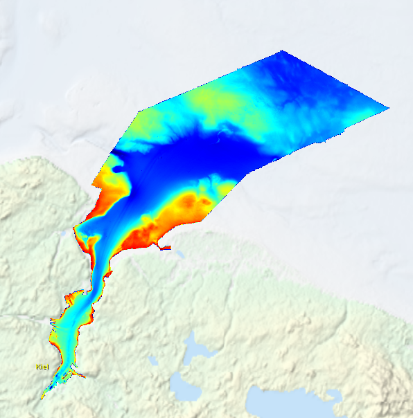
High resolution composite DTM based on multi beam surveys in Kiel Bay. All data acquired in the years 2013-2016.
-
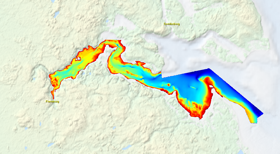
High resolution composite DTM based on multi beam surveys in Flensburg Bay. All data acquired in the years 2012-2013.
-
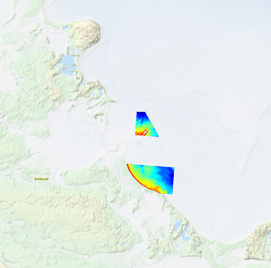
High resolution composite DTM based on multi beam surveys in German Bodden waters. All data acquired in 2016.
-
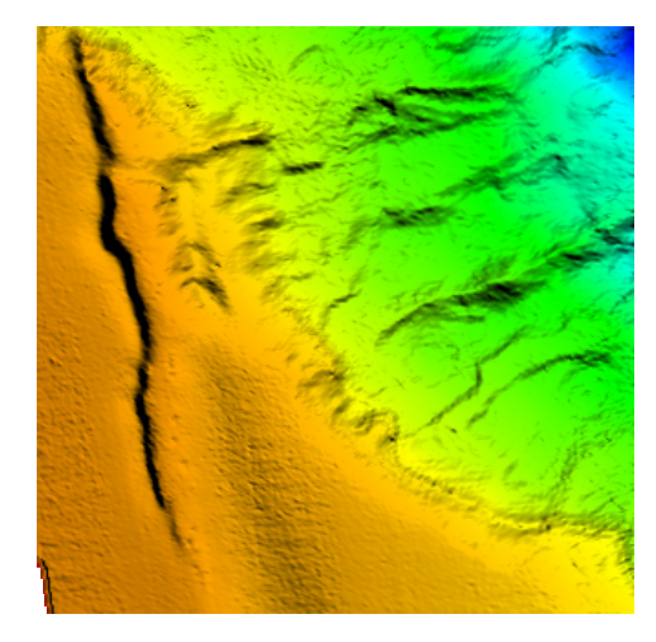
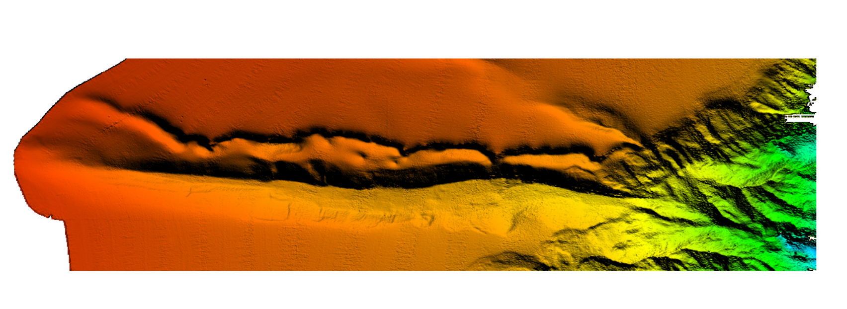
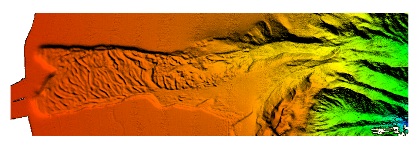
The data were acquired with a Simrad EM710 Multi Beam echosounder onboard the R/V Urania in order to cover the outer Malta Plateau and upper Malta Escarpment for a geological survey in the framework of EU FP7 project EUROFLEETS. The data were published in: Micallef, A., Georgiopoulou, A., Le Bas, T., Mountjoy, J.J., Huvenne, V., Lo Iacono, C., 2013. The Malta-Sicily Escarpment: Mass Movement dynamics in a sediment-undersupplied margin, in: Krastel, S., Berhmann, J.H., Volker, D., Stipp, M., Berndt, C., Urgeles, R., Chaytor, J.D., Huhn, K., Strasser, M., Harbitz, C.B. (Eds.), Submarine Mass Movements and Their Consequences. Springer International Publishing, Switzerland, pp. 317-328.
-
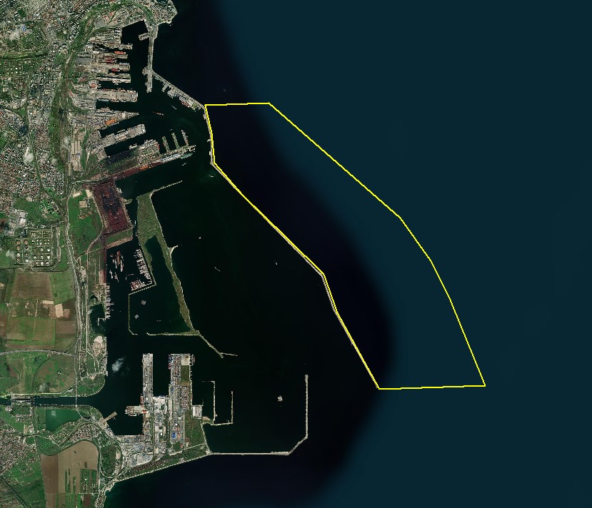
The DTM is produced with Kongsberg multibeam echosounder survey, acquired in August 2021 by Marine Research Ltd. The resolution is 1/256 arc-minutes (~7.2m). It is located at Constanta Harbour, Romania, on the coastal region of the Black Sea. Depths are referenced to the Local Sea Level - Marea Neagra 1975 and the coordinates are expressed into the WGS84 reference frame.
-
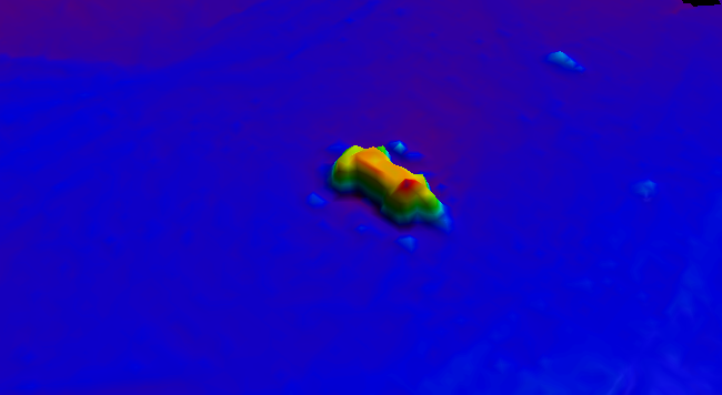
BalticSea_Maritime_Administration_Latvia Wreck found using MBES technique
-
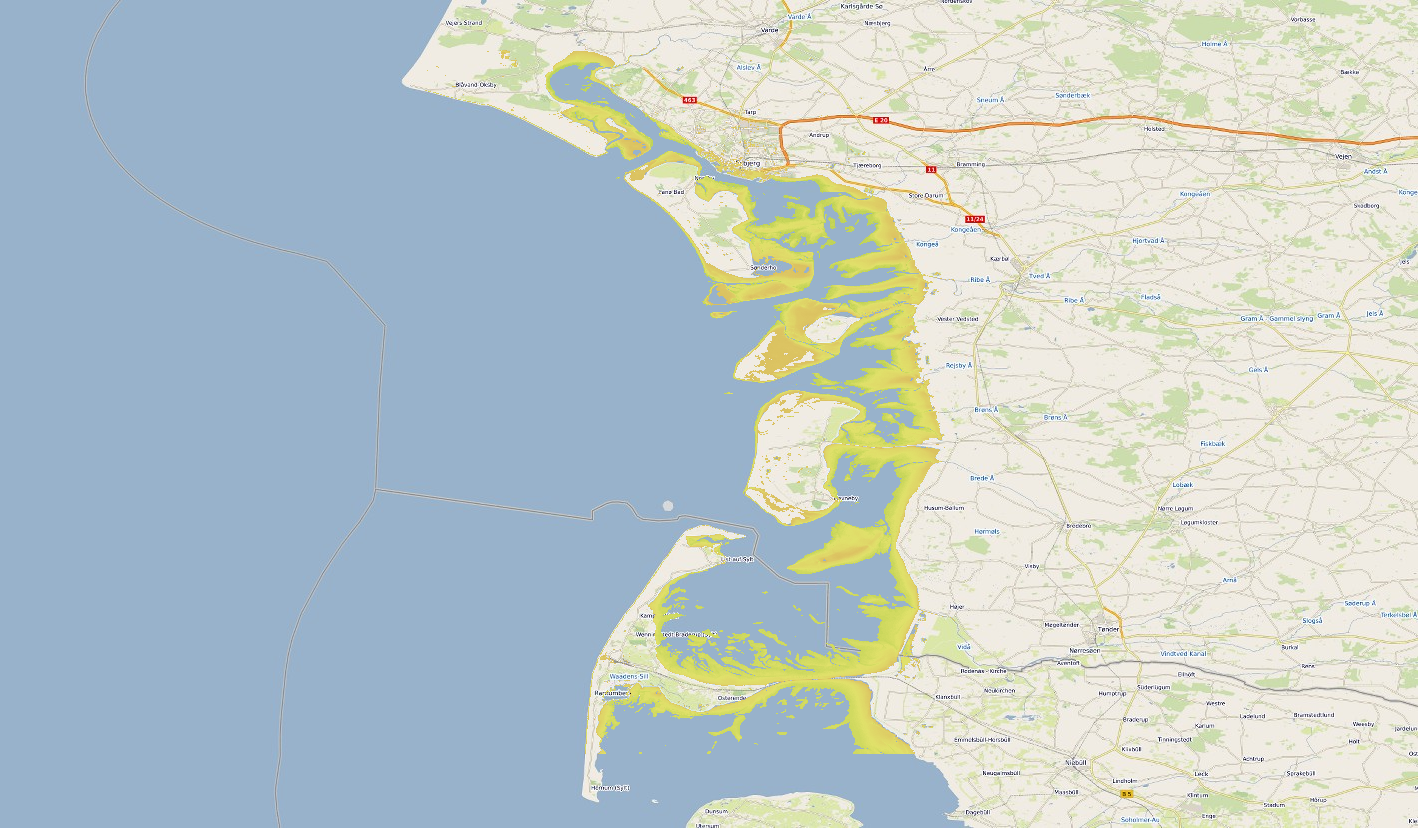
Satellite-derived intertidal bathymetry for the Danish Wadden on the West coast of Denmark
-
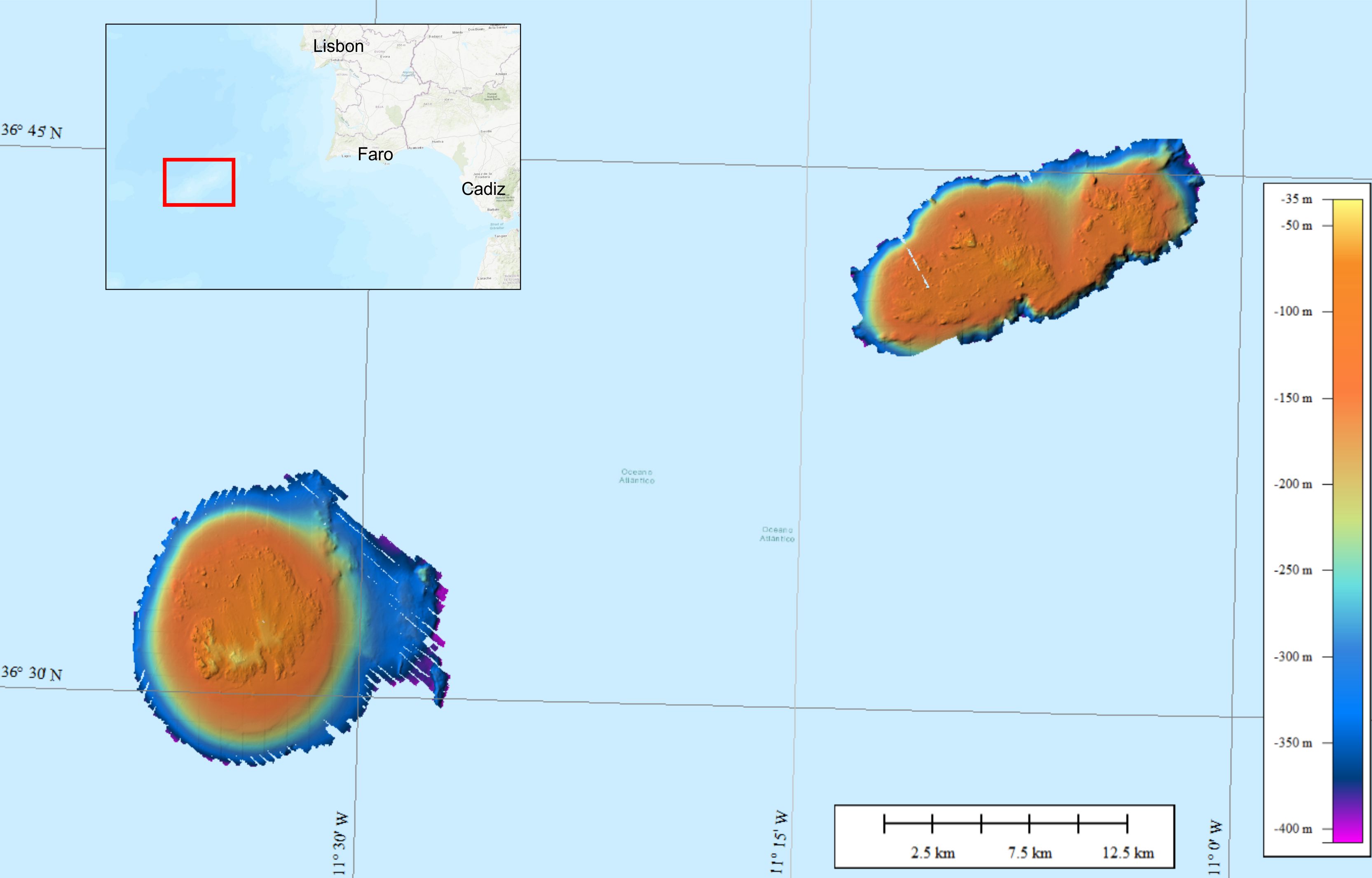
Bathymetric data were collected on the Gorringe Bank, located along the Europe-Africa obliquely convergent plate boundary offshore SW Portugal. The high-resolution swath bathymetry dataset allowed the investigation of the shallow-depth structure of the Horseshoe Seamounts. Data were collected by means of the MBES system Reson SeaBat8101. The MBES was hull-mounted on a 60 meters long vessel. The MBES has 101 beams 1,5° x 1,5°; the operational frequency was 240 kHz. A LandStar 12 channel DGPS system was used for ship positioning and a motion sensor TSS-DMS02-05 was used to provide corrections for attitude data. A Sound Velocity Sensor was installed near the transducers thus providing realtime sound speed for beam steering. A sound velocity profiler Reson SVP20 was lowered through the water column every 6–8 h to get the velocity profile required for the depth computation. The bathymetric data were processed using the PDS2000 software. Data de-spiking was carried out without the application of automatic filters in order to preserve data accuracy and resolution.