 EMODnet Product Catalogue
EMODNet Bathymetry
Type of resources
Available actions
Topics
Keywords
Contact for the resource
Provided by
Years
Formats
Representation types
Scale 1:
Resolution
-
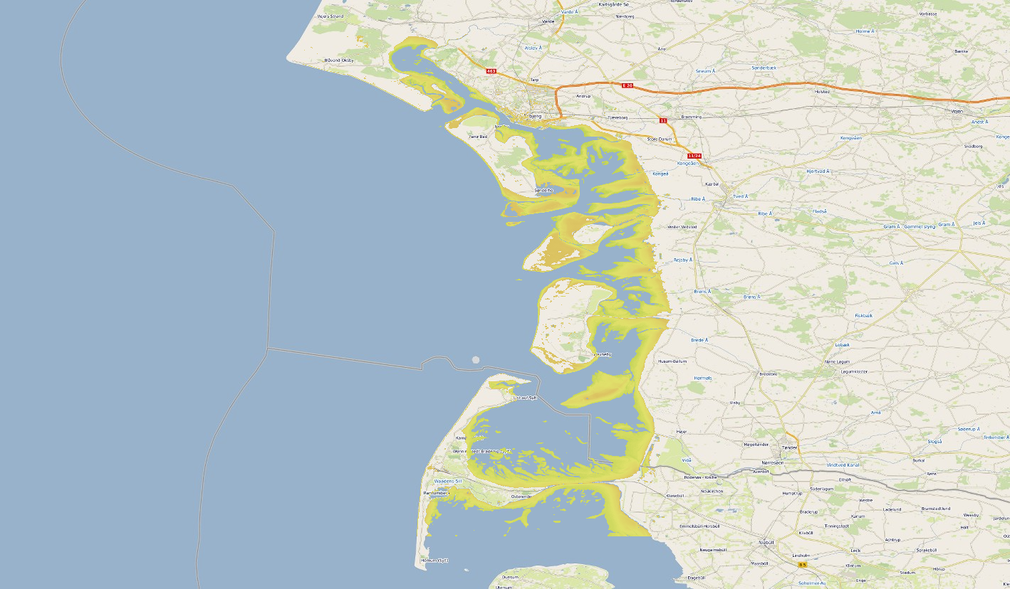
Satellite-derived intertidal bathymetry for the Danish Wadden on the West coast of Denmark
-
The data have been acquired with a SeaBat RESON 7125 (frequency 450kHz and depth up to 150 m) multibeam echosounder mounted on board of the research vessel "Minerva 1" (party chief F. G. Falese) between 27 september and 5 october 2016. The main objective of this cruise was the search of relict sand deposits potentially exploitable for beach nourishment on these continental shelves. Weather and marine conditions were fair during the acquisition.
-
The data have been acquired with a SeaBat RESON 8125 (455kHz) e Seabat RESON 8160 (50 kHz) multibeam echosounders mounted on board of the research vessel "Universitatis" (chief scientist F.L. Chiocci; party chief F. Falese). The main objective of this cruise was the search of relict sand deposits potentially exploitable for beach nourishment on these continental shelves. Weather conditions were good during the acquisition.
-
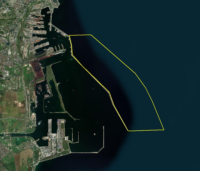
The DTM is produced with Kongsberg multibeam echosounder survey, acquired in August 2021 by Marine Research Ltd. The resolution is 1/256 arc-minutes (~7.2m). It is located at Constanta Harbour, Romania, on the coastal region of the Black Sea. Depths are referenced to the Local Sea Level - Marea Neagra 1975 and the coordinates are expressed into the WGS84 reference frame.
-
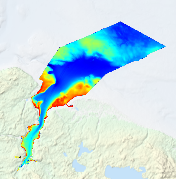
High resolution composite DTM based on multi beam surveys in Kiel Bay. All data acquired in the years 2013-2016.
-
Grid processed for the purpose of the HR DTMs layer of EMODnet Bathymetry HRSM, October 2020
-
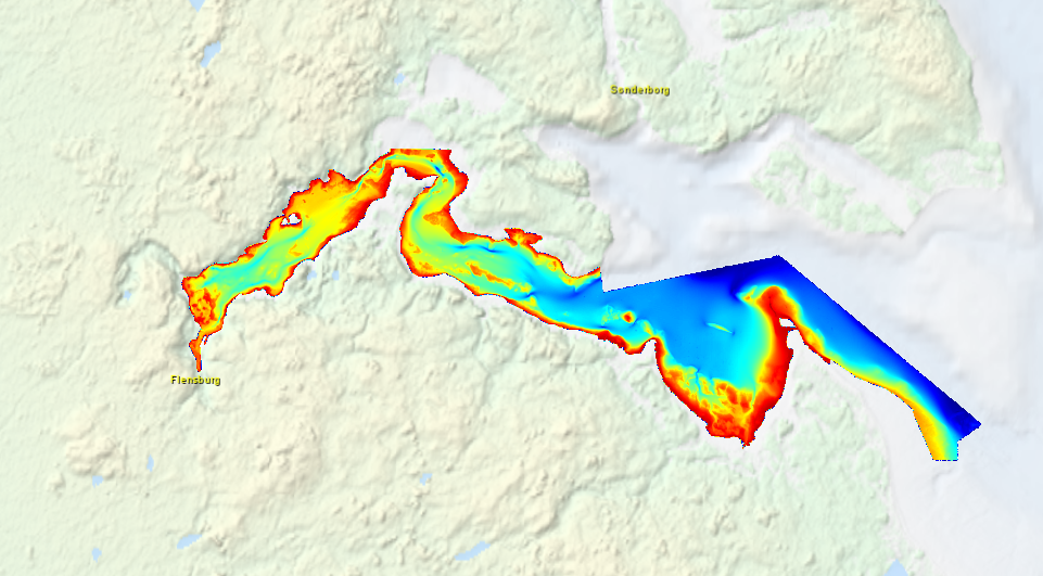
High resolution composite DTM based on multi beam surveys in Flensburg Bay. All data acquired in the years 2012-2013.
-
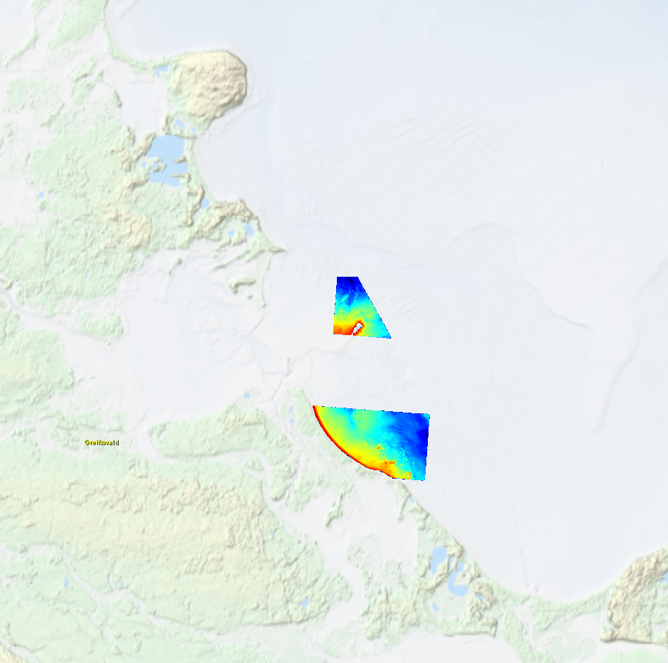
High resolution composite DTM based on multi beam surveys in German Bodden waters. All data acquired in 2016.
-
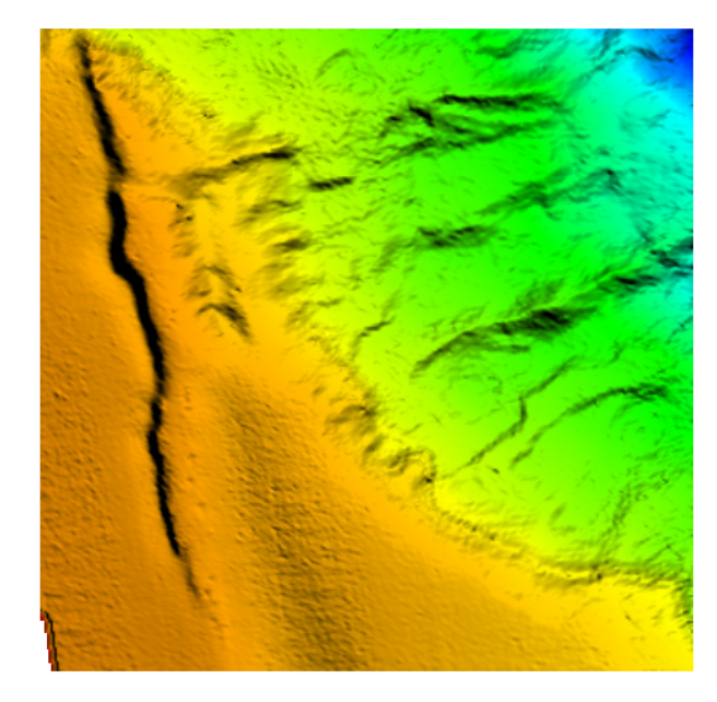
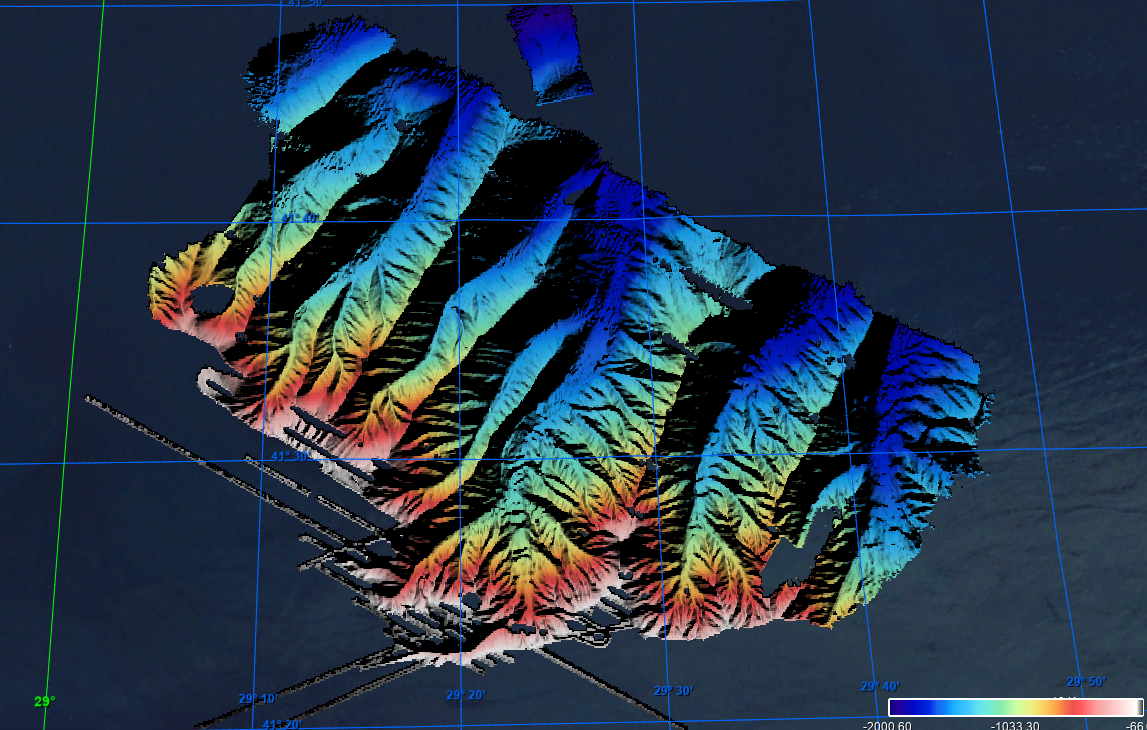
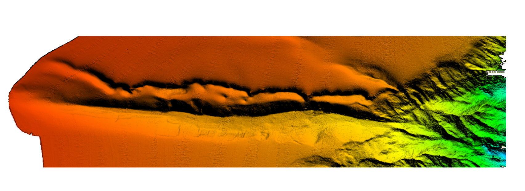
The data were acquired with a Simrad EM710 Multi Beam echosounder onboard the R/V Urania in order to cover the outer Malta Plateau and upper Malta Escarpment for a geological survey in the framework of EU FP7 project EUROFLEETS. The data were published in: Micallef, A., Georgiopoulou, A., Le Bas, T., Mountjoy, J.J., Huvenne, V., Lo Iacono, C., 2013. The Malta-Sicily Escarpment: Mass Movement dynamics in a sediment-undersupplied margin, in: Krastel, S., Berhmann, J.H., Volker, D., Stipp, M., Berndt, C., Urgeles, R., Chaytor, J.D., Huhn, K., Strasser, M., Harbitz, C.B. (Eds.), Submarine Mass Movements and Their Consequences. Springer International Publishing, Switzerland, pp. 317-328.
-
The data were acquired with a Simrad EM710 Multi Beam echosounder onboard the R/V Urania in order to cover the outer Malta Plateau and upper Malta Escarpment for a geological survey in the framework of EU FP7 project EUROFLEETS. The data were published in: Micallef, A., Georgiopoulou, A., Le Bas, T., Mountjoy, J.J., Huvenne, V., Lo Iacono, C., 2013. The Malta-Sicily Escarpment: Mass Movement dynamics in a sediment-undersupplied margin, in: Krastel, S., Berhmann, J.H., Volker, D., Stipp, M., Berndt, C., Urgeles, R., Chaytor, J.D., Huhn, K., Strasser, M., Harbitz, C.B. (Eds.), Submarine Mass Movements and Their Consequences. Springer International Publishing, Switzerland, pp. 317-328.