 EMODnet Product Catalogue
multi-beam echosounders
Type of resources
Available actions
Topics
Keywords
Contact for the resource
Provided by
Years
Formats
Representation types
Scale 1:
Resolution
-
High resolution composite DTM based on single beam, multi beam and Lidar covering Norderney and waters in proximty. All data was acquired in the year 2016. Data used:SDN:CPRD:1850_DGM_Norderney_2016
-
Satellite-derived bathymetry for the Venice Lagoon
-
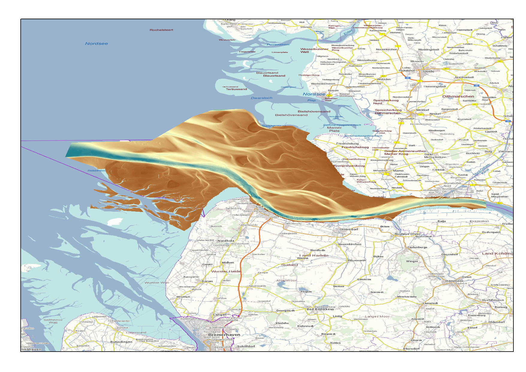
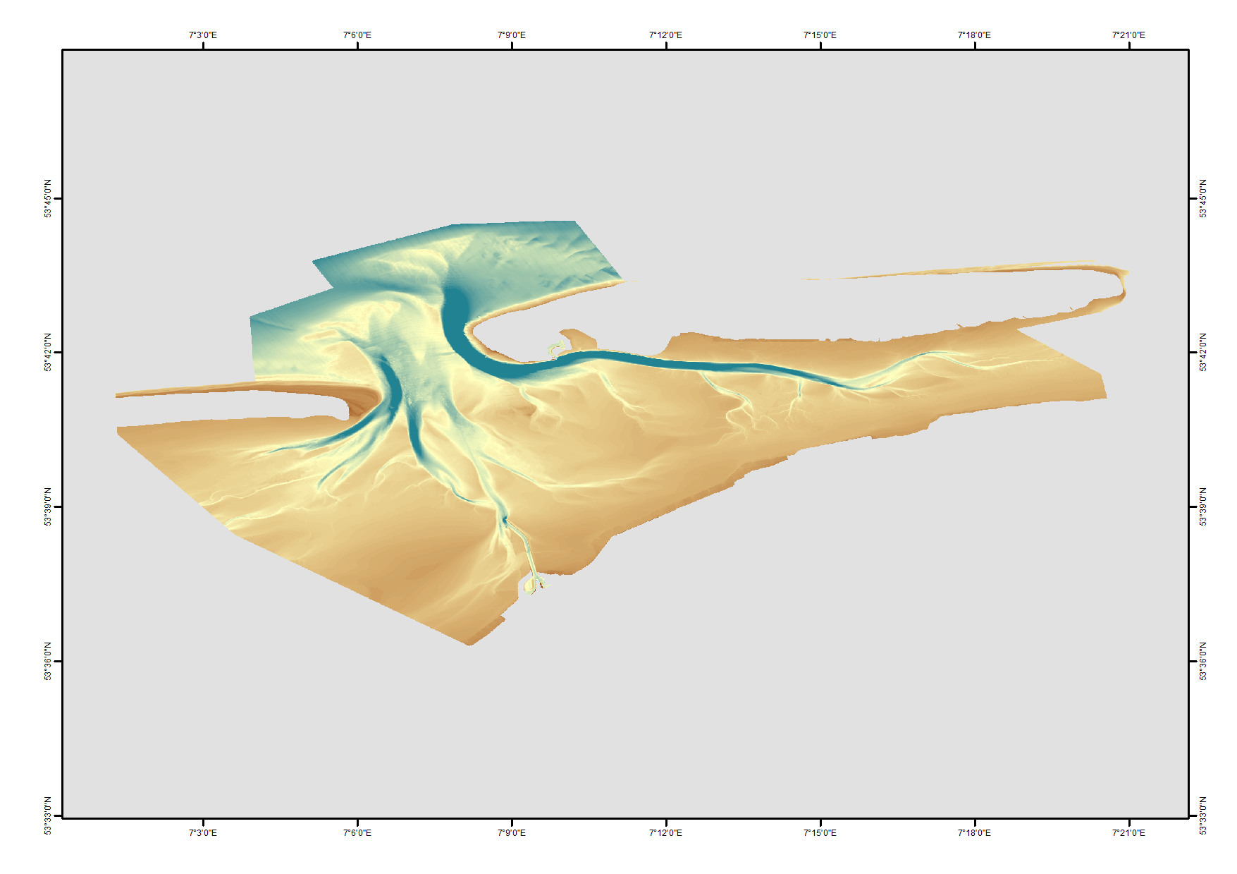
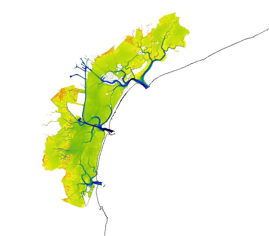
High Resolution DTM of the German Elbe Approach.
-
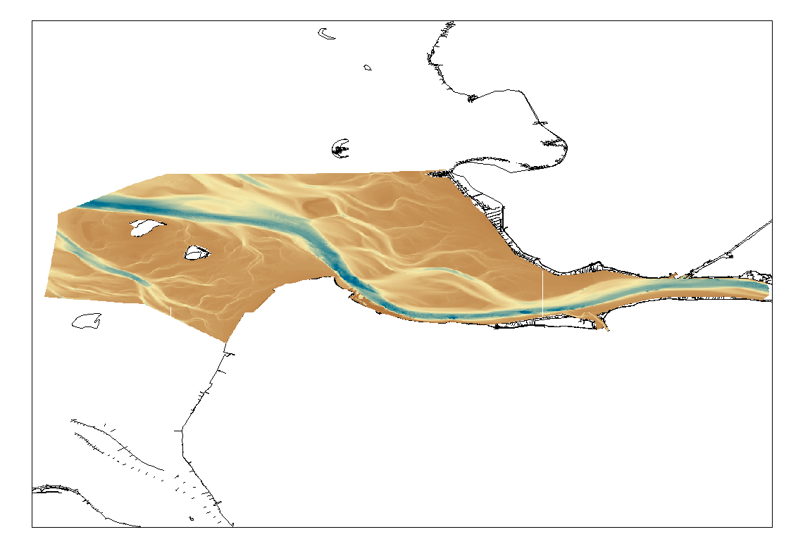
High Resolution DTM of the German Elbe Approach.
-
Multibeam bathymetry collected from Asköfjärden and Fifång Deep, east of Askö Island in southern Stockholm archipelago. The data were collected with Stockholm University research vessels (RV) Electra and Skidbladner between 2012 and 2018 for multiple purposes. Some of the data were collected as a part of a course in marine geophysical mapping at Stockholm University. The processing of the raw data was carried out using the Qimera software by QPS. The data have been cleared for public release by the Swedish Maritime Administration.
-
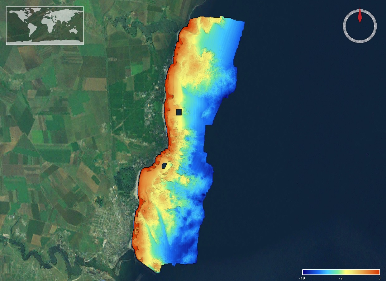
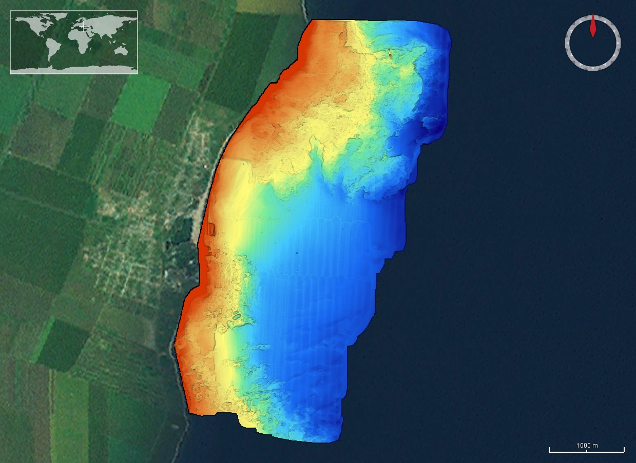
The DTM is produced with Kongsberg multibeam echosounder survey, acquired in March 2020 by Marine Research Ltd. The resolution is 1/256 arc-minutes (~7.2m). It is located at Tuzla, Romania, on the coastal region of the Black Sea. Depths are referenced to the Local Sea Level - Marea Neagra 1975 and the coordinates are expressed into the WGS84 reference frame.
-
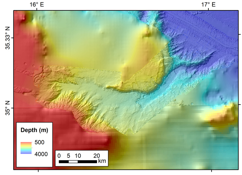
The data were acquired with Reson SeaBat 7150 and 8111 multibeam echosounder systems on board the R/V OGS Explora in order to cover the Malta Escarpment for a geological survey in the framework of EU FP7 project SCARP.
-
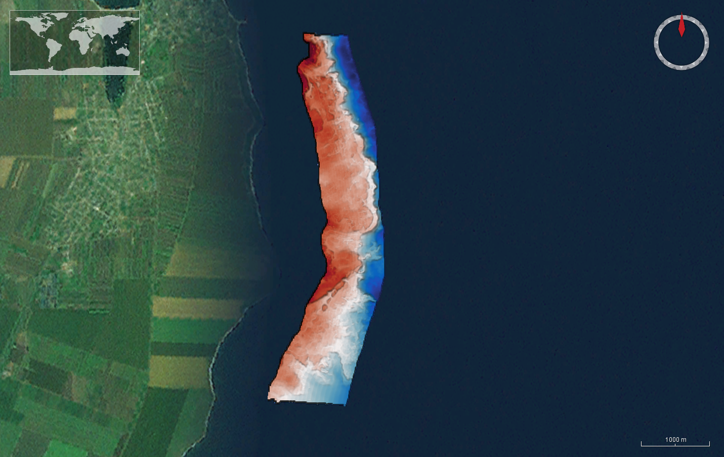
The DTM is produced with Kongsberg multibeam echosounder survey, acquired in 2015 by Marine Research Ltd. The resolution is 1/256 arc-minutes (~7.2m). It is located north of Mangalia Port, Romania, on the coastal region of the Black Sea. Depths are referenced to the Mean Sea Level and the coordinates are expressed into the WGS84 reference frame.
-
The data were acquired with a Simrad EM710 Multi Beam echosounder onboard the R/V Urania in order to cover the outer Malta Plateau and upper Malta Escarpment for a geological survey in the framework of EU FP7 project EUROFLEETS. The data were published in: Micallef, A., Georgiopoulou, A., Le Bas, T., Mountjoy, J.J., Huvenne, V., Lo Iacono, C., 2013. The Malta-Sicily Escarpment: Mass Movement dynamics in a sediment-undersupplied margin, in: Krastel, S., Berhmann, J.H., Volker, D., Stipp, M., Berndt, C., Urgeles, R., Chaytor, J.D., Huhn, K., Strasser, M., Harbitz, C.B. (Eds.), Submarine Mass Movements and Their Consequences. Springer International Publishing, Switzerland, pp. 317-328.
-
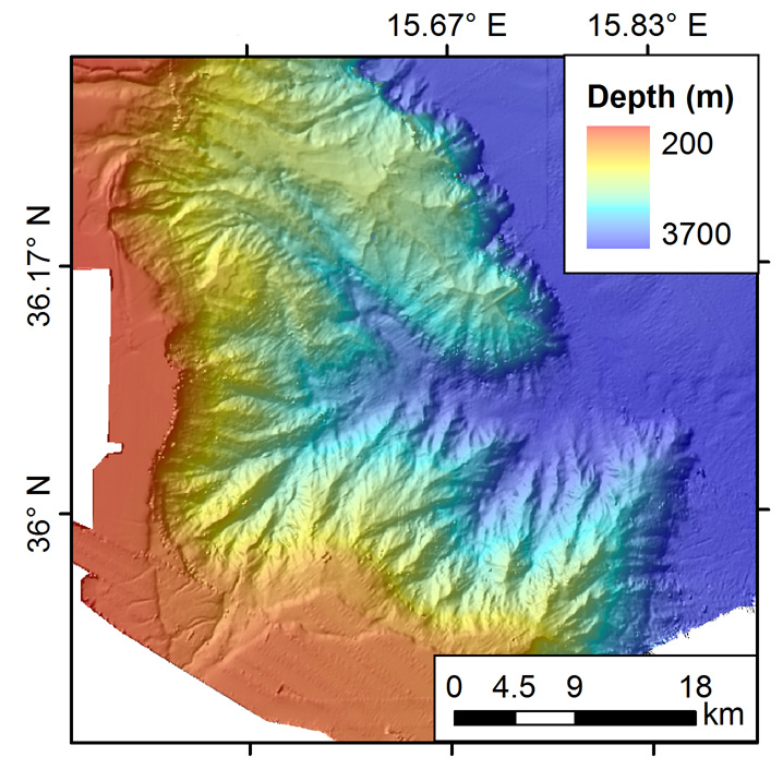
The DTM is produced with Kongsberg multibeam echosounder survey, acquired in 2015 by Marine Research Ltd. The resolution is 1/256 arc-minutes (~7.2m). It is located in Costinesti, Romania, on the coastal region of the Black Sea. Depths are referenced to the Mean Sea Level and the coordinates are expressed into the WGS84 reference frame.