Objectives
The objectives of challenge 7 – River Inputs were:
- To provide an overview of the temporal and spatial variability of riverine material fluxes to the Mediterranean Sea and eels capture data.
- To identify the major trends that could threaten these ecosystems in the near future because of climate change and socio-economic development.
- To assess the uncertainty in these scenarios, as their reliability could be examined in the light of knowledge limitations on the modelling algorithms available at the time as well as input data sets that naturally impact the resulting river scenarios.
- To allow identification of major data and knowledge gaps existing at that time which would have to be closed by future research efforts in order to assess the potential impact of global change in the Mediterranean region via the riverine link between land and sea.
Methodology
Regarding water discharge and nutrients (Total Nitrogen and Total Phosphorus) time series from in-situ and model data, the selection of stations was based upon the following criteria:
- Station distance from the coast less than 100 km. A buffer zone of 100 km from the Mediterranean coast was created in order to define the distance threshold for the stations to be considered as representative.
- River runoff greater than 10 m3/sec. Rivers with water discharge lower than 10 m3/s (or 0.315 km3/y) were disregarded, since they are usually inadequately monitored. Regarding North African rivers, due to the scarcity of river flows and lack of data availability, most of the representative stations were included in the dataset regardless of their discharge volume.
- Stations influenced by sea-water were not included, since they were not considered as representative for water discharge, TSM and nutrient concentrations and fluxes.
Since the origin of the data came from a great diversity of research programs, where each program had its own purpose and data collection design, there was a need for a reference dataset common for all basins. This was to guide us through the selection process and to help us avoid the bias that came from the spatial and temporal heterogeneity. Thus, the E-Hype’s basin classification by mean annual discharge was used to determine which basins met our 10 m3/s threshold, regardless of the station’s position or the time period during which the data was collected. This comparison of the in-situ data with the model data was possible to be viewed as a first means of validation process for our results.
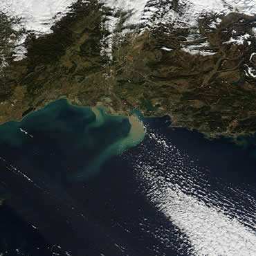
Regarding Total Suspended Matter (TSM), concentration, the time series data were retrieved from satellite data due to the lack of proper and homogeneous in-situ data sets, both in terms of temporal coverage and accessibility. For each river mouth, we set a box of ~ 20 x 20 km2 (i.e., 2-3 times the river-induced Rossby radius of deformation), and extracted the TSM concentration daily data from the CoastClour Project database. For each box, we selected the daily mean TSM within the range 0.001-1000 mg/l, in order to avoid underestimated values and spikes. This technique aims to simulate a TSM station (i.e., a single station) at the mouth of each river and allows for a homogeneous and synoptic collection of the data.
Data Sources
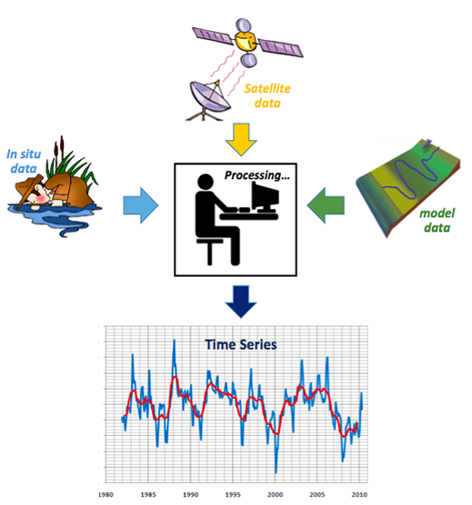
The production of time series from in-situ, modelled and satellite data, which constituted the targeted products of this challenge, was based on the following data sources.
For the River Discharge characteristic:
The data source 'SMHI – Hypeweb– Europe' was used for the production of the modelled time series for the relevant components of targeted products 1 and 2.
The data sources CISL Research Data Archive, Global River Discharge-Rivdis and SESAME (Southern European Seas: Assessing and Modelling Environmental Changes, obtained through PERSEUS project), were used for the production of the in situ time series for the relevant components of targeted products 1 and 2.
For the nutrient (Total Nitrogen and Total Phosphorus) characteristics:
The data source ‘SMHI – Hypeweb– Europe’ was used for the production of the model time series for the relevant components of targeted products 5 and 7, as well as for the products 6 and 8.
The SESAME data set was also used through the PERSEUS project, for the production of an annual time series from TN and TP in-situ data, for the relevant components of targeted products 5 and 7.
For the Total Suspended Matter (TSM) characteristic:
The ‘CoastColour’ Project, was the most important dataset we could find and fully satisfied the necessary requirements to build the targeted products 3 and 4.
For Eels Production characteristic:
The FAO data-base was used for the production of eels time series for targeted product 9. Although it didn’t provide a complete dataset, it could be considered, at the time, as a starting point to measure/evaluate the fitness for purpose.
Targeted Products
Final Challenge Report: MedSea Checkpoint Challenge 7 (River Inputs): Description of Targeted Products, the methodology and the expert evaluation of fitness for purpose
How to Cite: “Skoulikidis, N., Kouvada, D., Kalaitzakis, N., Falcini, F., & Simoncelli, S. (2017). EMODnet MedSea CheckPoint Challenge 7 (River Inputs) Report. European Marine Observation and Data Network. https://doi.org/10.25423/cmcc/medsea_checkpoint_challenge7“
Team Involved
Nikos Skoulikidis (HCMR), Dora Kouvarda (HCMR), Nektarios Kalaitzakis (HCMR), Federico Falcini (CNR)