EMODnet has a number of mechanisms for receiving user feedback (since 2009 and ongoing) ranging from the EMODnet Portal operational helpdesk and survey to feedback gathered from stakeholder workshops e.g., EMODnet for the Blue Economy sector, Open Conferences, Hackathons and more. In addition to these European scale activities, it is important to also assess the fitness-for-use of EMODnet at regional sea-basin scale, namely the Mediterranean Sea, Black Sea, North Sea (and Northeast Atlantic) and Artic Ocean. In addition, whilst EMODnet has over 100 concrete use cases, it is not always reported how and why EMODnet’s data and data products were fit for use for the specific application. To provide more user-driven feedback, EMODnet conducted a Sea-basin Checkpoint (SBCP) activity between 2015-2018. This was user-driven, regional sea-basin focused, to test if the EMODnet service offer was fit-for-use by a variety of stakeholders for concrete societal challenges and applications e.g., how Findable, Accessible, Interoperable and Reusable (FAIR) and fit-for-use are the EMODnet data and data products for siting an offshore wind farm, tracking an oil spill, etc. The text below explains the context and rationale of the EMODnet SBCPs, noting that the methodologies and approaches were state-of-the-art at the time and remain an extremely useful approach to assessing the fitness for use of the EMODnet offer. Reports from the individual SBCP regional assessments and data adequacy reports, together with an overarching SBCP stakeholder workshop are available in the EMODnet Portal Report section here.
SBCP concept, rationale and methodology: The concept of EMODnet Sea-basin Checkpoints was introduced within the EU Green Paper 'Marine Knowledge 2020: from seabed mapping to ocean forecasting' (COM-2012-437). In spite of EU initiatives such as EMODnet, Copernicus and Data Collection Framework (DCF) for Fisheries to deliver seamless layers of marine data across national boundaries, there are still shortcomings with the availability and accessibility of EU marine data. To tackle all these issues and introduce the user-perspective in the assessment of whether marine data actually meet the needs of private, public and research users, EC DG MARE established a series of 'Sea-basin Checkpoints' projects, starting with the Mediterranean and North Sea in 2013 and extending to the Arctic, Atlantic, Baltic Sea and Black Sea in 2015. For each sea basin, a team acted as surrogate users by stress-testing the data against a series of end-user challenges (e.g. determining the best area for wind farm siting, predicting the fate of an oil spill at sea, determining whether the marine protected areas in each sea-basin constituted a coherent network etc.) and generating a number of products. By facing the challenges and comparing the products obtained with the expected ones, the teams were able to assess the adequacy of the data, in terms of its availability and fitness-for-use, bearing in mind the particular purpose (the challenge) the assessments were aiming to address. Data gaps and duplications as well as significant bottlenecks were also identified and highlighted. Each of the six Sea-basin Checkpoint teams approached these assessments using different methods, whilst always striving to maintain the user perspective.
The aims of the EMODnet Sea-basin Checkpoints were the following:
-
Examine the current data collection, observation, surveying, sampling and data assembly programs in the respective sea basin for all compartments of the marine environment (air, ice, fresh water, marine water, riverbed/seabed, biota/biology, and human activities);
-
Assess and demonstrate how they can fit into purpose in the 11 challenge areas in terms of data uncertainty, availability, accessibility and adequacy;
-
Deliver the findings to stakeholders through an Internet portal with dynamic mapping features and a stakeholder workshop.
Each project was composed of the following phases:
- A literature review containing an overview of the available information on the sea basin;
- An adequacy check of the data and databases assessing how well all available marine data meets the needs of users;
- Data analysis for a number of specific challenges. This encompassed the development of data products by the challenges, including for each product initial specifications (expected accuracy, data requirements in order to reach that accuracy), and the final assessment of the adequacy of existing data with the specifications;
- Development of a web portal to disseminate all results and provide an overview of available information;
- The set-up and management of an expert panel that reviews the progress and results and formulated an advice to the EC and coastal Member States;
-
The organisation of a stakeholder workshop that presented the results of the project and improved the quality based on likely feedback.
The conclusions and recommendations from the different Sea-basin Checkpoints as well as an integrated summary report can be found and downloaded from this reports page.
Arctic
The Arctic Checkpoint project ran for three years from 2015 to 2018, and covered the Arctic Ocean as defined in the CIA factbook and therefore including Baffin Bay, Barents Sea, Beaufort Sea, Chukchi Sea, East Siberian Sea, Greenland Sea, Hudson Bay, Hudson Strait, Kara Sea, Laptev Sea, Northwest Passage, and other tributary water bodies. The European part of the Arctic area is relatively limited, making this Checkpoint a unique one among the other Sea-basin Checkpoints.
The Arctic Ocean receives inflow of Atlantic and Pacific Water and the Arctic deep water and receives a large amount of fresh water from rivers compared to other oceans.
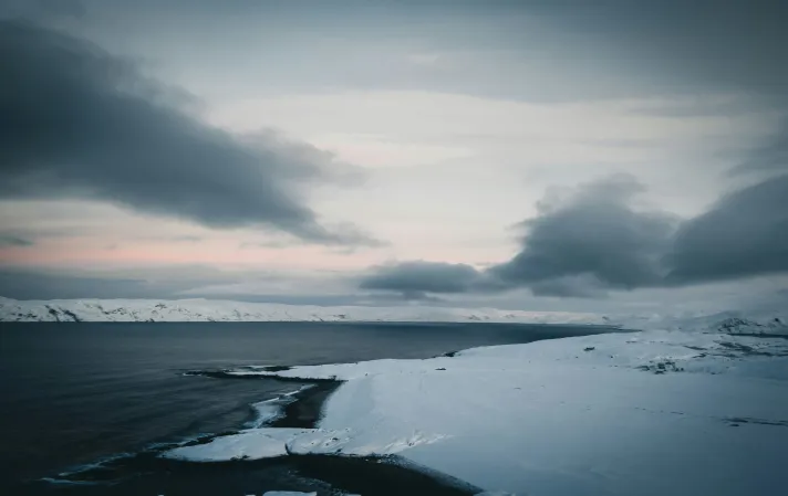
Arctic landscape, in Murmansk, Russia. Picture by Alex Jiang, available on Unsplash
Arctic Consortium
The EMODnet Arctic checkpoint project was run by a consortium consisting of the following partners:
- Arcadis (Lead: Belinda Kater)
- Wageningen Marine Research (WMR)
- SINTEF
- Mariene Informatie Service (MARIS)
Atlantic
The Atlantic Checkpoint was a system-wide monitoring assessment activity aimed at supporting sustainable Blue Growth across the North Atlantic Ocean. It provided a clear overview of the current observation landscape and assessed how well existing observations and data assembly programs met the needs of targeted end-user challenges. The assessment prioritised optimising monitoring systems in terms of availability, operational reliability, efficiency, time consistency, space consistency, and identified future observational priorities to meet these challenges. The Atlantic Sea basin covers from the equator to the Arctic Ocean, excluding the North Sea. The Atlantic Sea basin coasts include the coasts of the UK, metropolitan France, continental Spain, continental Portugal, Ireland, and Azores.
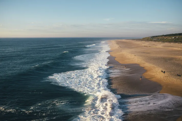
Atlantic coastline of Nazaré, Portugal. Picture by Luis, available on Unsplash
Atlantic Consortium
The EMODnet Atlantic checkpoint project was run by a consortium consisting of the following partners:
- The Institut Français de Recherche pour l'Exploitation de la Mer (Ifremer, Lead: Jacques Populus)
- Centre for Environment, fisheries and Aquaculture Science (Cefas)
- Marine Institute
- HR Wallingford
- Instituto Português do Mar e da Atmosfera (IPMA)
- AZTI
- European Global Ocean Observation System (EuroGOOS)
- Collecte Localisation Satellites (CLS)
- ACRI-HE
Baltic Sea
The Baltic Sea Checkpoint project ran from 2015 to 2018 and included territorial waters and jurisdictional waters of EU and non-EU Member States, as well as high seas, as defined by the Marine Strategy Framework Directive (MSFD). The maritime basin boundaries were defined by coastlines and adjacent sea basins. The project aimed to support sustainable growth in the Blue Economy by assessing the potential of current marine observation and data services for targeted end-user applications. The project exampled data collection, observation, surveying, sampling, and data assembly programs in the Baltic Sea basin, assessed their suitability for challenge areas in terms of data uncertainty, availability, accessibility, and adequacy, and delivered findings to stakeholders.

Baltic Sea coastline in Rostock, Germany. Picture by Philipp Deus available on Unsplash
Baltic Sea Consortium
The EMODnet Baltic Sea Checkpoint project was run by a consortium consisting of the following partners:
- Danish Meteorological Institute (DMI, Lead: Jun She)
- Technical University of Denmark (DTU)
- ETT SpA (ETT)
- EuroGOOS AISBL (EuroGOOS)
- Finish Meteorological Institute (FMI)
- Klaipeda University (KU)
- Swedish Maritime Agency (SMA)
- Swedish Meteorological and Hydrological Institute (SMHI)
- Tallinn University of Technology (TUT)
- Subcontractor: Grontmij A/S (Grontmij)
Black Sea
The Black Sea Checkpoint was a sea basin monitoring system assessment activity from 2015 to 2018, which aimed to support sustainable growth in the marine and maritime economy by assessing the potential of available marine observation and data services to address end-user challenges. The Black Sea basin included territorial waters and jurisdictional waters of EU Member States and non-EU-Member States as well as high seas, as defined by the Marine Strategy Framework Directive. The boundaries of these maritime basins were coastlines and boundaries with adjacent sea basins and includes the Sea of Azov.
Black Sea coastline in Kıyıköy, Turkey. Picture by Gökhan Öztürk, available on Unsplash
Black Sea Consortium
The EMODnet Black Sea Checkpoint project was run by a consortium consisting of the following partners:
- Institute of Oceanology of the Bulgarian Academy of Sciences (IO-BAS, Lead: Atanas Palazov)
- Euro-Mediterranean center on Climate change (CMCC)
- National Institute for Marine Research and Development (NIMRD)
- Collecte Localisation Satellites (CLS)
- The Institut Français de Recherche pour l'Exploitation de la Mer (Ifremer)
Mediterranean Sea
The Mediterranean Sea Checkpoint project ran from 2013 to 2018, assessing how the monitoring system met the needs of public and private users based upon seven targeted end-user challenges. The project produced ‘fitness for purpose’ indices to show the performance and gaps of the monitoring system. The checkpoint aimed to clarify the observation landscape across the Mediterranean, highlighting existing national and international programs and their synergies, while also depicting monitoring indices of the performance, accessibility, and usability of observational and modelling data sets. Additionally, it prioritised needs to optimize the system, including data collection, management, networking, modelling, and forecasting, and provided recommendations for improvements to better meet application requirements.
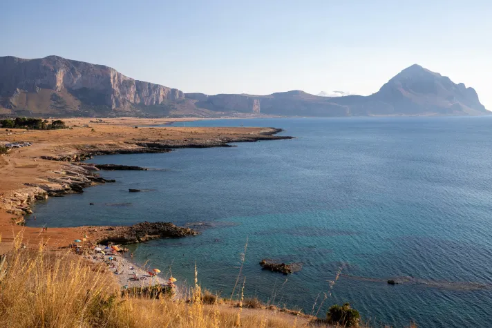
Mediterranean coastline of Macari, Italy. Picture by Alexandra Smielova, available on Unsplash
Mediterranean Sea Consortium
The EMODnet Mediterranean Sea Checkpoint project was run by a consortium consisting of the following partners:
- University of Bologna (Lead: Nadia Pinardi)
- Istituto Nazionale di Geofisica e Vulcanologia (INGV)
- ETT SpA (ETT)
- The Institut Français de Recherche pour l'Exploitation de la Mer (Ifremer)
- Collecte Localisation Satellites (CLS)
- University of Athens (NKUA)
- Hellenic Centre for Marine Research (HCMR)
- Balearic Islands Coastal and Forecasting System (SOCIB)
- L’Istituto di Scienze Marine del Consiglio Nazionale delle Ricerche (CNR-ISMAR)
- Oceans Catalonia International (OCEANS-CAT)
- El Centro de Estudios Avanzados de Blanes (CEAB)
- The Institute of Atmospheric Sciences and Climate (ISAC-CNR)
- France Energies Marines
- Euro-Mediterranean center on Climate change (CMCC)
- CLU Srl
- University of Cyprus-Oceanography Centre (OC-UCY)
North Sea
The North Sea Checkpoint project aimed to assess the usage of available data to address questions about the North Sea. Its purpose was to audit the value of marine data services in solving commercial and policy challenges within the Blue Economy. With an increasing number of public marine data sources available through initiatives like EMODnet and Copernicus, the project sought to support users in finding the right data products for their challenges and to examine how existing data services could be improved in terms of content and delivery. Essentially, it aimed to determine the role of EU initiatives like EMODnet and Copernicus in providing information and whether this data met the needs of economic activities and innovation in the marine area. The assessment was conducted through seven challenges, serving as proxy projects for policymakers, commercial entities, and other marine users requiring usable data.
North Sea landscape in De Hors, Netherlands. Picture by Karsten Würth, available on Unsplash
North Sea Consortium
The EMODnet North Sea Checkpoint project was run by a consortium consisting of the following partners:
- HR Wallingford (Lead: Quillon Harpham)
- McAlister Elliot Partners (MEP)
- IMARES
Challenges
In order to assess the fitness for purpose of data, the Checkpoints performed a number of end-user challenges, making us of existing and available data, and assessing whether the resolution, availability and consistency of those data are sufficient to meet the challenges.
| Arctic | Atlantic | Baltic Sea | Black Sea | Mediterranean Sea | North Sea | |
| Windfarm Siting | X | X | X | X | X | X |
| Marine Protected Areas | X | X | X | X | X | X |
| Oil Platform Leak | X | X | X | X | X | X |
| Climate & Coastal Protection | X | X | X | X | X | X |
| Coasts | X | X | X | X | ||
| Fisheries management | X | X | X | X | X | X |
| Fisheries impact | X | X | X | X | ||
| Eutrophication | X | X | X | X | X | |
| River inputs | X | X | X | X | X | X |
| Bathymetry | X | X | X | X | ||
| Alien species | X | X | X | X |
Wind Farm Siting
The Windfarm Siting challenge aimed to assess the suitability of offshore areas for wind farm development by evaluating a range of critical factors, including wind strength, seafloor geology, environmental impacts, proximity to the power grid, and existing maritime activities such as shipping and fishing. It also considered the appropriateness of fixed versus floating wind farm technologies. A central objective was to determine whether currently available marine datasets are adequate for informed site selection or if significant data gaps exist, particularly near territorial boundaries. The initiative served as a practical test of both technical feasibility and data fitness for offshore renewable energy planning.
Climate
This challenge evaluated publicly available data on climate change and aimed to compute the change of key ocean characteristics over past 10 to 100 years, temperature, internal energy, ice coverage and phytoplankton abundance (top three species), to assess the availability and suitability of marine data sets and identify gaps in the EU data collection framework.
Marine Protected Areas
The Marine Protected Aras (MPAs) challenge focused analysing the existing network of Marine Protected Areas in relation to fishery activities and climate change impacts. It aimed to determine whether the network constituted a representative and coherent system, as described in Article 13 of the Marine Strategy Framework Directive. Additionally, the challenge assessed the availability and suitability of marine data sets and identify gaps in the EU data collection framework.
Coasts
The Coasts challenge aimed to track sea-level rise and sediment balance along coastal stretches of the sea basins, as defined by small regions Nomenclature of Territorial Units for Statistics (NUTS3) administrative division for EU countries and Global Administrative Areas (GADM) divisions for non-EU countries, over the past 10, 50 and 100 years. Additionally, the challenge aimed to assess the availability and suitability of marine data sets and identify gaps in the EU data collection framework.
Oil Platform Leaks
The Oil Platform Leaks challenge aims to determine the likely trajectory of oil slicks and release rapid information on oil movement and environmental impacts through impact bulletins, i.e. reports, at 24 and 72 hours. Each bulletin highlighted the fitness for use of the available marine data sets and identified gaps in the EMODnet data collection framework. The challenge focused on monitoring oil spills, assessing the statistical likelihood of sensitive coastal areas being affected within 24, 48 and 72 hours, assessing the suitability of available marine data sets, and identify gaps in the EU data collection framework. The challenge used the Oil Spill Contingency and Response (OSCAR) model to simulate oil spill fate and weathering, and QGIS system to display and cross-reference oil spill forecasts with coastal data. The OSCAR simulation used data such as the date, time, location, depth, oil type, and spill amount or rate.
Fisheries Management
The Fisheries Management challenge aimed to gather comprehensive fish catch information for the entire sea basin, including landings, discards, and by-catch of fish, mammals, reptiles and seabirds (mass & number by species and year). It sought to evaluate the availability and suitability of marine data sets and identify the gaps in the EU data collection framework. This data spanned periods before and after the implementation of the Data Collection Regulation, with time-series data as extensive as possible, varying by species.
Fishery Impact
This challenge aimed to create map layers showing the extent of the fisheries impact, specifically from trawlers, on the seafloor. The challenge assessed the availability and suitability of marine data sets and identified the gaps in the EU data collection framework. Using available habitat and Vessel Monitoring Systems (VMS) data, the challenge produced two main products: the first mapped areas where bottom habitats were disturbed by bottom trawling, integrating data from various sources to provide new perspectives on fishing activities. VMS recorded the position and speed of fishing vessels, and fishing time was calculated from this data, combined with logbook data and maps of fishing effort. The second product assessed damage to the sea floor, both living and non-living components, to predict disturbance based on fishing pressure and habitat sensitivity.
River Inputs
The River Inputs challenge aimed to estimate the annual water discharges for each river bordering the sea basin, including inputs of fresh water, sediment loading, total nitrogen and phosphates, to assess the availability and suitability of the marine data sets and identify the gaps in the EU data collection framework. The challenge considered nine products to estimate the number of monitored rivers relative to the total number, defining a river by either its outlet, basin district, region, or country. The challenge sought to estimate time series of annual inputs for each river, including the mass of freshwater discharged and its temperature, sediment load, fluxes of total nitrogen and phosphates, and biota such as eels and salmon (both inwards and outwards, recruitment and escapement).
Eutrophication
The Eutrophication challenge aimed to produce data layers showing seasonal averages and changes of eutrophication in the basin over the past 10 years, i.e. for reduction or increase, to assess the availability and suitability of marine data sets and identify gaps in the current EU data collection framework.
Bathymetry
The Bathymetry challenge aimed to produce digital maps of water depth and uncertainty for representative areas of the sea basin, highlighting priority areas for surveying to ensure safer navigation based on emerging needs. The challenge assessed the availability and suitability of marine data and identified gaps in the EU data collection framework.
Alien Species
The Alien Species challenge aimed to identify and source alien species and their adverse impacts on the ecosystems and socio-economy of the sea basin, as established by the Ballast Water Management Convention on Good Environmental Status (GES) of marine waters. The challenge sought to assess the availability and suitability of marine data sets and identify gaps in the EU data collection framework, and resulted in digital maps detailing the species, family, year of introduction, reason for introduction, geographical areas, impacts on both the ecosystem and economy.