Data on temperature, salinity and currents in the water column, sea level trends, wave height and period, wind speed and direction, water turbidity (light attenuation), underwater noise, river flow, and sea-ice coverage.
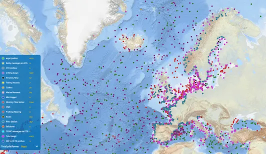
EMODnet Physics is an upstream ocean data integrating service. It builds on the discovery of data sources or providers and their connection to the EMODnet Physics infrastructure. It provides a single point of access to in situ ocean physics time-series data and vertical profiles, data products and metadata built with common standards, free of charge and no restrictions.
The available parameters cover temperature, salinity and currents profiles, sea level trends, wave height and period, wind speed and direction, water turbidity (light attenuation), underwater noise, river flow, and sea-ice coverage.
Objectives
EMODnet Physics has successfully designed, organized, and is running operational services that provide ocean physics data and data products built with common standards, free of charge, and without restrictions. The available parameters cover temperature, salinity, and current profiles, sea level trends, wave height and period, wind speed and direction, water turbidity (light attenuation), underwater noise, river flow, and sea-ice coverage.
The data sources can include research institutes that hold data from scientific expeditions, such as ICES; environmental protection agencies that perform routine monitoring surveys; research programs and infrastructures that manage marine monitoring systems (e.g., Argo, OceanSITES, GO-SHIP, etc.) and repeated observations (CTDs) or observatories and networks (e.g., EMSO, SeaDataNet); and private companies that work in the blue economy sector.
Physics manages the following data categories: 1) data is a series of values sampled by an in-situ platform, 2) data collection is a grouping of similar in situ data, 3) product is the outcome of a reprocessing method. The outcome of a numerical model (that uses in situ data) is a product. The result of the QC/QF procedure is a qualified dataset or data collection. Data and data collections can be provided in near-real-time or fast delivery (NRT-FD) modes. The in-situ data are harmonized and normalized in terms of metadata, and only basic or automatic quality control (QC) is applied—primarily targeting large level shifts and obvious outliers. These new data sources may contribute to one or more data collections. Whenever research-quality-controlled data (RQD) for a given source become available, Physics integrates them into the relevant data and data collections. It is important to note that rigorous quality control (QC) requires significant effort and time from expert centers; the process can take from several months to years. Consequently, time series produced by continuous monitoring platforms may exhibit varying data quality depending on the age of the recordings.
Background
EMODnet Physics' marine data infrastructure originates from advancements made by the Global Ocean Observing System (GOOS) community, particularly its European component (EuroGOOS), in developing operational physical oceanography capabilities.
The consortium represents strong cooperation between several key players: the in situ component of the Copernicus Marine Service (CMEMS), namely the In Situ Thematic Assembly Centre (In Situ TAC); the SeaDataNet network of National Oceanographic Data Centers (NODCs); the International Council for the Exploration of the Sea (ICES); and the Joint Technical Commission for Oceanography and Marine Meteorology's in situ Observations Programme Support Centre (OceanOPS).
EMODnet Physics integrates European marine data collection initiatives with international programs such as Argo, the Data Buoy Cooperation Group (DBCP), OceanSITES, the Global Ocean Ship-based Hydrographic Investigations Program (GO-SHIP), the Global Sea Level Observing System (GLOSS), and the Ship Observation Team (SOT), which includes the Volunteer Observing Ship (VOS) and the Ship of Opportunity Program (SOOP). It also incorporates contributions from OceanGliders and data collected via tagged marine animals.
It is important to recognize that the quality and quantity of oceanographic data rely heavily on the efforts of principal investigators, marine technicians, ship crews, and volunteers, who often work under challenging conditions.Institutions that maintain observation platforms, as well as the projects that plan, fund, and execute field campaigns and operational ocean monitoring, are responsible for ensuring the spatial and temporal coverage of oceanographic profile data. Data managers, in turn, preserve and ensure the reusability of the data. This extensive and evolving network deserves credit for the aggregated data collections now available through EMODnet Physics.
Approach
EMODnet Physics does not operate any platforms directly; rather, it serves as the final step in aggregating and disseminating oceanographic in situ data for public access.
Data from key European oceanographic sources, networks, repositories, and databases—including EuroGOOS, SeaDataNet NODCs, ICES, PANGAEA, the Permanent Service for Mean Sea Level (PSMSL), SONEL - GNSS, GLOSS, and the European Multidisciplinary Seafloor and Water Column Observatory (EMSO)—are all integrated and made available through EMODnet Physics.
The initiative also extends beyond European borders, providing a comprehensive entry point to global ocean physical observations through partnerships with international networks and systems (e.g., Argo, GO-SHIP), covering areas from the Arctic Ocean (International Arctic Buoy Program - IABP) to the Southern Ocean (Southern Ocean Observing System - SOOS), including deep-sea observations (Deep Ocean Observing System - DOOS).
Operational data management is conducted in collaboration with the In Situ TAC of the Copernicus Marine Service, which applies a second tier of harmonized Quality Control/Quality Flag (QC/QF) processes to the data streams and Physics synchronizes these data several times per day.
The goal of EMODnet Physics' data integration is to provide the most comprehensive catalogue of in situ ocean physics data. To support open science, EMODnet Physics encourages the adoption of the CC-BY license for its data products.
Beyond federated data management, EMODnet Physics develops aggregated data products and interoperability services to enable seamless machine-to-machine interactions. Datasets are enriched with metadata and are available for download in multiple formats (e.g., NetCDF, CSV, TXT).
Products
Temperature and Salinity in the water column
Temperature is a crucial component of the climate system and its variability in the water column. Sea-surface temperature (SST) has a significant impact on energy, momentum, and gas exchanges between the ocean and atmosphere. Daily variations in SST can exceed 3°C and can lead to changes of over 10 Wm-2 in the surface energy budget in the tropics and subtropics.
Subsurface ocean temperature is a fundamental observation for understanding various ocean phenomena that influence climate, including ocean stratification, circulation, mixed layer dynamics, water mass properties, and coastal shelf-open ocean exchange. Profiling subsurface temperature observation systems also contribute to in-situ validation of satellite observations of surface temperature. Changes in ocean temperature, for instance, can impact the growth rate of farmed fish, as well as the distribution and abundance of wild fish stocks and other economically and socially valuable marine species.
Salinity observations play a role in monitoring the global water cycle, ocean density, mass, and more. These in-situ data are essential inputs for many ocean models, for validating and calibrating remote sensing observations, and for understanding the ocean's role in the global climate system.
The EMODnet Physics data collection includes moorings, which offer high temporal resolution at specific locations but have limited spatial resolution due to array density; gliders and tagged animals that provide higher spatial resolution depending on endurance and instrument characteristics; profiling floats (ARGO) that deliver temperature profiles typically from 0-2,000 meters; casts from ship-based Conductivity-Temperature-Depth (CTD) observations along research voyage tracks, providing temperature observations throughout the water column; Expendable probes (xBT) dropped from a network of volunteer commercial vessels along major shipping routes, observing temperature to several hundred meters depth on a roughly seasonal repeat schedule; and surface loads and ferrybox repeated transects, which offer high-resolution sea surface temperature datasets.
Using these in situ data, it is possible to analyze trends, create maps, and generate gridded data products. Examples include the CORA (Coriolis Ocean Dataset for Reanalysis), developed by IFREMER for the Copernicus Marine Service and regularly updated (annually), and the SeaDataNet Regional Climatology products, developed by SeaDataNet partners using DIVA software and periodically updated.
EMODnet Physics is also offering a SMOS Sea Surface Salinity product developed by the Barcelona Expert Center – CISC for EMODnet.
Sea Surface Currents
The general circulation of the ocean surface plays a significant role in the transport of heat, salt, passive tracers, and ocean pollutants. Ocean currents, in conjunction with atmospheric currents, contribute to the redistribution of equatorial heat content towards the poles. There are two main types of sea currents: surface wind-driven currents and the thermohaline circulation.
The existing surface current observing systems, such as moorings and Lagrangian drifters, capture a substantial portion of this range. EMODnet Physics combines these observations with land-based High-Frequency (HF) radar observations, which provide a high-resolution tool (albeit with limited spatial coverage) for improved understanding of surface currents, eddies, air-sea fluxes, and exchanges between coastal waters and the open ocean. EMODnet Physics, currently, includes approximately 150 antennas, combines the European HFR node observation capacity with global sources, making it one of the most comprehensive sources of HF Radar observations worldwide.
Sea Level
Sea level is considered an Essential Ocean Variable by the Global Ocean Observing System (GOOS). Measurements of sea level along coasts have been conducted since the 19th century using tide gauges.
Tide gauges remain a key method for observing trends in mean sea level, assessing extreme events, making tidal predictions, supporting geodetic applications, and facilitating harbor operations and navigation. Tide gauge measurements are increasingly important for new warning systems for tsunamis and storm surges, as coastal inundation and storm surges can lead to significant flood events and the destruction of property and infrastructure.
Sea level is regarded as one of the most crucial Essential Climate Variables (ECVs), given that its projected evolution over the next few decades is predicted to pose challenges for millions of people, particularly those in vulnerable areas. Continuous monitoring of sea level trends is essential, and EMODnet Physics includes both operational stations (network of European Tide Gauge Stations), fast operating stations (international tsunami networks), Global Sea Level Observing Systems (GLOSS) core network, Permanent Service for Mean Sea Level (PSMSL) global sea level database, and geodetic data from GNSS stations (SONEL).
EMODnet Physics also includes gridded and reanalysis products developed by CMCC for EMODnet Physics. The map is based on SSALTO/DUACS altimeter products produced and distributed by the Copernicus Marine Service. The satellite trends reflect changes in sea surface height, with most of the spatial variation resulting from the influence of winds blowing over the ocean.
Wave (height and period) - Sea State and Wind (speed and direction)
Sea state refers to the characterization of waves and swells, including their height, wavelength, period, and directional wave energy flux. It is widely recognized that sea state significantly impacts marine safety, marine transport, and the potential for damage to structures. However, the availability of in-situ wave and wind observations remains limited.
EMODnet Physics provides access to these data by integrating multiple data sources, such as the Data Buoy Cooperation Panel, OceanSITES, EuroGOOS regional observations in Europe, and more, into a single catalogue. Operational data are aggregated to provide a synoptic dynamic view of sea state conditions.
River Runoff Data
River runoffs exert a strong influence on their neighboring coastal areas in various ways, such as modifying water stratification, introducing significant fluctuations in circulation patterns, and modulating the impact of upwelling events. However, uncertainties arise due to the global decline of hydrometric networks, which affects the availability of river runoff data and information on water properties like temperature and salinity.
Typically, climatology products of rivers are imposed at the land boundaries of coastal or regional ocean models, overlooking the inter-annual variability in flow and associated properties of rivers. This omission limits our understanding of river dynamics and their impact on coastal areas. River flow fluctuations, from low to high levels, occur frequently and rapidly due to heavy rainfall, disrupting plant life and animal reproduction. These factors are crucial for coastal area management and improved forecasting systems.
EMODnet Physics serves as an in situ hub for accessing operational river runoff data, offering over 600 stations. River runoff data can be accessed through the EMODnet geoviewer and an advanced product that also includes river catchment information.
The EMODnet Physics River runoff operational product is developed in collaboration with CoLabAtlantic+. The research-quality river data database is operated by the Global Runoff Data Center (GRDC). EMODnet Physics includes a subset of the GRDC, focusing on coastal areas and including only stations located near the river mouths.
Water Clarity (Light Attenuation)
Light attenuation is a significant parameter for determining the photic zone, which refers to the zone with sufficient light for photosynthesis. It is essential for understanding total primary production and the distribution between pelagic and benthic primary production. In addition to working on in-situ data collection of water clarity data, including the availability of a database for parameters such as turbidity, EMODnet Physics offers a Total Suspended Matter (TSM) product.
The TSM product represents the percentage of suspended particles (not dissolved) and is presented as a gridded product. It is based on the CoastColour L2W Concentrations Data, which is obtained from the OC4 algorithm for clear and moderately turbid waters, as well as the CoastColour v1 neural network. The L2W product is then remapped onto a regular grid while maintaining a full resolution of 300 meters. This allows for the generation of products covering European sea basins on a monthly average basis.
The TSM product, developed by CNR – ISMAR for EMODnet Physics, covers the period from 2003 to 2012.
Underwater Noise
Underwater noise, which has adverse effects on the health of marine species and biological productivity, is gaining attention as a form of pollution. Maritime traffic serves as the main source of continuous noise, while impulsive noise sources include pile driving during construction, seismic exploration using airguns, explosions, and sonar systems.
EMODnet Physics provides two products related to underwater noise: the collection of impulsive noise events and the atlas of sites for continuous noise monitoring.
The impulsive noise events are compiled nationally from registers of licensed events, such as pile driving, controlled explosions from naval operations, and other activities that release energy. Most Member States provide these data to the Regional Sea Conventions, contributing to regional assessments of MSFD descriptor 11.1.1 (Low and mid-frequency impulsive noise). Regional registries, operated by ICES (HELCOM, OSPAR) and Centro Tecnologico Naval (Mediterranean Sea), are unified and made available through EMODnet Physics.
These efforts aim to enhance understanding and assessment of underwater noise impacts in different regions.
Guidelines from TG NOISE:
- JRC Publications Repository - Setting EU Threshold Values for impulsive underwater sound
- JRC Publications Repository - Setting EU Threshold Values for continuous underwater sound
Ice Extent and Ice-type
Sea ice extent and thickness are rapidly decreasing, particularly in the Arctic. This loss of sea ice can have long-lasting effects on the cold branch of the global thermohaline circulation. EMODnet Physics incorporates in-situ data collections from various sources, including the International Arctic Buoy Cooperation Program, the Woods Hole Ice-Tethered Profiler Program, and icebreakers and research vessels operating in the Arctic area (ARICE). Additionally, EMODnet Physics supports the Southern Ocean Observation System (SOOS ) by providing the data backend infrastructure to host and make Southern Ocean data accessible.
Communication
In this section you will find thematic-specific communication material, and a direct link to the video gallery.