The EMODnet Geology team responsible for the work on Seafloor Geology, led by the German Federal Institute for Geosciences and Natural Resources (BGR) have updated the Seafloor Geology data products. This data product compiles and harmonizes the European marine geology map data as detailed as possible for the following themes:
- Pre-Quaternary and
- Quaternary geology;
- geomorphology.
These three data themes show Europe’s geology under the seas from the ancient past of the Earth (more than 2500 Million years ago) to the young, Quaternary deposits and the features that form the surface of the Earth (including the seafloor), the geomorphology. From these data we can read the story about the evolution in the European, marine part of our planet Earth: From the oldest rocks and how they form, to the youngest rocks and geomorphological features representing the most recent geological and environmental changes.
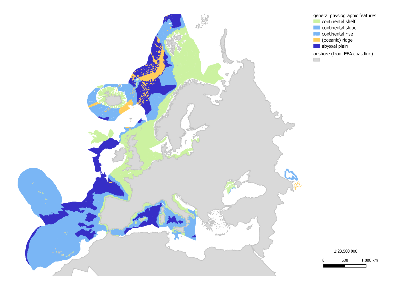
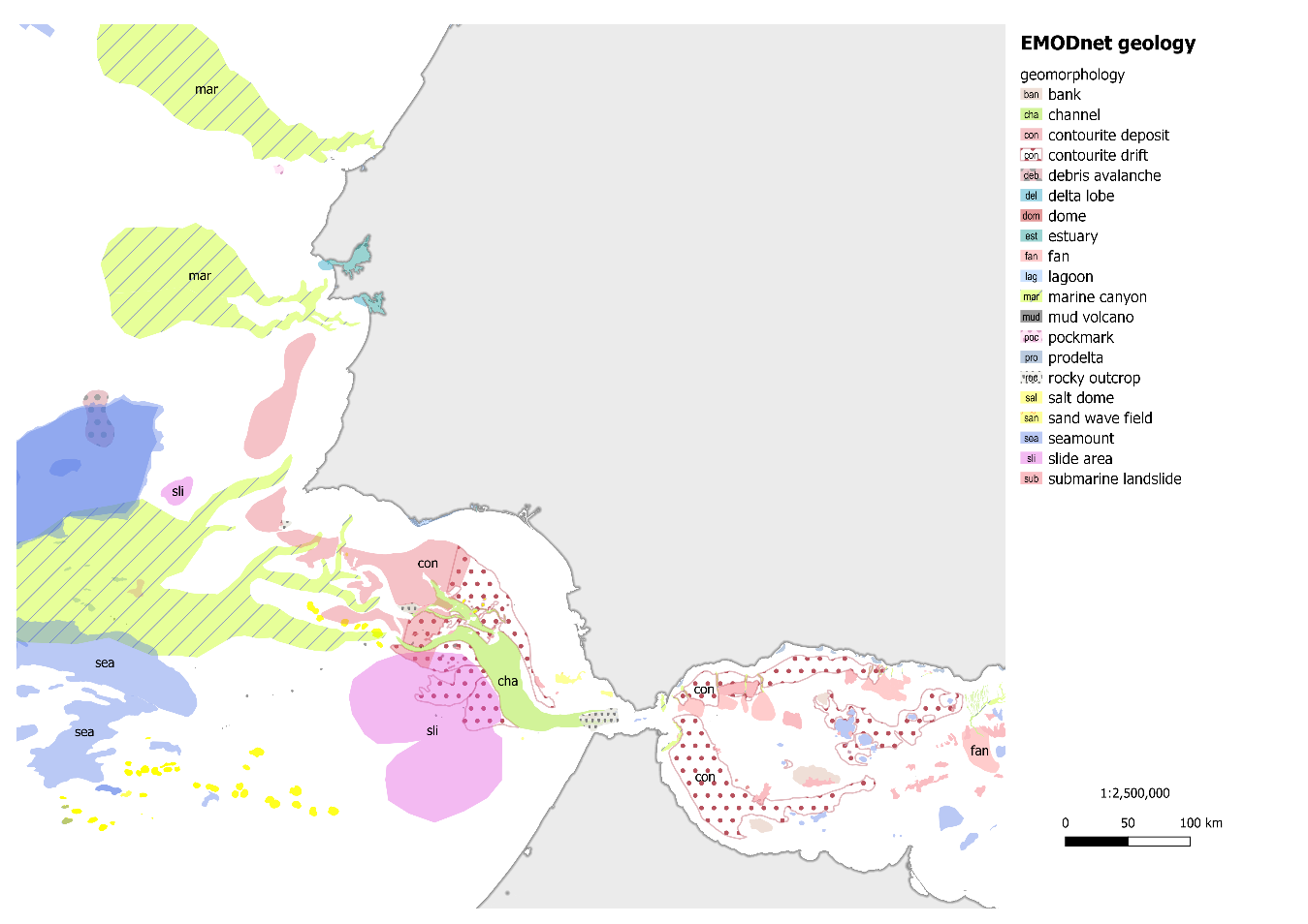
A new update of the “Seafloor Geology” data products is now being released. New data are added to the Quaternary geology and geomorphology map products and an additional new layer of general physiographic features was compiled and published on the EMODnet Geology Portal (Fig. 1). This new layer shows at an overview scale the continental shelf and slope, the continental rise, ridges and abyssal plains and complements the actualized, detailed geomorphology map information (Fig. 2).
Users can find information on scientifically valuable geological and geomorphological structures, on geological material (lithology), its age (stratigraphy) and its forms (geomorphology) on the seafloor in Europe. They can find information on the seafloor, important for geoscience research and investigations of future exploration of mineral and energy resources, but also for habitat mapping. The data presented here are also a source of knowledge about the features of the seafloor surface, the geomorphology, valuable for habitats of numerous species and many other ocean uses, including fishing, tourism, and other activities. In addition, the layers provide information on the sea floor conditions to plan building infrastructures, such as wind parks, or pipelines or establish a protection area for endangered species.
To help to increase the performance and offer a better useability of data to the user, the Quaternary geology layer was subdivided according to its resolution into four new layers in four different scales:
> 100k (large scale),
100 – 300 k (medium scale),
300 – 1500 k (small scale),
1500 – 3000 k (very small scale).
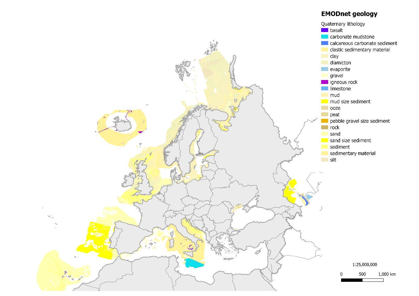
The large and medium scales present the data useful for e.g. information for local off-shore construction purpose, the smaller scales may help regional planners for cross-regional planning and decision making. A summary of the Quaternary data layer is presented in Figure 3.
Media
Services
Investigate the product in the interactive map viewer
Download the product from the data products page
Integrate the product in your own desktop software using WMS and WFS
Please note that EMODnet is in the process to provide a central access point to its data and data products through the
Central Portal in the coming months. More information can be found here.