In March 2025 EMODnet released an updated version of the Bathymetry Digital Terrain Model for Europe and European waters of the Caribbean (see article below for full details). The DTM has been a flagship EMODnet data product for many years, and the latest version is available on the EMODnet Portal Map Viewer. In this blog, EMODnet experts Conor Delaney, EMODnet Technical Coordinator and George Spoelstra, EMODnet Bathymetry expert, take a look into the latest DTM, explaining how this was created from a technical perspective, and how to access it via the EMODnet Portal.
What is the EMODnet DTM?
The digital terrain model of the seabed, the Bathymetry DTM, describes the depth of the European seas at a resolution of circa 115 metres by 115 metres. The model of the sea floor is constructed from various seabed surveys that are carried out by member states and other entities. Not all of the data used for the DTM is published under an Open Data licence. When dealing with restricted data The EMODnet Bathymetry team have obtained permissions to use restricted data for the construction of the DTM for Europe.
In figure 1 below, is the ‘Source metadata’ layer for the DTM as it appears in the MapViewer of EMODnet, clicking on a specific parcel will reveal more information on the source data used.
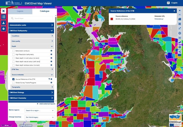
Figure 1: The ‘Source metadata’ layer of DTM, showing the seabed surveys used in the construction of the Bathymetry of the DTM. ©EMODnet Secretariat
What is new?
The new 2024 EMODnet DTM covering both European and Caribbean waters, builds on the previous 2022 release but has been improved substantially. A total of 22063 datasets of which 21890 individual surveys and 173 compiled DTMs are now part of this release.
Especially noticeable is the increase of coverage in the Atlantic Ocean region which is due to two major contributions, one from the Marine and Freshwater Research Institute of Iceland (see figure 3) and the other from the Portuguese Hydrographic Institute. The Portuguese Continental Shelf Mapping Project is part of the SEAMAP 2030 program, led by the Hydrographic Institute of Portugal. Its goal is to map the nation’s maritime territories comprehensively by 2030, aligning with global efforts like the Seabed 2030 Project. The initiative supports Portugal's proposal to extend its continental shelf beyond 200 nautical miles, submitted to the UN in 2009 and updated in 2017.
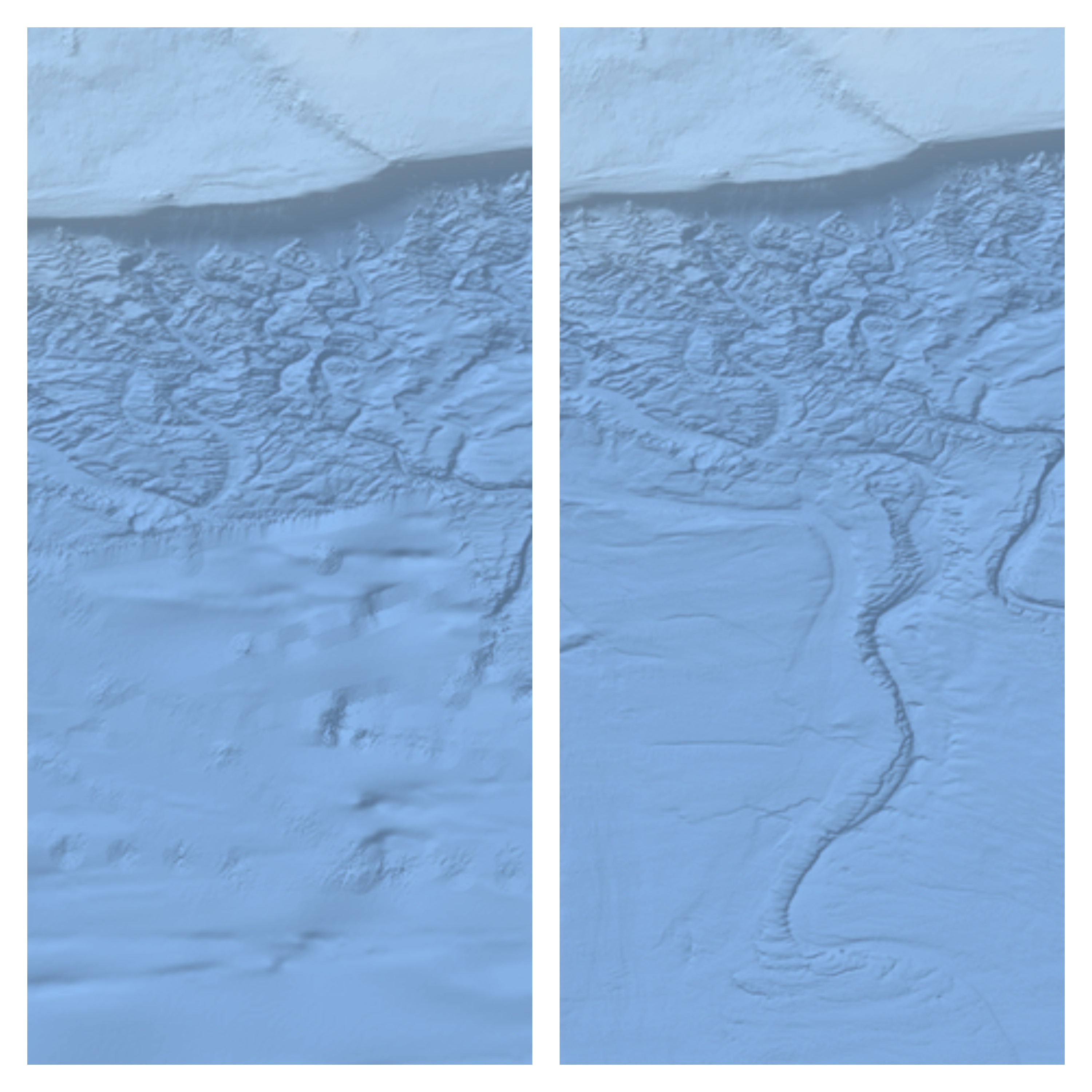
Figure 2: EMODnet DTM 2022 (left) and 2024 (right) showing an area south of Iceland. The improvement in coverage is clearly visible. ©EMODnet Secretariat
One of the layers in the EMODnet Central Portal shows the areas where higher resolution data is available. For 2024 a total of 20 new areas have been added. The beauty of this layer is astonishing as it shows landscapes that nobody has ever seen before (see figure 4). All high-resolution datasets are downloadable through the map viewer. The download is a single zip archive that contains the data in NetCDF and CSV format and also the associated metadata.
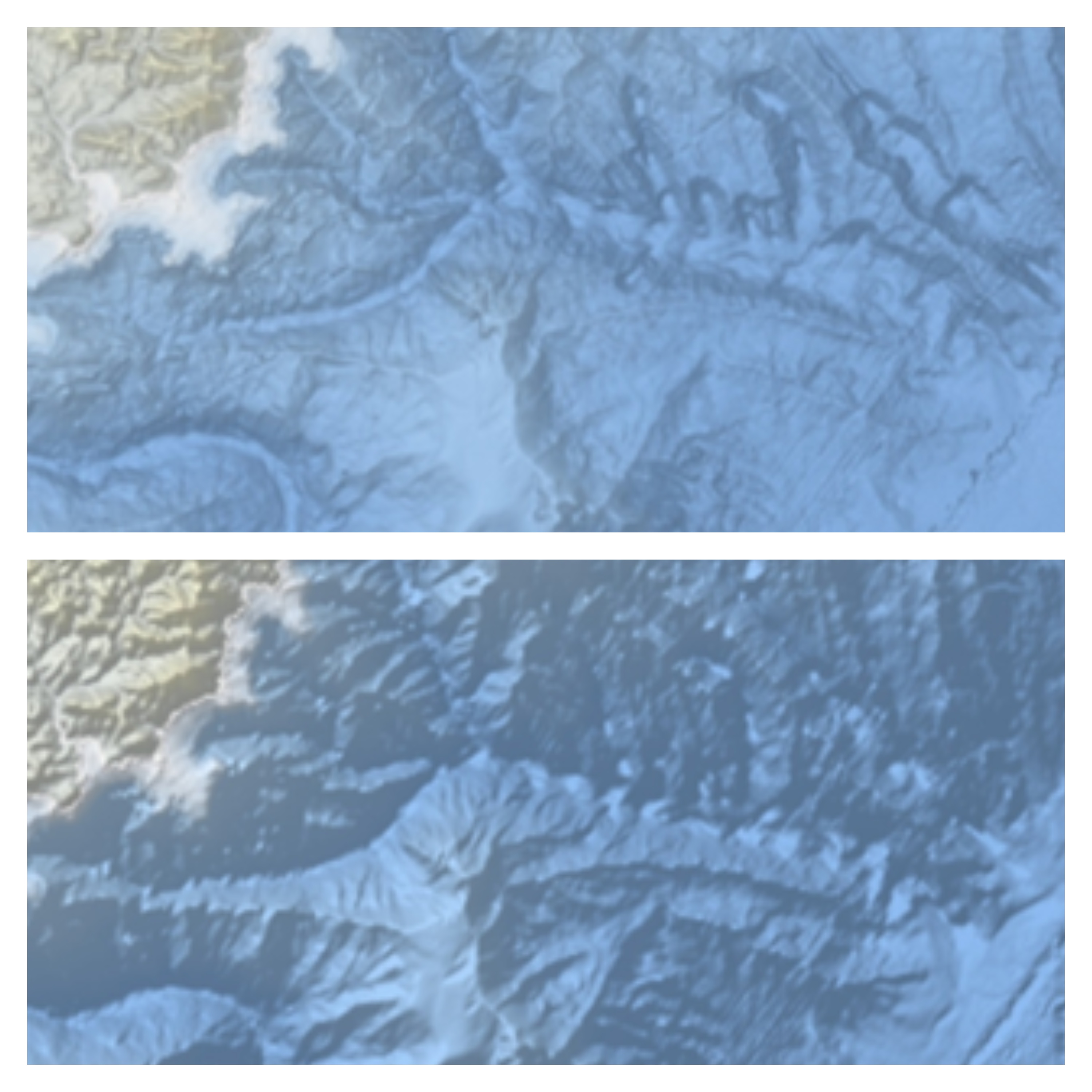
Figure 3: Improved hill shading showing more details that where obscured by strong shadows in the 2022 release.©EMODnet Secretariat
"With this new EMODnet bathymetric DTM release, we didn't just add a wealth of new data—we also put a strong focus on improving the cartography. The render resolution has doubled, and we've implemented new hill shading algorithms to enhance terrain visibility. It's been a tremendous effort, as always, but well worth it. Not improving means falling behind, and we're constantly looking for ways to make our maps more informative and visually compelling. I’m proud to be part of that ongoing process." George Spoelstra, lead cartographer behind the update.
How to access the DTM
There are several ways to access, visualise and download the Bathymetry DTM. The most popular options are via the EMODnet MapViewer or via the EMODnet ERDDAP server.
Downloading via the MapViewer
The EMODnet MapViewer is located at https://emodnet.ec.europa.eu/geoviewer/.
The workflow for subsetting and downloading the DTM is as follows:
Open the EMODnet Bathymetry grouping.
Select any of the mean depth layers.
Click on the Downloads button on the left. This will trigger the Downloads dialog box on the right of the Map Viewer;
In the Download dialog box, click on the button at the top (Click here to select and area on the map’) and draw a box on the DTM as it is visualised in the Map Viewer.
Finally, on the righthand side of the screen select the desired file format and click the download icon beside the file format drop list. The usual file format used is netCDF (.nc).
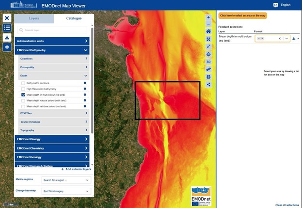
Figure 4: In this image, the EMODnet Map Viewer ‘Download’ tool on the left was clicked, and this in turn opened the selected region and download service on the righthand side. A region has been selected by drawing a box on the map. (need to update graph and text).©EMODnet Secretariat
Alternative:
If a user wants to have access to the full EMODnet DTM, e.g. in case of using the DTM in a hydrodynamical model, then the workflow for downloading the DTM in fixed tiles is as follows:
- Open the EMODnet Bathymetry grouping.
- Select the ‘DTM Tiles’ sub folder and activate the layer ‘Tile structure and download’
- This will provide a grid with the 59 DTM Tiles covering the full European DTM and the Caribbean DTM
- Click on a DTM Tile. This will trigger the DTM Tile Download dialog box on the right of the Map Viewer;
- In the Download dialog box, choose any of the available data formats and click on the associated download URL
- Repeat the same for the other DTM Tiles of interest
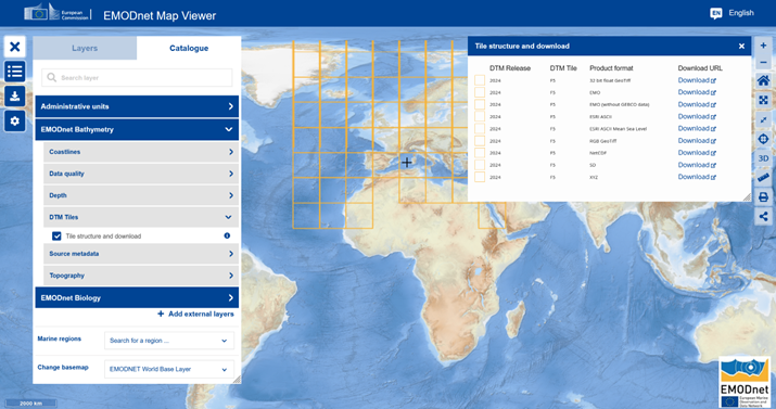
Figure 5: In this image, the EMODnet Map Viewer ‘DTM Tiles’ folder was opened and the related layer was activated. This displayed the DTM Tiles grid on the map and by clicking on a grid dell opened the format options for downloading the selected DTM Tile. ©EMODnet Secretariat
Downloading via ERDDAP
Another option is to subset and download the DTM via the EMODnet ERDDAP server. ERDDAP is the backend technology that is used to serve Bathymetry to the MapViewer.
In figure 6 we see an ERDDAP form (link above) that allows user to subset and downloads the Bathymetry DTM in a number of formats. The red arrow in the figure points to the file format selection and download button, the recommend file format to select is netCDF (.nc).
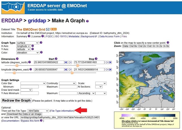
Figure 6: The tool that ERDDAP forms for subsetting and downloading the Bathymetry DTM. Zooming into the Bathymetry DTM, as seen in the graphic window, sets the various parameters (latitude and longitude for example) and constructs the URL to the data. The red arrow points to the file format section menu. ©EMODnet Secretariat
