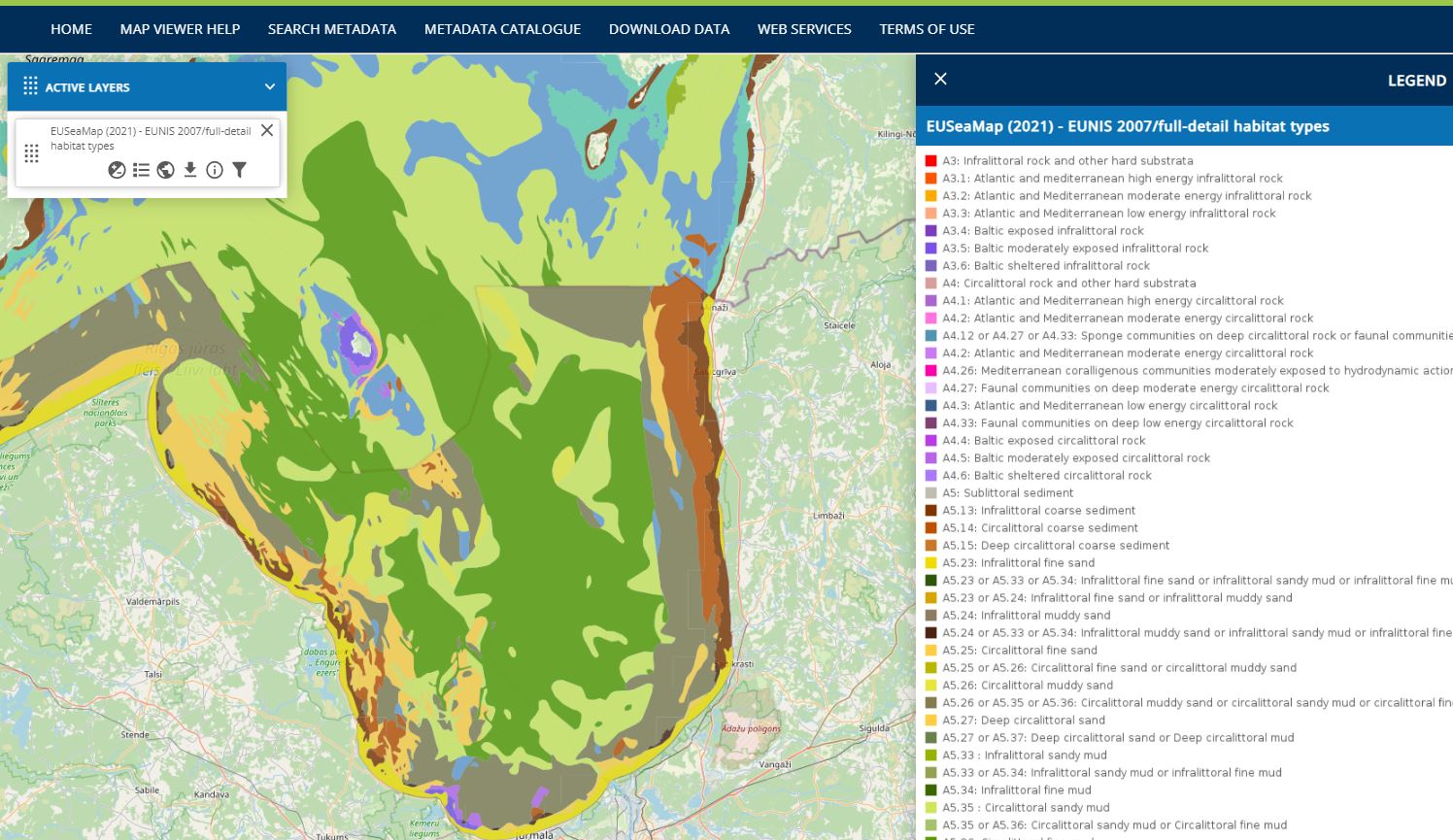
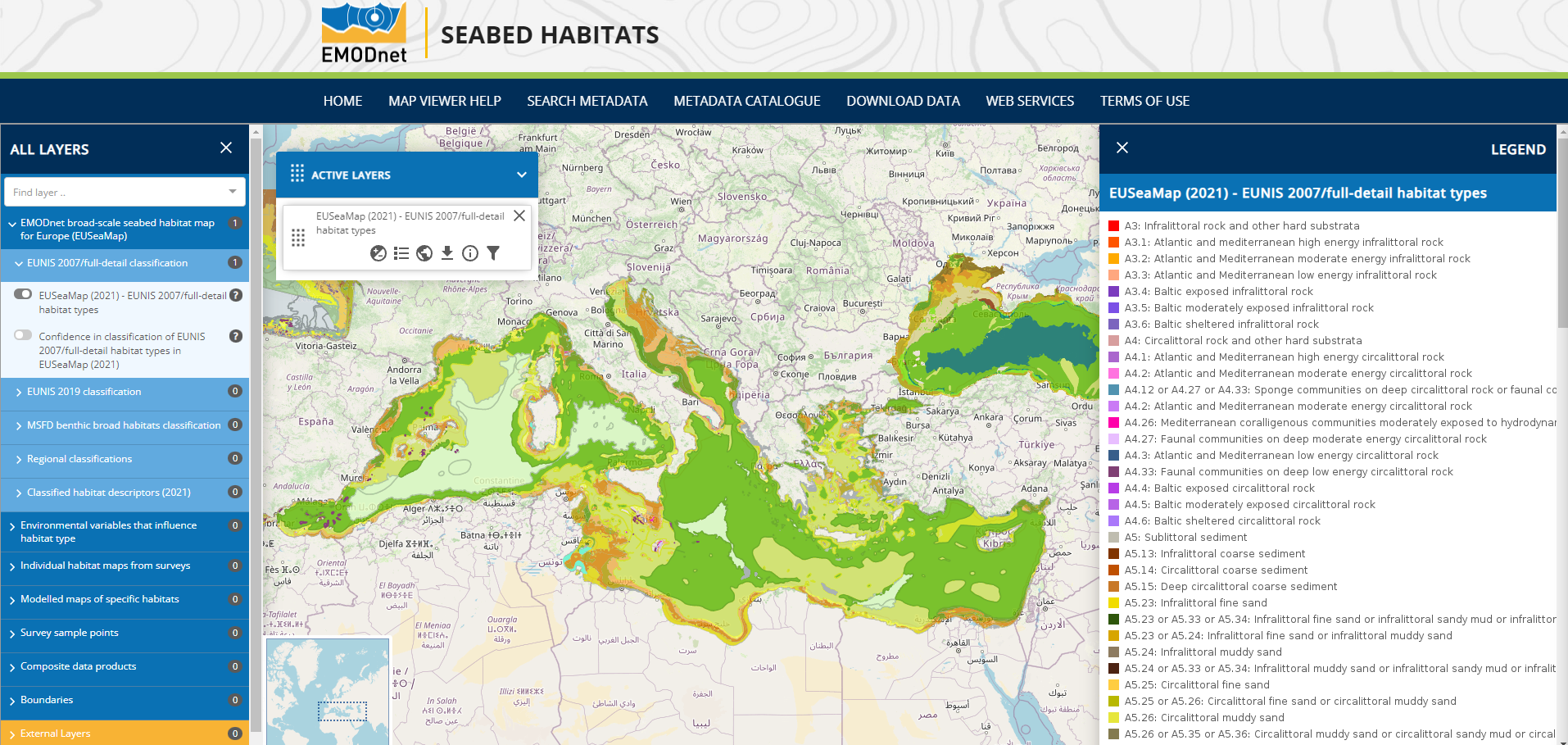
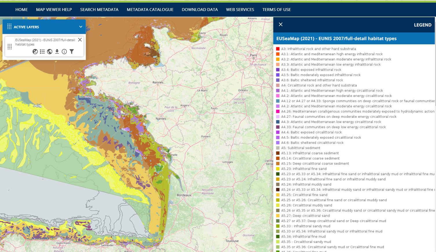
EMODnet Seabed Habitat has published the newest release of the EMODnet broad-scale seabed habitat map for Europe, EUSeaMap 2021, now available in three Europe-wide classification systems (EUNIS habitat classification 2007, EUNIS marine habitat classification 2019 and MSFD Benthic Broad Habitat Types), and two regional classifications (HELCOM Underwater Biotopes in the Baltic and Barcelona Convention habitat types in the Mediterranean).
EUSeaMap 2021 has filled in the gaps between the patchy array of habitat maps from surveys to allow us to estimate the potential extent of physical damage to the seabed due to human activities in the Northeast Atlantic. Without it the data gaps would be too huge to allow any meaningful assessment.
The habitat maps are accompanied by confidence assessment layers that are specific to each classification system, and a suite of ‘habitat descriptor’ layers that provide valuable information on their own, such as Biological Zones. Each of these layers is also accompanied by a confidence assessment. All continuous environmental input layers are also freely available.
Due to its full coverage, it is particularly suited to provide area calculations for habitats at a regional scale. There are multiple applications of EUSeaMap across different sectors, demonstrable from the use cases reported from previous iterations of the product. For example: offshore infrastructure has used EUSeaMap for their environmental impact assessments, policy makers have used EUSeaMap in their trans-boundary marine spatial plans and academics have used EUSeaMap to quantify natural capital in their area of interest.
EUSeaMap 2021 builds on previous iterations with an updated seabed substrate layer, which is predominantly comprised of the seabed substrate layer provided by our partners at EMODnet Geology. In addition, the inclusion of biogenic substrates has enabled us to classify habitats to the new EUNIS 2019 classification system. The map is produced by combining various environmental drivers of seabed habitat distribution, such as water depth, seabed substrate and amount of light reaching the seabed, to predict physical habitats at a broad scale. Details of what environmental variables are selected at each sea basin can be found in the EUSeaMap 2021 technical report.
The next iteration will be in 2023. It will include updated depth and substrate data and for the first time will be extended to the Caspian Sea and some EU territories of the Caribbean.
Services
Visualize the EUSeaMap 2021 dataset
Download the EUSeaMap 2021 dataset
Related documents
EUSeaMap 2021 Technical Report
Media
Please note that EMODnet is in the process to provide a central access point to its data and data products through the
Central Portal in the coming months. More information can be found here.