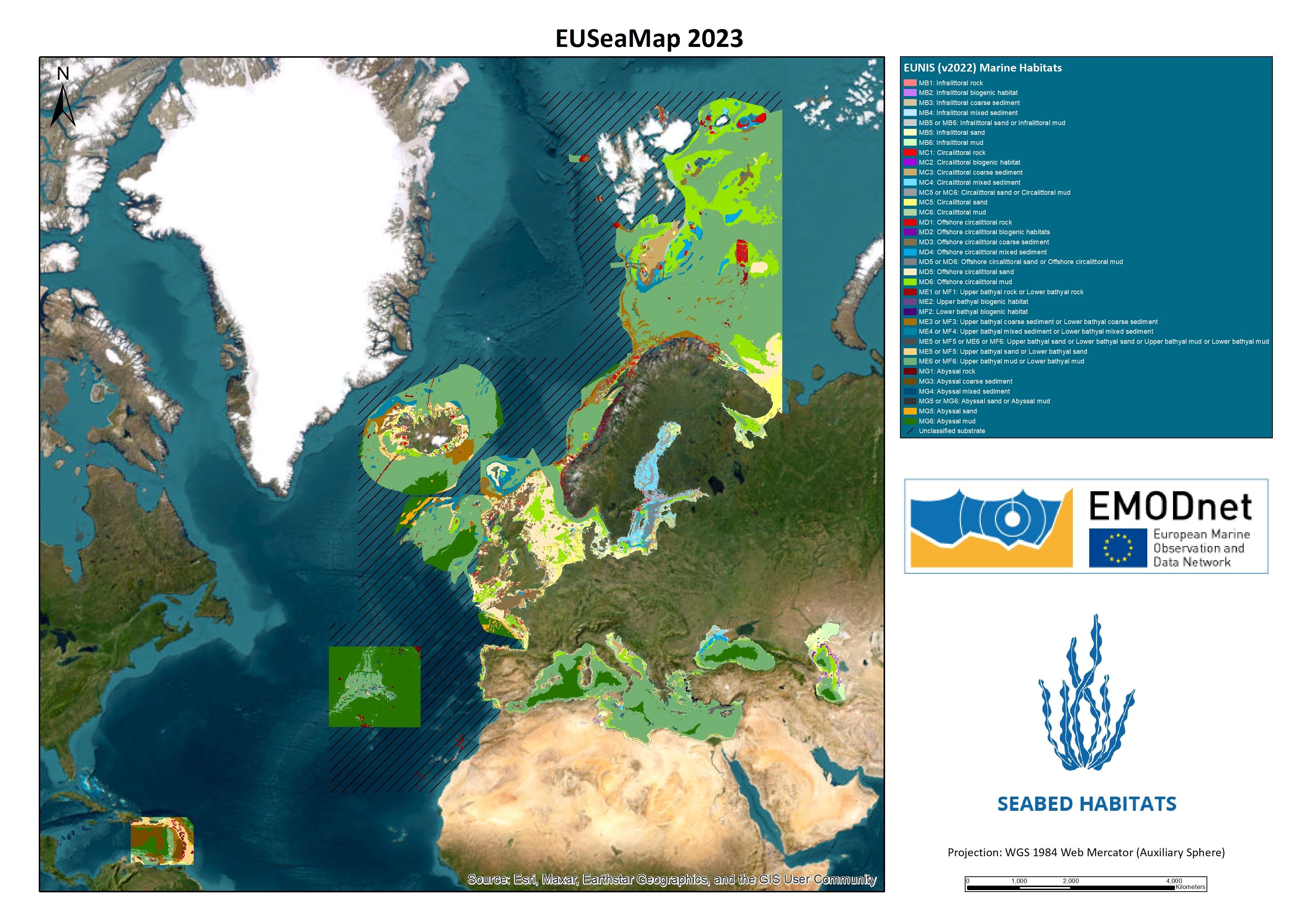
EUSeaMap is a great example of what EMODnet has achieved bringing open data and specialised expertise in thematic in situ marine data together to produce a multi-disciplinary product relying on interoperable data from bathymetry and geology, seafloor (benthic) biodiversity, bottom water currents and more! EUSeaMap continually evolving, versioned output from EMODnet Seabed Habitats. The product uses existing marine environmental data to create a predictive habitat map covering all European sea basins and some European territories in the Caribbean. This latest storymap illustrates the approach used in constructing EUSeaMap and its applications. It shows the different phases of EUSeaMap from the first iteration in 2012 to the most recent published version - EUSeaMap 2023.
Evolution of EUSeaMap
The earliest version was released in 2012 and built on the work started by the MESH (Mapping European Seabed Habitats) project in developing a unified seabed habitat map of north-west Europe. Subsequent versions of EUSeaMap build on previous iterations with expanded coverage and classification systems, updated higher resolution seabed substrate data, and improved outputs from oceanographic models. EMODnet Bathymetry, EMODnet Geology and Copernicus Marine Environment Monitoring Service (CMEMS) are key data providers (e.g., to provide model outputs of bottom water currents).
A new updated version (EUSeaMap 2023) was delivered at the end of the last phase of EMODnet Seabed Habitats in late 2023. This version extends to include the Caspian basin and some EU jurisdictional areas in the Caribbean. This has resulted in delivery of a first baseline broadscale habitat map for these regions. The technical report associated with this can be found here.
Applications
EUSeaMap products have been used for assessing and reporting the status of European seas, designing ecologically coherent Marine Protected Area networks, establishing monitoring programmes for seabed habitats and informing marine planning.
European Directives, such as the Marine Strategy Framework Directive (MSFD), demand reliable full coverage marine habitat maps for assessment and monitoring of benthic habitats. MSFD Descriptor 6 considers Seafloor Integrity and requires quantitative reporting by each Member State on the impacts of anthropogenic activities on benthic habitats to help define Good Environmental Status (GES) and environmental targets in their jurisdictions.
EUSeaMap has been used by many Member States in the creation of their initial marine spatial plans. It has been used in UK waters in reviewing the developing Marine Protected Areas (MPA) network, where it was used to provide the predicted area of each broad-scale habitat within a given biogeographic region.
It is intended to continue the development of EUSeaMap in future phases as an important product which will continue to inform policy decisions and support management of marine areas, biodiversity and climate change monitoring.

Figure 1. EUSeaMap 2023 ©EMODnet Seabed Habitats
