EMODnet Seabed Habitats have published a new story map on EUSeaMap - a comprehensive, free and ready-to-use map of physical seabed habitats - and its applications in an EU Reporting context. It also gives insights into why the map has changed since its first iteration in 2012.
There have been many versions of EUSeaMap. The changes reflect an improvement in the input data used to create the map as opposed to any changes in habitat extent. A brief summary of the various iterations of EUSeaMap is detailed in the story map.
European Directives, such as the Marine Strategy Framework Directive (MSFD), demand reliable full coverage habitat maps for assessment and monitoring of benthic habitats. MSFD Descriptor 6 considers Seafloor Integrity and requires quantitative reporting on the impacts of anthropogenic activities on benthic habitats. Sediment type combined with biological zone forms the basis of the MSFD classification scheme, known as Benthic Broad Habitat Types (BBHT). EUSeaMap can be classified according to MSFD BBHT and used as a benchmark dataset for reporting on the extent of benthic marine habitats in European waters.
I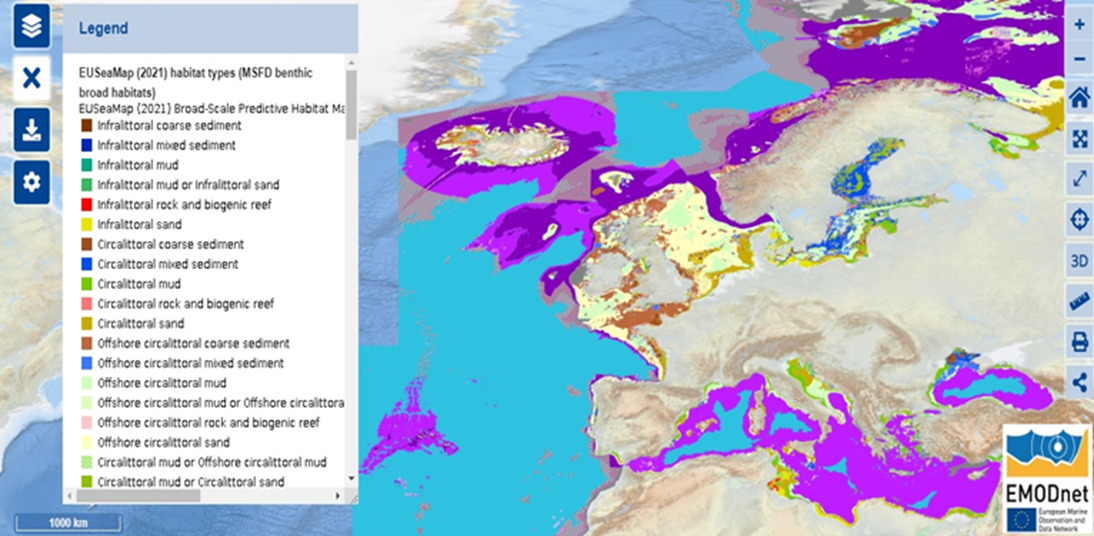
EUSeaMap displayed using the MSFD BBHT classification scheme. (©EMODnet Seabed Habitats).