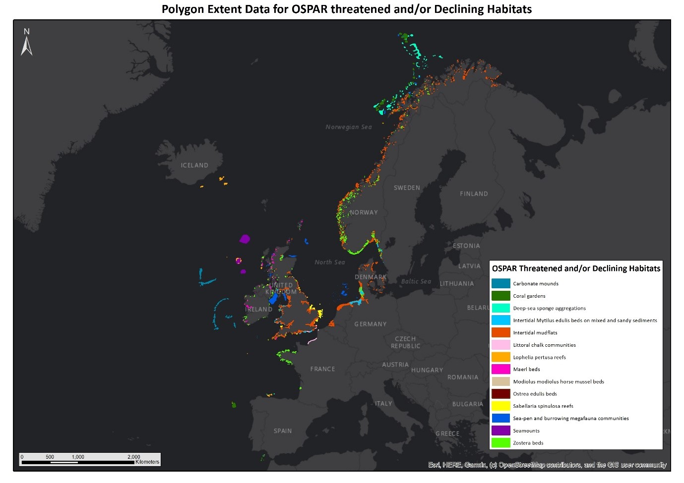
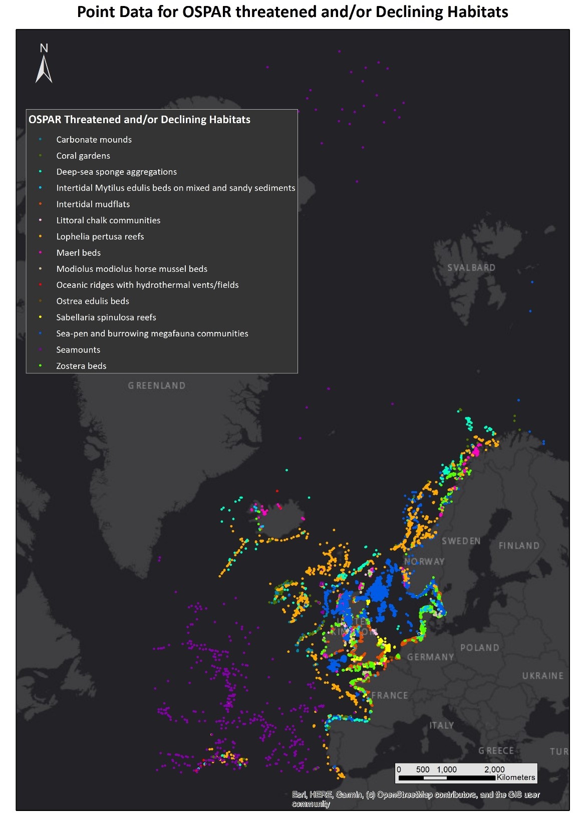
The latest OSPAR Threatened and/or Declining Habitats dataset (version 2020) is now available to view, download and access as a web service via the EMODnet Seabed Habitats portal. This dataset comprises point and polygon data and shows the distribution of habitats on the OSPAR list of threatened and/or declining species and habitats within the North-east Atlantic.
The latest update includes an additional 60,000 polygons and 65,000 points, almost doubling the quantity of data previously collated. Data on the extent of Intertidal mudflats and point distribution of Zostera marina accounted for almost 75% of the new data.
The polygon data shows the extent of habitats and can be combined with more extensive broad habitat type map coverage (e.g., EUSeaMap for Atlantic and Arctic regions) to produce a more detailed habitat map for impact assessments and marine spatial planning in the OSPAR area.
Point data can be combined with environmental variables to produce predictive habitat models.
A call for data is issued every 2 years. Data are submitted by the OSPAR contracting parties and collated by the JNCC who publish the datasets through the EMODnet Seabed Habitats portal. A new third-party provider, Oceana, provided data to the latest version.
Media