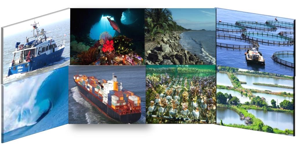
PLOCAN, the Oceanic Platform of the Canary Islands, is a joint initiative between the Spanish and the Canary Islands governments. It is a multipurpose service centre with novel land-based and sea-based infrastructures to support research, technology development and innovation in the marine and maritime sector. Its mission is to promote long-term observation and sustainability of the ocean, providing a cost-effective combination of services, such as observatories, test site, base for underwater vehicles, training and innovation hub.
More information about PLOCAN
![]()
CORES Ltd., Coastal Research and Engineering Services, is an SME located in Varna, Bulgaria. CORES collect, provide and use data and observations of aquatic environments, together with the relevant services and research activities, along the Western Black Sea coast and adjacent inland water bodies. Collection of marine data, and presenting accurate information in real-time using telemetry (including bathymetry, physics, water quality) is one of the core activities of CORES ltd. The company is involved in research, and building data-bases on human activities in the Western Black sea (marine aquaculture, offshore wind, oil & gas, dredging works).
More information about CORES
![]()
DEME, the Belgian Dredging, Environmental and Marine Engineering group is an international market leader for complex marine engineering works. Building on more than 140 years of experience and know-how, DEME has organically moved into several related sectors, such as the financing of marine engineering and environmental projects, executing complex EPC related marine engineering projects including civil engineering works, the development and construction of renewable energy projects, providing services for the oil, gas and energy sector, the decontaminating and recycling of polluted soils and silts, the harvesting of marine resources, etc. DEME is committed to conducting its business in a way that minimises adverse impact on the environment.
More information about DEME
![]()
ESGEMAR, S.A. was established in 1984 and since beginning has been drawn up technical consulting in projects related with the marine environment.
ESGEMAR, S.A.has a vast experience in marine geophysical exploration, marine geology, geotechnical studies, submarine resources, submarine hazards cartography, seafloor mapping and charting, underground hazards mapping for fishing, biodiversity studies, marine environment and underwater environmental impact reports.
More information about ESGEMAR
The company has an active co-operation with Research Institutes and close relationships with European Universities.
It has also maintained and improved the business management, focused on quality assurance and environmental values. ESGEMAR have renewed certifications ISO 9001:2015 and ISO 14001:2015.
![]()
GAMMA CONSULTING / SRF GAMMA_ COMPANY PROFILE
Gamma Consulting is a private, independent company with wide spectrum of interests and capabilities. The company was set up in 1991 under the name of Scientific-research firm Gamma (SRF Gamma). The company's main interests were revolving around water and natural resources in Georgia. Later on, the sphere of company’s capabilities expanded to include environmental consultancy, design and engineering services.
More information about GAMMA CONSULTING
In 2011 decision was made to ‘separate’ environmental, natural resources and design units from the lab service. This is when Gamma Consulting was formed. To date Gamma Consulting is one of the leading consultancy centres focused on environment protection, environmental engineering, water and natural resources in Georgia. Services provided to the clients are backed by the laboratory complex of SRF Gamma.
Company staff is around 100 strong with expertise including environmental and soil science, engineering, geology, hydrology, hydrogeology, chemistry, biology, microbiology, engineering, design, and IT.
![]()
Ocean and inland waters
From data acquisition to end users’ applications
SeaTopic provides expertise and technologies for sustainable exploitation of salt/fresh water and water ways.
The company was created in 2015 by 5 shareholders with sound competencies in oceanography/hydrography, a portfolio of proven technologies and a consequent international cooperation network.
More information about SeaTopic
SeaTopic is positioned at the frontier of R&D and business development. The company works in collaboration with public and private partners, of very various profiles and fields of activities: navigation, aquaculture, protection of marine environment, risk management, etc.
Our rationale is to gather best expertise and techniques to provide quality solutions for our customers: from data acquisition, to modelling and forecast services, up to user applications.
Portfolio:
- Partnership for setting up, managing or contributing to development projects
- Contracts for provisioning of services, products or expertise
- Support for fund raising
- Umbrella for projects needing an international legal framework
![]()
HR Wallingford is an independent civil engineering and environmental hydraulics organisation.
HR Wallingford delivers practical solutions to the complex water-related challenges faced by their international clients. With a 70 year track record of achievement, their unique mix of know-how, assets and facilities includes state of the art physical modelling laboratories, a full range of numerical modelling tools and, above all, enthusiastic people with world-renowned skills and expertise.
More information about HR Wallingford
Based in the UK, HR Wallingford has a reputation for excellence and innovation, which we sustain by re-investing profits from our operations into programmes of strategic research and development.
HR Wallingford reaches clients and partners globally through a network of offices, agents and alliances around the world.
![]()
The University of Genoa is an education and research institute based in Genoa, the biggest and most important commercial harbor of Italy. There are different research groups in the University focused on the marine environment dealing with different subjects such as biology, ecology, geophysics, industry, economy…
More information about University of Genoa
The research group based in the Department of Civil, Chemical and Environmental Engineering develops research about the dynamics of the sea (currents, waves, winds) either with theoretical approach and with numerical tools. Specific interest relies in coupled ocean-atmospheric dynamics, sea wave growth and propagation, deep-water/continental shelf/costal morphodynamics, coastal structures and future climate projections.
![]()
Envision Marine Ltd. is an international environmental consultancy and research company, specialising in marine, coastal and seabed mapping and surveys along with spatial data analysis and decision support for marine developments, planning and coastal zone management. We deliver quality bespoke products and services to a wide variety of clients (from governments and NGOs to industry and the private sector) world-wide.
More information about Envision Marine Ltd.
Envision has experience of baseline mapping for Environmental Assessment and habitat mapping for marine management objectives in the UK, Europe and internationally. A detailed understanding of both the survey and analytical techniques required for seabed mapping has been derived from a broad portfolio of mapping projects completed to the satisfaction of our diverse range of clients.
Envision Marine has been involved in mapping surveys and projects and have contributed to the development of survey protocols through the BioMar LIFE project (1992-6), the Broadscale Mapping Project (1996-9) and Intereg IIIB – MESH Project (2004-2008) along with numerous protected area mapping projects in the UK.
![]()
Since 1979, RPS Ocean Science (formerly ASA) has been a science and technology solutions company, specialized in data analysis and management, including oceanographic, meteorological, biological, chemical, and limnological data, large-scale data integration, Big Data analytics, Cloud computing, and data dissemination technologies. Our capabilities are founded on a large and diverse range of hydrologic, oceanographic, and meteorological instrumentation, sophisticated computing facilities and extensive suites of validated modeling software and data analysis tools that have been adopted as a standard to specially assist with ocean planning, oil spill responses and Search and Rescue missions.
More information about RPS Ocean Science
Our core business activities are:
- Oceanographic, meteorological and inland water measurements
- Integrated real-time monitoring systems
- Coastal and marine geoscience
- Software development and Geomatics
- Numerical modeling of physical, chemical and biological processes
- Coastal engineering support
- Environmental consultancy and planning
- Data management and analytic
![]()
Lange Research Aircraft GmbH (LRA) is a spin-off of Lange Aviation GmbH, a pioneer in commercial electric flying, with 20 years of experience as a designer and manufacturer of high performance gliders. Based on this technology, LRA develops -with a team of about 30 people- a hybrid hydrogen-powered electric aircraft with an extremely long range and maximum reliability. This product opens up a variety of commercial applications in manned and unmanned missions.
More information about Lange Research Aircraft GmbH (LRA)
The Antares E2 project is an electrically powered aircraft that can be used for multiple observation or surveillance tasks. The outstanding features of this aircraft are an extremely long flight duration of 40 h and a payload of approx. 200 kg. The Antares E2 carries optical, thermosensitive and multi- / hyperspectral imaging sensors. Another unique feature of the product is its high reliability, which allows its use in the area of marine tasks. Monitoring and surveillance missions today are flown by conventionally powered aircraft – bringing additional pollution into the air. The Antares E2 is blue and will make the operation of such missions more economical by significantly reducing fuel consumption and lowering set-up costs, and the dimension will allow this cost advantage for new missions not yet flown for economic reasons and unlock this market.
Polytechnic University of Catalonia (Universitat Politècnica de Catalunya, UPC), currently referred to as BarcelonaTech and commonly named just as UPC, is the largest engineering university in Catalonia, Spain. It also offers programs in other disciplines such as mathematics and architecture.UPC's objectives are based on internationalization, as it is one of Europe's technical universities with the most international PhD students and the university with the largest share of international master's degree students. UPC is a university aiming at achieving the highest degree of engineering/technical excellence and has bilateral agreements with several top- ranked European universities.
More information about Universitat Politècnica de Catalunya and Obsea
The UPC generates knowledge and transfers it to the production sector to increase businesses' capacity for innovation and competitiveness. In addition to this kind of collaboration, which is often international in scope, the UPC also specifically attends to the needs of small and medium-sized enterprises that want to innovate, by becoming their main technological partner.
The SARTI research group at UPC operates the Obsea underwater cabled observatory (www.obsea.es) that was deployed in 2009 in the Mediterranean Sea with two main objectives: to study and monitor coastal process and biological habitat at the Catalan coast, and secondly to become a reference underwater test site for new instruments, sensors and also as a test site for new data communication protocols and data management. The Obsea data management system is dealing with many different types of data, mainly physical parameters and biological indicators using video cameras.
The Obsea observatory is already monitoring real time underwater noise and seismometry. Many interoperability experiments have been carried out using the observatory with the data produced already available through EMODnet or via public datasets in Pangaea (https://doi.pangaea.de/10.1594/PANGAEA.883072).
Obsea is participating as one of the firsts underwater noise acoustic providers in order to generate underwater noise products from EMODnet Physics.
![]()
![]()
IST is the largest and most reputed school of Engineering, Science and Technology in Portugal. The MARETEC centre is an IST centre which main expertise is in developing, implementing, validating and providing forecasts for watershed, coastal and ocean hydrodynamic and ecological processes by means of numerical models.
More information about IST and MARETEC
MARETEC’s main activities focus on numerical modelling applied to water environments, monitoring and data management. MARETEC is the main developer of the MOHID modelling system (http://www.mohid.com) an open source numerical tool able to simulate open ocean, estuaries and watersheds processes. IST has been involved in many international projects in areas related to marine pollution and coastal preparedness, marine renewable energies, hydrodynamics and water quality and sustainable management of marine ecosystem services. MARETEC is currently collaborating with EMODnet physics as an ensemble centre for river data.
Thames Estuary Partnership (TEP) was set up by a group of key stakeholders in 1999 to provide an unbiased forum for thought, leadership, debate, and planning for the long-term benefit of the tidal river. The Thames Estuary Partnership region runs through the most densely populated city in Europe and some of the UK's most extensive marine and coastal protected areas. As an independent charity we exist to improve shared understanding of the river's needs amongst key stakeholders.
More information about Thames Estuary Partnership
We achieve this by bringing together port and local authorities, riverside developers, leisure users, charities, and other user groups and agencies through regular networking events, action groups, and independently-run research projects aimed at maximising the social, economic and environmental benefits for the tidal Thames. We also develop a wide range of projects relating to flooding, green and blue infrastructure, environmental enhancement, data, recreational water use, industry, pollution, education and skills, maritime or archaeological heritage and seascapes of particular appeal to our stakeholders.TEP’s ongoing projects are:
- Estuary Edges
- Thames Citizen Fish
- Greater Thames Data Project
- Coastal Partnership Network
- North Thames Fisheries Local Action Group (FLAG)
- Greater Thames Estuary Fish Migration Roadmap
To centralise and maintain the growing amount of data TEP is beginning to generate, we have established a Data Hub page to make in-house produced data publicly available: access-tep-thames.opendata.arcgis.com
URL: www.thamesestuarypartnership.org
Helzel Messtechnik GmbH, founded in 1995, specialises on the development and production of environmental and oceanographic measurement systems. Their passion for environmental and oceanographic measurement technology is reflected in WERA® – Ocean Remote Sensing, a shore-based over-the-horizon radar to measure ocean currents, waves and wind up to ranges of more than 200 km.
More information about Helzel Messtechnik GmbH
URL : www.helzel.com
![]()
![]()
Nodalpoint Systems is a Greek SME, founded in 2008, focusing on designing, implementing, and delivering solutions using the Oracle technology portfolio and Oracle Reference and Enterprise Technology architectures. Typical end customers are large companies and public sector institutions introducing or utilizing Oracle Fusion Middleware solutions as part of their IT modernization strategy and efforts. The company maintains an internal R&D department focusing on big data analytics and artificial intelligence (AI); a product of this activity is SatShipAI, providing maritime surveillance from open satellite imagery based upon cutting-edge AI techniques.
More information about Nodalpoint Systems and SatShipAI
Consistent maritime surveillance for detecting illegal activities in the seas and oceans remains an open problem: piracy, smuggling, pollution, and illegal fishing are only some of the activities involving rogue vessels that are taking place every day in the vast open seas.
Currently, the asset mainly used for maritime surveillance in the open seas is the Automatic Identification System (AIS); but AIS is a co-operative system: rogue actors can always switch off their onboard AIS transponder, or even spoof it, thus becoming "dark" ships. And even legitimate, non-rogue vessels, can seem dark unwillingly (and even unknowingly to them) from the receiving point of view, despite transmitting: shore AIS receivers have only a range of about 40 NM; and satellite AIS reception is compromised due to signal congestion, when too many ships are present in the satellite’s field of reception, compounded by the fact that the satellite spends only a limited time covering a certain area.
SatShipAI aims to enhance and complement the maritime surveillance capabilities currently provided by AIS and similar systems using state of the art Artificial Intelligence (AI), in order to provide ship detection, type classification, and size estimation from open satellite imagery.
Saildrone is a provider of ocean data collected using a global fleet of wind and solar-powered unmanned surface vehicles (USVs) called saildrones, which make ocean data collection possible and cost-effective at scale. Each USV carries a suite of sensors to collect atmospheric, oceanographic, biogeochemical and acoustic data. Data quality has been evaluated and validated against reference assets including ships, moorings, satellites and profilers by partners including NOAA and NASA.
More information about Saildrone
Saildrone operates fleets in the Arctic, Antarctic, Atlantic, Pacific, and Southern Oceans, collecting data on a fully managed mission-as-a-service model, for a range of mission objectives, including air-sea fluxes, carbon monitoring, acoustic fish stock assessment, oil detection, air-sea gas exchange, and bathymetry. Working in close partnership with the global scientific community, governments and private companies, Saildrone is assembling one the world's largest high-resolution in-situ ocean datasets.
Sofar is powered by the dream to build the world’s best ocean data platform. Our team combines expertise in ocean science, technology, and innovation to develop new solutions for ocean exploration and observation. We are deeply passionate about making ocean data widely available to ocean communities and enthusiasts with powerful tools and visualizations.
More information about Sofar
Sofar makes the Spotter wave buoy which introduced an affordable and convenient way to obtain high-quality wave data anywhere on the planet. Spotter can be set either as a free floating platform or a moored station, sending wave statistics to an online dashboard and API without requiring any shore-based system.
![]()
dotOcean is providing control units and software to automate vessels and seagoing systems by connecting them to a cloud SaaS platform. The control unit called ‘Automate Your Boat’ enables customers to build their own autonomous vessel. Autonomous vessels are deployed to collect hydrographic, environmental and security data. The use of cloud based data products and application specific SaaS platforms allow to automate these processes and reducing OPEX, CAPEX and risks
URL: www.dotocean.eu
![]()
Raceix Ltd. is an early-stage Irish B2B company with offices in Munster, Ireland and Savannah, Georgia (USA). Raceix is developing ‘BoatingOS', an entirely new operating system which will power the next generation of chart-plotters; much like how Android works for smartphones.
More information about Raceix
BoatingOS is an always-connected platform, delivering data to the helm in a usable, understandable and contextually aware way, while also unlocking millions of data points which will enrich the boating experience on board. The solution will not only improve safety at sea but will also aid in surveying and it will deliver key environmental data back to relevant authorities in Europe (e.g. EMODnet) and the world through the connected multipurpose marine laboratory platform.
URL: www.raceix.com
dCarbonX Ltd is a private UK company established to discover geothermal, subsurface energy storage and carbon sequestration assets to facilitate the energy transition. Based in London, dCarbonX Ltd is originating and building a portfolio of high-value Energy Transition sub-surface assets in EMEA, deploying advanced technologies in a new process known as ‘Decarbonization Exploration’ and using its proprietary ARC (Avoid-Reduce- Capture) methodology.
More information about dCarbonX
dCarbonX Ltd was founded in 2020 by experienced international explorationists, Dr. Angus McCoss, Dr. John O’Sullivan and Mr. Tony O’Reilly. dCarbonX Ltd uses data and interpretation techniques developed within the natural resources exploration industries to locate and prove the existence of dispatchable subsurface assets that can support intermittent renewable energy sources, such as wind and solar. These subsurface assets include saline reservoir systems (for the permanent sequestration of carbon or seasonal storage of hydrogen carriers), deeply buried salt layers (for safe hydrogen and syngas storage in caverns), and geothermal resources (for heating/cooling (HVAC), power & hydrogen generation and lithium extraction). dCarbonX Ltd strategically co-ventures with significant partners and customers across regions and technologies to bring its discovered decarbonisation assets into development to support the energy transition.
URL: www.dcarbonx.com
![]()
The Society for Underwater Technology (SUT) is an international Learned Society for marine technology, science and engineering established in 1966. SUT has branches in 10 countries, over 1000 individual members and over 150 corporate members from a wide section of offshore industry, academia, & government agencies. Many of their members work in the fields of offshore energy, diving, subsea engineering and underwater robotics.
More information about SUT
SUT plays a key role in enabling industry professionals to interact with the wider ocean community and policy-makers. SUT publishes the Journal of Underwater Technology, a peer reviewed international journal, and hosts a weekly Underwater Technology podcast to inform the Society's members, marine professionals & the public about news and developments in the broad areas of underwater technology, ocean science and offshore engineering.
URL: www.sut.org
Cerema (Centre for Studies and Expertise on Risks, the Environment, Mobility and Urban Planning) is the major French public agency for developing public expertise in the fields of urban planning, regional cohesion and ecological and energy transition for resilient and climate-neutral cities and regions. It has a staff of 2,700 people out of which 500 are dedicated to research and innovation activities.
More information about Cerema
Under its Sea and Coast activities, Cerema offers support to national and local maritime and coastal policies, including marine spatial planning, geo-data, strategy for integrated coastal management, development of offshore wind farms, shoreline monitoring, reduction of business’ impact on the marine environment, maritime security and traffic monitoring systems.
URL: www.cerema.fr/en
![]()
develogic GmbH is a German based company founded in 2000, with a focus on developing and manufacturing turn-key customized data-acquisition and telemetry solutions for marine monitoring applications. These high-performance products are used by well-known customers in various research and industrial projects and include systems, such as modular pressure housings (>6000m depth), data loggers and acoustic telemetry solutions to seafloor landers, acoustic and seismic recording systems, underwater cameras, hydroacoustic modems and telemetry buoys.
More information about develogic
develogic systems are adopted in worldwide applications and are essential building blocks for multiple large-scale projects. These include under water observatories in the Mediterranean (Odyssea), to outside of Greenland (Greenland Telemetry), the Antarctic (AAD Krill), as well as the deep sea (LoVe), where oceanographic sensors are installed for monitoring and include measurements of CTD, ADCP, O2, CO2, CH4 and the use of 4K Cameras.
URL: www.develogic.com

Associação BIOPOLIS is a private, non-profit institution created in the scope of the Horizon 2020 Widening programme BIOPOLIS - Teaming to Upgrade to Excellence in Environmental Biology Ecosystem Research and Agrobiodiversity. Associação BIOPOLIS manages CIBIO, the Research Centre in Biodiversity and Genetic Resources, in Vairão, Portugal.
More information about BIOPOLIS-CIBIO
Research at BIOPOLIS-CIBIO aims at understanding the origins and maintenance of biodiversity, and to apply this knowledge to address (a) societal challenges related to climate and land use changes, environmental degradation, the loss and sustainable use of biodiversity and agrobiodiversity; and (b) the management, restoration and sustainable use of ecosystems and their services. BIOPOLIS-CIBIO research is strongly aligned with national and international goals, including Europe’s 2020 Agenda and Horizon 2020 Strategy, the Millennium Development Goals, and the 2030 Agenda for Sustainable Development.
URL: cibio.up.pt/en/
The Cyprus Marine and Maritime Institute (CMMI) was established in April 2019 and it is a Centre of Excellence for marine and maritime research, innovation and technology development. It is based in the city of Larnaca in Cyprus. CMMI has received funding from the European Union’s Horizon 2020 Research and Innovation Programme and matching funding from the Cyprus Government. The institute’s vision is to generate sustainable Blue Growth, by building on the needs of industrial and societal blue economy stakeholders. It has ten Research and Innovation Centres that are involved in maritime engineering, marine robotics, maritime digitalisation, marine observation, marine and coastal ecosystems, maritime human element, marine cultural heritage, marine and maritime policies and regional cooperation, and underwater and seabed technologies.
More information about CMMI
CMMI is engaged in projects that aim to create solutions to issues that concern both the industry and the society. CMMI has developed an extensive network of stakeholders to promote cooperation in marine and maritime research, technology development, and education, training, and entrepreneurship for the Blue Economy.
URL: www.cmmi.blue
![]()
Fugro is the world’s leading Geo-data specialist. Through integrated data acquisition, analysis and advice, we unlock insights from Geo-data to help clients mitigate risks during design, construction and operation of their assets. This work is accomplished on land and at sea by a team of approximately 9000 talented employees working in 59 countries. Together, we are united in the purpose of creating a safe and liveable world, delivering innovative solutions that support the energy transition, sustainable infrastructure and climate change adaptation.
More information about Fugro
Fugro leads private-sector support for The Nippon Foundation-GEBCO Seabed 2030 Project and the United Nations Decade of Ocean Science for Sustainable Development (2021-2030). Our participation is varied and tangible, involving high-level planning and outreach, crowdsourced bathymetry contributions, and long-term loan of expert staff for improving the way ocean science data is coordinated, accessed and shared, particularly as it relates to the private sector.
URL: www.fugro.com
e-BO Enterprises is a Belgian company established in 2000. It works in the marine and maritime domain with professional activities spanning computing and other services for land, offshore and vessels. Related to ocean data include providing private LTE connectivity offshore, the Offshare application for O&M control rooms in the offshore renewable energy sector, IT services and network connectivity to vessel operators and offshore windfarms.
More information about e-BIO Enterprises
e-BO Enterprises also provides the Incident Management platform used by the Belgian Coastguard component responsible for all aspects of the protection of the Belgian EEZ (MIK) as specified in the Belgian Marine Spatial Plan and the Maritime Security Act of 2023. This platform serves the 4 MIK government partners with a consolidated data view and guided operating procedures using marine data sources ranging from environmental to border protection measures, some which are already partners like VLIZ, RBINS and MDK.
![]()
Marine Centre Wales, School of Ocean Sciences, Bangor University was established in 2016. Current activities of the Marine Centre Wales that are related to marine and maritime and/or ocean data include developing and hosting IMARDIS (Integrated Marine Data and Information System) a cyberinfrastructure primarily designed to meets of the Welsh marine renewable energy sectors. As well as providing access to marine data via the IMARDIS portal, MCW also carries out work to apply advanced analytics and visualisation to marine big data using artificial intelligence and machine learning approaches. Existing links with EMODnet include providing access to EMODnet data through the iMARDIS portal.
More information about Marine Centre Wales, School of Ocean Sciences, Bangor University
Marine Centre Wales provides a forum for the development of research and innovation projects that deliver cutting edge science and support economic development and inform environmental policy at a range of scales from local, national to international. It has been designed to facilitate interactions between researchers undertaking applied research, businesses requiring answers to specific and pressing research questions, policy makers working on evolving governance and legislation. The aim is to bring together different perspectives, fostering the development of a joined-up marine community to address cross-sectoral strategic objectives.
Marine Centre Wales, School of Ocean Sciences, Bangor University
Puertos del Estado, overseen by the Spanish Ministry of Transport, manages the coordination and efficiency control of Spain's 46 state-owned ports. The organization executes port policy, promotes research in port-related areas, and contributes to technological development. It plays a key role in oceanography and marine climatology, providing real-time and historical data through various networks.
More information about Puertos del Estado
Puertos del Estado has a network of operational oceanography platforms (coastal buoys, deep water buoys, tide-gauges and weather stations) where the ocean and met-ocean data are already provided to EMODnet (Physics). Puertos Del Estado is also a collaborator with EMODnet, Copernicus Marine Service and EuroGOOS also via the Marine In Situ Coordination Group (MIC). The organization is a significant contributor to Operational Oceanography in Europe through its involvement in EuroGOOS, IBIROOS, MONGOOS, and other relevant initiatives.
VOTO, Voice of the Ocean, is a foundation that conducts, supports, and promotes science and communication regarding the sea and its dynamic processes. VOTO continually occupies several ocean observatories in the Baltic Sea using autonomous surface and subsurface platforms.
More information about Voice of the Ocean
VOTO supports the scientific community by providing research infrastructure, accelerating the development of new platforms and sensors, contributing to open-source software, and freely sharing all the data that it collects. Existing links with EMODnet include supplying near real time and delayed mode data to EMODnet Physics via the ERDDAP server.
![]()
Oceano Vox is a start-up specializing in the acquisition of environmental data relying on participatory science and the Ocean IoT (Internet of Things). Oceano Vox is building the largest network of ocean and climate sensors in the world thanks to a low-carbon and highly competitive alternative with thousands of vessels of opportunity around the World.
More information about Oceano Vox
Due to global warming, severe weather events will double by 2050. Predicting these events is crucial to ensuring the safety of maritime and coastal communities. However, current tools do not make it possible to forecast them in very short time frames due to lack of in-situ weather data or sufficient precision near the coasts. Oceano Vox fills this gap with an innovative solution open to all users and maritime stakeholders. Based on their disruptive technology, Oceano VOX is deploying a complementary network in coastal and polar regions where the need for reliable and accurate information is most urgent to fight against the global warming. These data will be made available to EMODnet, according to international standards, making that information available as interoperable data layers and data products.
The Renewable Grid Initiative (RGI), founded in 2009, is a collaboration of NGOs and transmission system operators (TSOs) promoting fair, transparent and sustainable grid development to enable the growth of renewables and achieve full decarbonization in line with the Paris Agreement. RGI is at the forefront of advancing sustainable solutions in the offshore renewable and grid sectors by fostering collaborations and innovations.
More information about the Renewables Grid Initiative

savvy navvy is a revolutionary, award-winning boat navigation app that combines essential information into one easy-to-use interface, empowering boaters to have a fun and safe experience on the water.
More information about savvy navvy
Van Oord is a Dutch family-owned company with more than 155 years of experience as an international marine contractor. The focus is on dredging, infrastructure and offshore energy. Van Oord strives to enhance the energy transition and to deliver climate adaptation and marine infrastructure solutions.