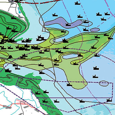
This challenge handled the ability to compute digital bathymetry and uncertainty for the sampling areas of the North Atlantic, and indicated regions showing priority areas for the surveying of safer navigation, to assess whether the available marine data sets available at that time* and appropriate to the use case, as well as to indicate gaps in the EU data collection framework.
The Bathymetry challenge attempted to compute:
- A digital map of water depth which covered representative areas of the North Atlantic;
- A digital map showing uncertainty in water depth covering representative areas of the North Atlantic; and
- Indication of the priority areas determined at that time*for surveying for safer navigation, taking into account the emerging needs identified at that time*.
HR Wallingford
Access to challenge products
The challenge partners ("the producers") were commissioned to perform a number of tests to evaluate marine data according to set user requirements. The table below enables:
- to discover :
- the Data Product Specifications (DPS) which describe data products in terms of user requirements according to ISO19131 principles and provide the basis for the quantitative assessment of the Products (Quality measures and scope of application) and of the Upstream Data sets supplied to- and used by- the challenges to create them.
- the Results (TDP) which describe the Data Product created together with the quantitative assessments (Quality measures and indicators) and the expert opinion. - to download the products (shapefile, excel, pdf) on an "as is" basis. All downloads suppose acceptance of the use limitations described in the “Expert opinion” and the “Legal constraints” accessible using the link to the Results.
to view the spatial data products (Maps) using a webGIS.
Data product were scored by experts from 1 to 5, resp. inadequate to excellent. The score is mentioned in the last column. “Good” means the Product was achieved to at least 50% of the requirements. “Inadequate” means “Impossible to produce or fails to meet all the objectives (not usable)”.